
MyTopo
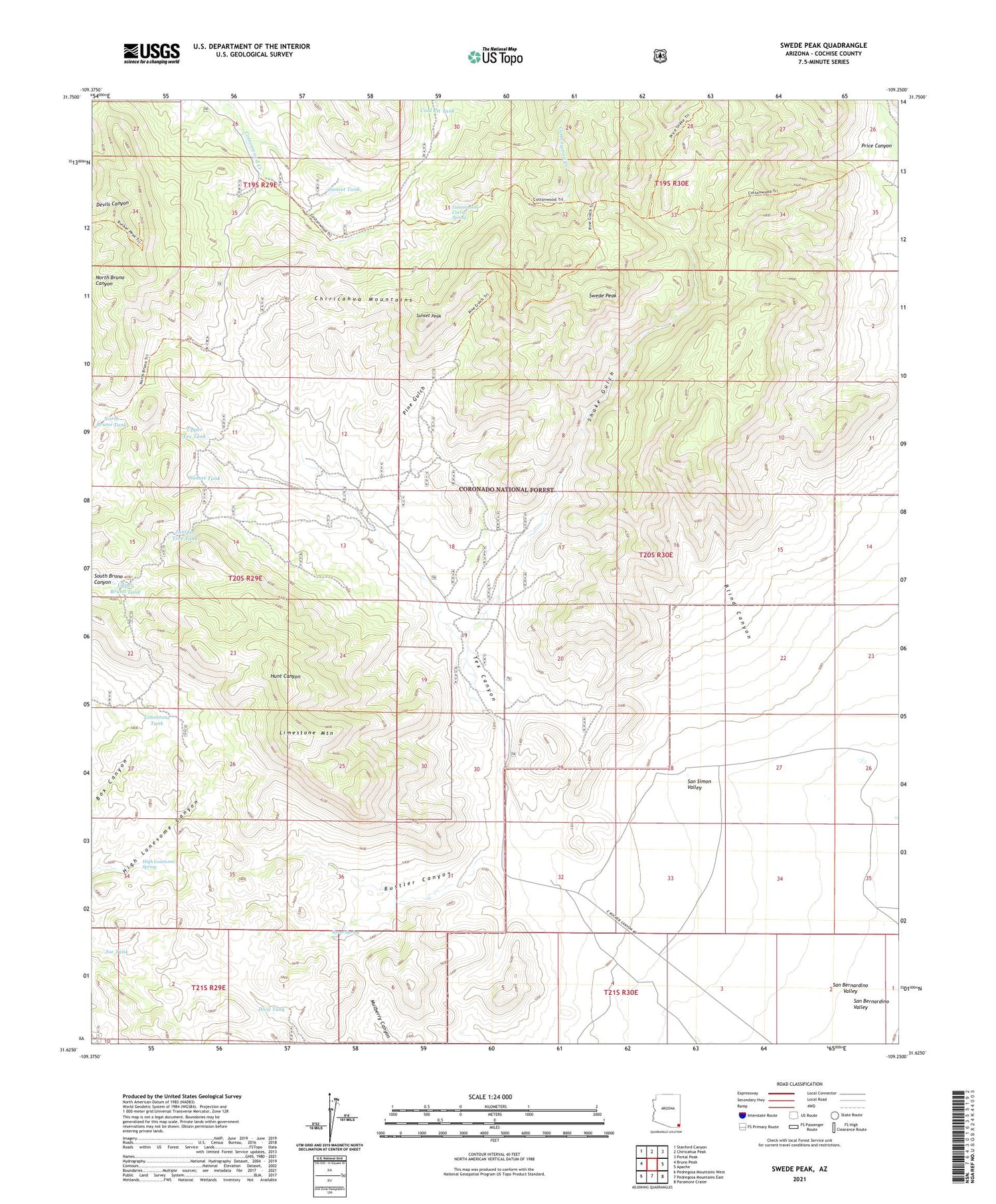
Swede Peak Arizona US Topo Map
Couldn't load pickup availability
Also explore the Swede Peak Forest Service Topo of this same quad for updated USFS data
2021 topographic map quadrangle Swede Peak in the state of Arizona. Scale: 1:24000. Based on the newly updated USGS 7.5' US Topo map series, this map is in the following counties: Cochise. The map contains contour data, water features, and other items you are used to seeing on USGS maps, but also has updated roads and other features. This is the next generation of topographic maps. Printed on high-quality waterproof paper with UV fade-resistant inks.
Quads adjacent to this one:
West: Bruno Peak
Northwest: Stanford Canyon
North: Chiricahua Peak
Northeast: Portal Peak
East: Apache
Southeast: Paramore Crater
South: Pedregosa Mountains East
Southwest: Pedregosa Mountains West
This map covers the same area as the classic USGS quad with code o31109f3.
Contains the following named places: Blind Canyon, Coal Pit Tank, Cottonwood Circle Two Hundred Thirtythree, Cottonwood Corral Spring, Cottonwood Tank, Divil Tank, Division Tank, High Lonesome Spring, Hill Tank, Joe Tank, Juniper Tree Tank, Krentz Ranch, Limestone Mountain, Limestone Tank, North Bruno Tank, Pine Gulch, Price Shake Pine Gulch Trail 235-236, Rustler Canyon, Saner Spring, Shake Gulch, Sunset Peak, Sunset Tank, Swede Peak, Tex Canyon, Upper Bruno Tank, Upper Tex Tank


