MyTopo
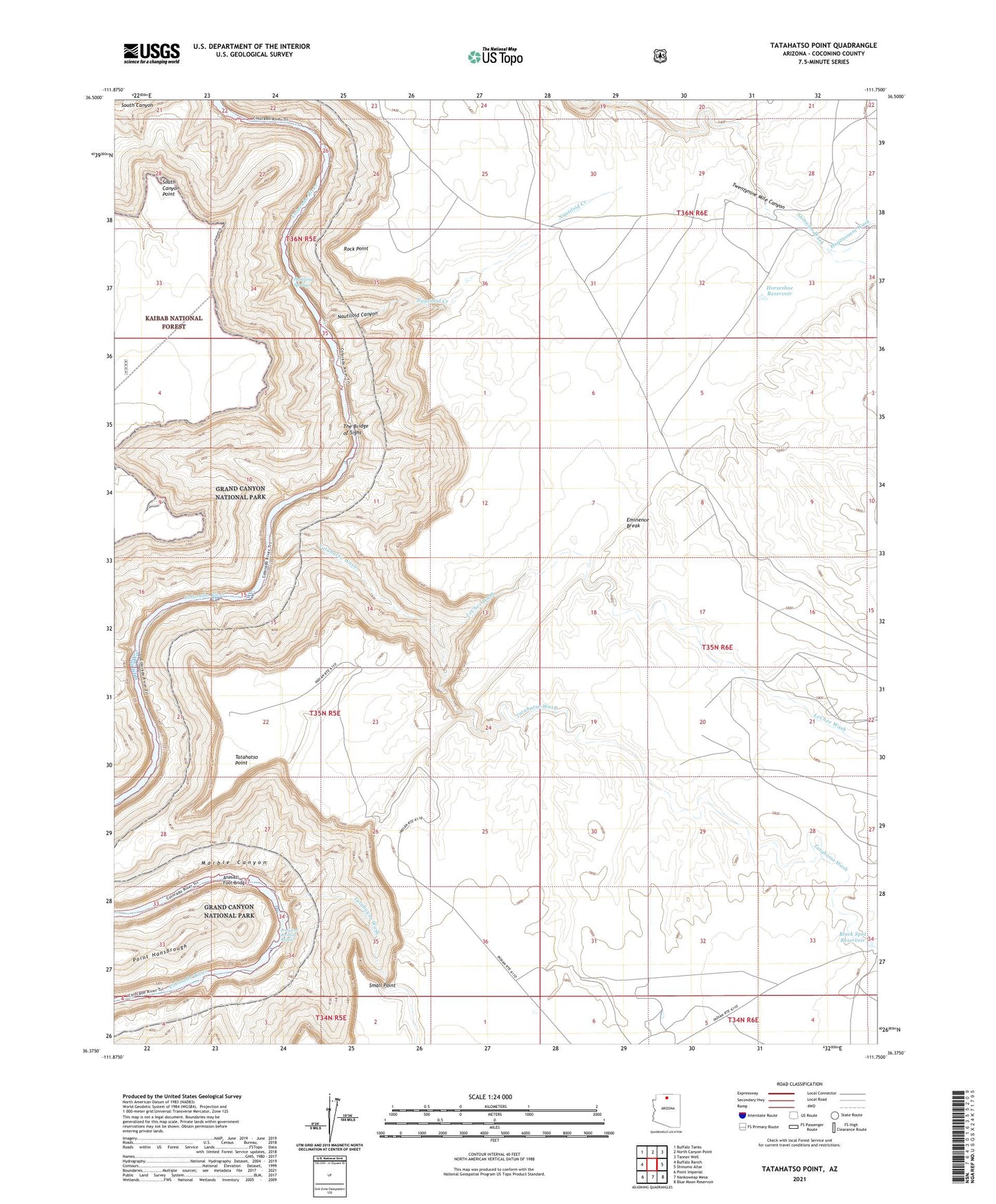
Tatahatso Point Arizona US Topo Map
Couldn't load pickup availability
Also explore the Tatahatso Point Forest Service Topo of this same quad for updated USFS data
2021 topographic map quadrangle Tatahatso Point in the state of Arizona. Scale: 1:24000. Based on the newly updated USGS 7.5' US Topo map series, this map is in the following counties: Coconino. The map contains contour data, water features, and other items you are used to seeing on USGS maps, but also has updated roads and other features. This is the next generation of topographic maps. Printed on high-quality waterproof paper with UV fade-resistant inks.
Quads adjacent to this one:
West: Buffalo Ranch
Northwest: Buffalo Tanks
North: North Canyon Point
Northeast: Tanner Well
East: Shinumo Altar
Southeast: Blue Moon Reservoir
South: Nankoweap Mesa
Southwest: Point Imperial
This map covers the same area as the classic USGS quad with code o36111d7.
Contains the following named places: Anasazi Foot Bridge, Black Spot Reservoir, Hanging Springs, Hogansaani Wash, Horseshoe Reservoir, LeChee Wash, Nautiloid Canyon, Nautiloid Creek, President Harding Rapids, Rock Point, Small Point, South Canyon Point, Tank Number Seven, Tatahatso Point, Tatahatso Wash, Tatahoysa Wash, The Bridge of Sighs, Vaseys Paradise