
MyTopo
Tanner Well Arizona US Topo Map
Couldn't load pickup availability
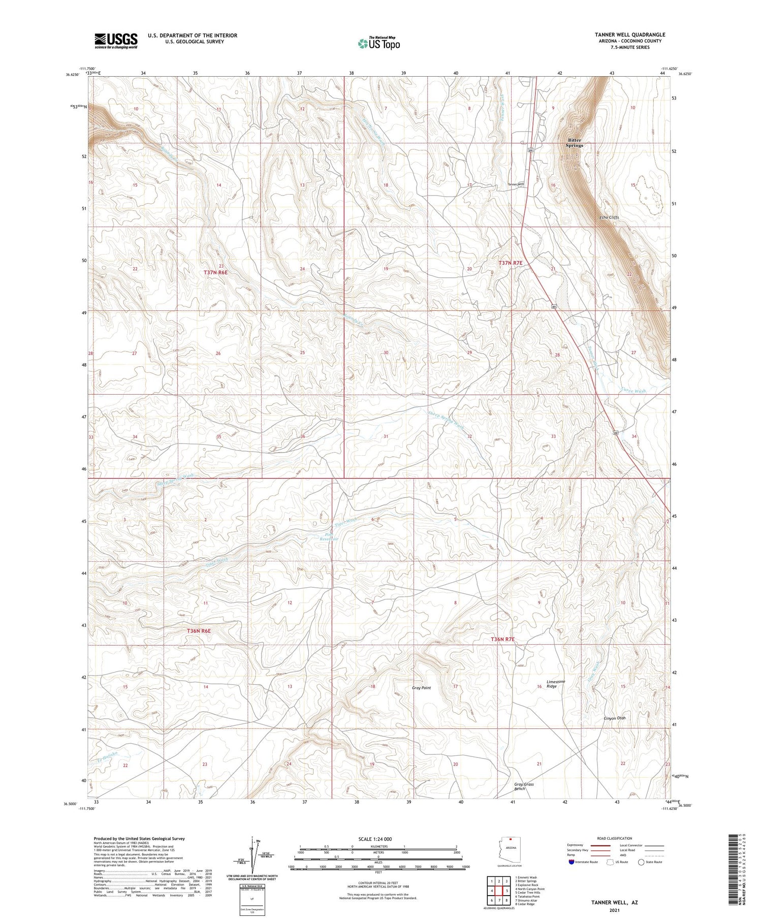
2021 topographic map quadrangle Tanner Well in the state of Arizona. Scale: 1:24000. Based on the newly updated USGS 7.5' US Topo map series, this map is in the following counties: Coconino. The map contains contour data, water features, and other items you are used to seeing on USGS maps, but also has updated roads and other features. This is the next generation of topographic maps. Printed on high-quality waterproof paper with UV fade-resistant inks.
Quads adjacent to this one:
West: North Canyon Point
Northwest: Emmett Wash
North: Bitter Springs
Northeast: Explosive Rock
East: Cedar Tree Hills
Southeast: Cedar Ridge
South: Shinumo Altar
Southwest: Tatahatso Point
This map covers the same area as the classic USGS quad with code o36111e6.
Contains the following named places: Bitter Springs Census Designated Place, Cinyon Otah, Curve Wash, Gray Grass Bench, Gray Point, Gray Wash, Limestone Tank, Pine Reservoir, Tanner Well


