MyTopo
Toh Atin Mesa East Arizona US Topo Map
Couldn't load pickup availability
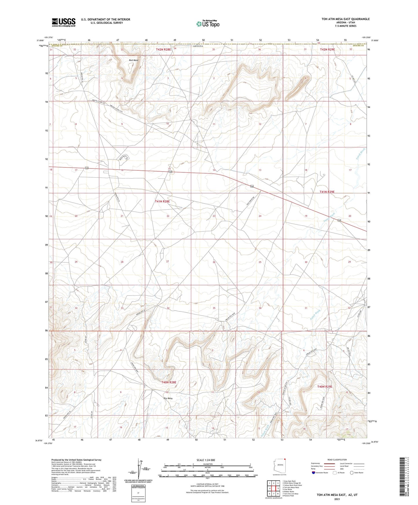
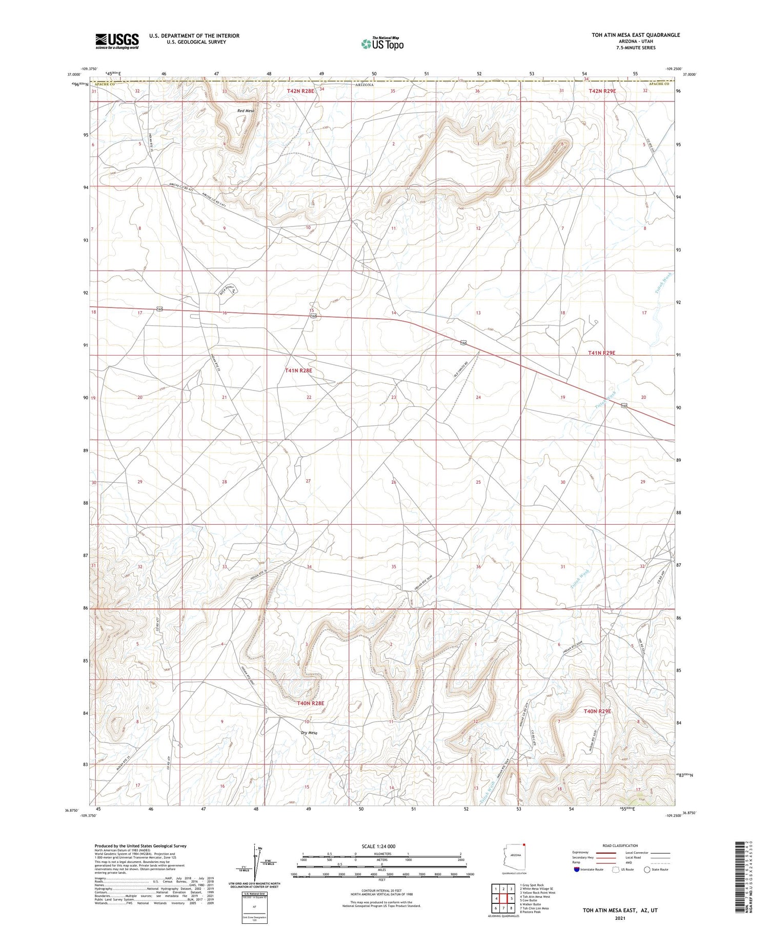
2021 topographic map quadrangle Toh Atin Mesa East in the state of Arizona. Scale: 1:24000. Based on the newly updated USGS 7.5' US Topo map series, this map is in the following counties: Apache, San Juan. The map contains contour data, water features, and other items you are used to seeing on USGS maps, but also has updated roads and other features. This is the next generation of topographic maps. Printed on high-quality waterproof paper with UV fade-resistant inks.
Quads adjacent to this one:
West: Toh Atin Mesa West
Northwest: Gray Spot Rock
North: White Mesa Village SE
Northeast: Yellow Rock Point West
East: Cow Butte
Southeast: Pastora Peak
South: Toh Chin Lini Mesa
Southwest: Walker Butte
Contains the following named places: Dry Mesa, Rattlesnake Mine, Red Mesa, Red Mesa Day School, ZIP Code: 86514