MyTopo
Walker Butte Arizona US Topo Map
Couldn't load pickup availability
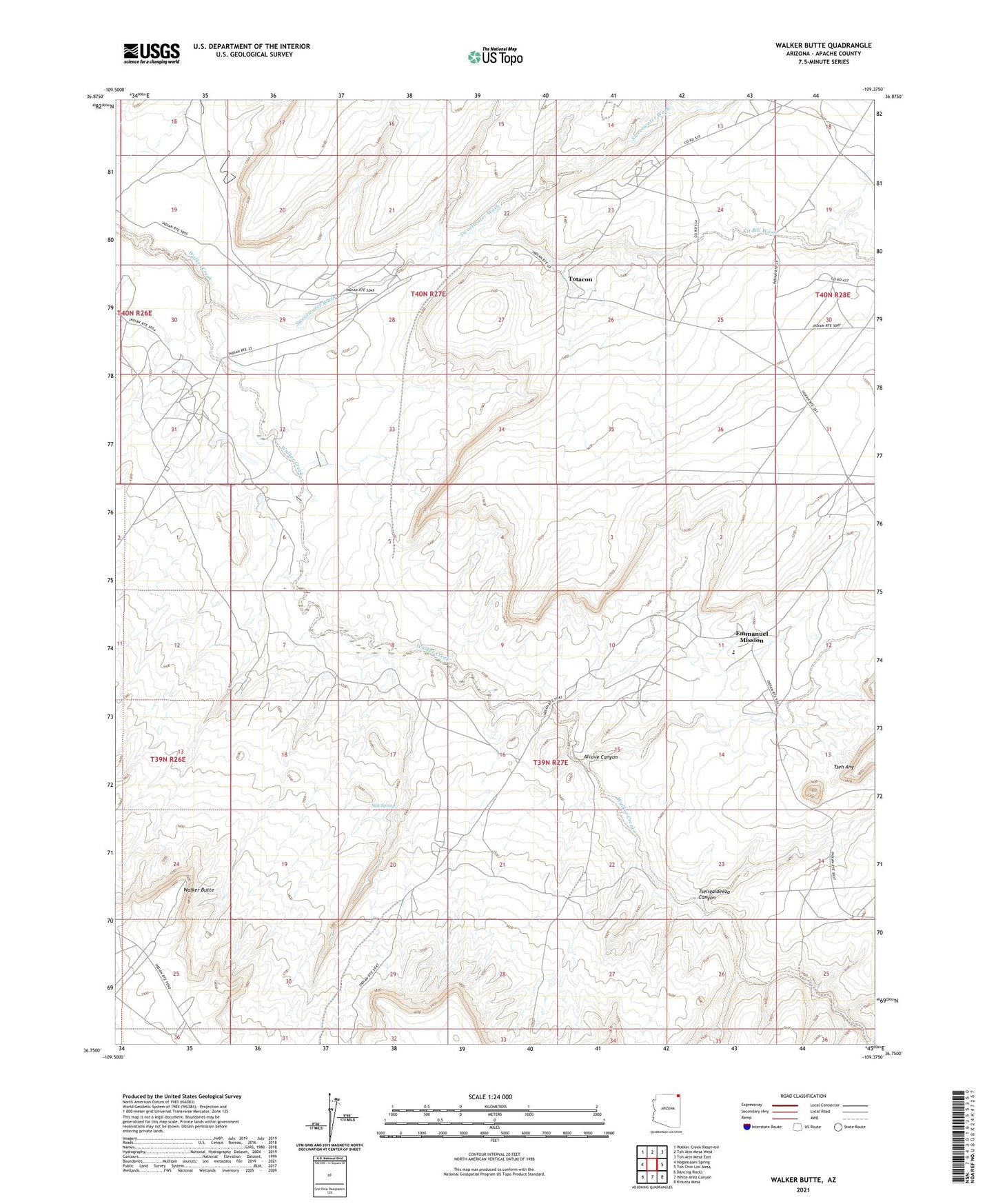
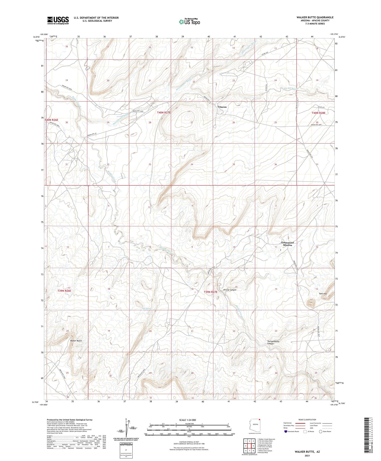
2021 topographic map quadrangle Walker Butte in the state of Arizona. Scale: 1:24000. Based on the newly updated USGS 7.5' US Topo map series, this map is in the following counties: Apache. The map contains contour data, water features, and other items you are used to seeing on USGS maps, but also has updated roads and other features. This is the next generation of topographic maps. Printed on high-quality waterproof paper with UV fade-resistant inks.
Quads adjacent to this one:
West: Hogansaani Spring
Northwest: Walker Creek Reservoir
North: Toh Atin Mesa West
Northeast: Toh Atin Mesa East
East: Toh Chin Lini Mesa
Southeast: Kinusta Mesa
South: White Area Canyon
Southwest: Dancing Rocks
This map covers the same area as the classic USGS quad with code o36109g4.
Contains the following named places: Alcove Canyon, Emmanuel Mission, Immanuel Mission School, Kit Sili Wash, Salt Spring, Sweetwater Wash, Totacon, Tseh Any, Tseligaideeza Canyon, Walker Butte