MyTopo
Fort Rock Ranch Arizona US Topo Map
Couldn't load pickup availability
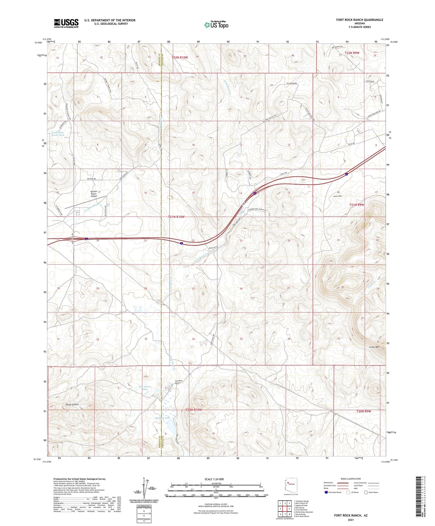
2021 topographic map quadrangle Fort Rock Ranch in the state of Arizona. Scale: 1:24000. Based on the newly updated USGS 7.5' US Topo map series, this map is in the following counties: Yavapai, Mohave. The map contains contour data, water features, and other items you are used to seeing on USGS maps, but also has updated roads and other features. This is the next generation of topographic maps. Printed on high-quality waterproof paper with UV fade-resistant inks.
Quads adjacent to this one:
West: Bull Spring
Northwest: Tuckayou Spring
North: Blye Canyon SE
Northeast: Sugarloaf Peak
East: Cross Mountain
Southeast: Anvil Rock Ranch
South: Devils Hump
Southwest: Penitentiary Mountain
This map covers the same area as the classic USGS quad with code o35113b3.
Contains the following named places: Apache Tank, Carl F Well, Dunton Ranch Airport, Esther F Well, Fort Rock Ranch, Horse Lake, Lagoon Tank, Little Dam North Tank, Meadow Lake, Red Hill Tank, Rose Tank, Three Sisters, Tom Bacon Lake, Well Number One