MyTopo
Union Pass Arizona US Topo Map
Couldn't load pickup availability
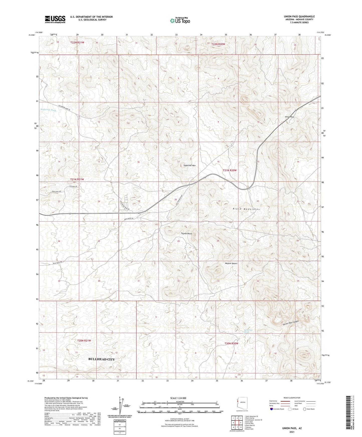
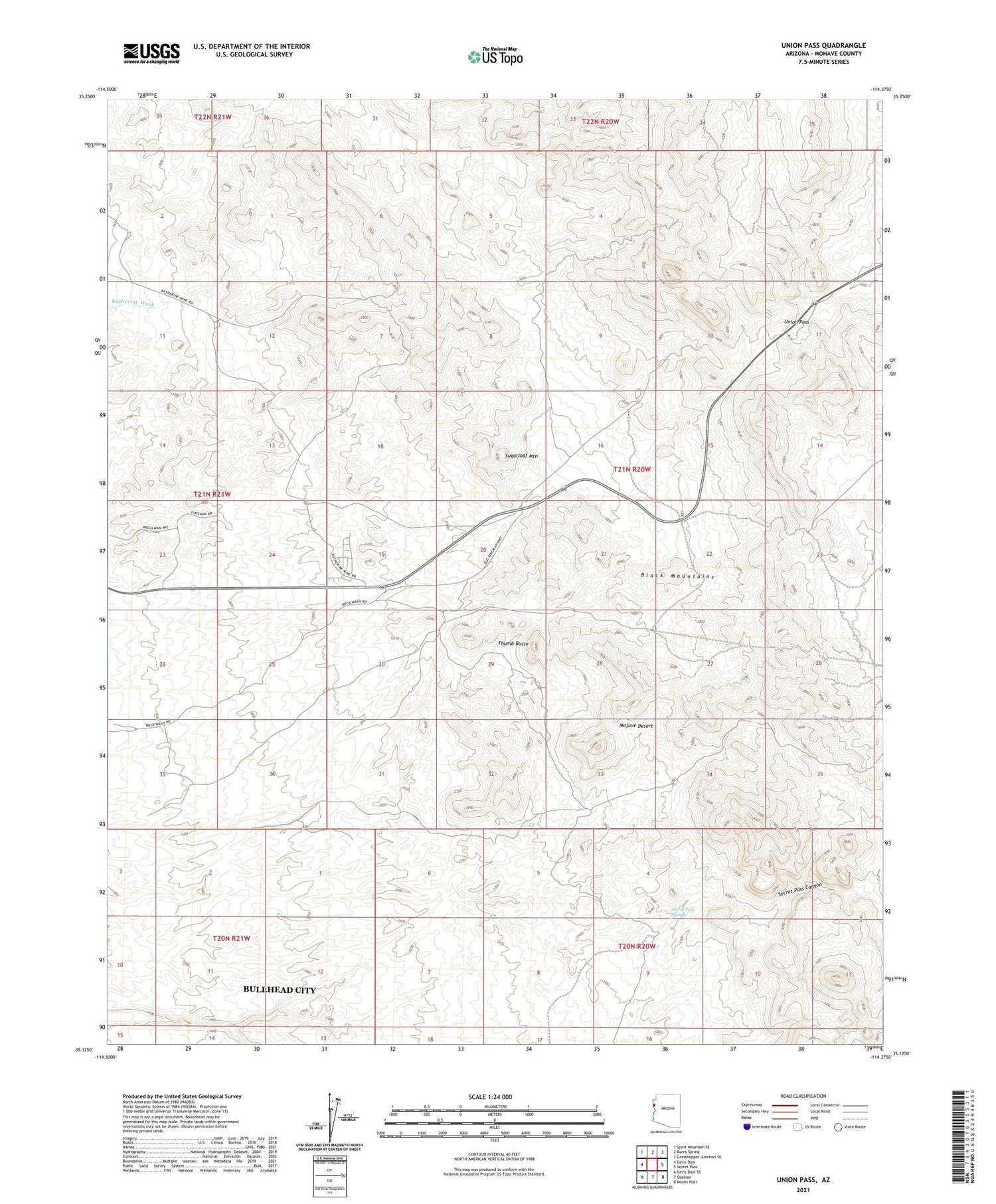
2021 topographic map quadrangle Union Pass in the state of Arizona. Scale: 1:24000. Based on the newly updated USGS 7.5' US Topo map series, this map is in the following counties: Mohave. The map contains contour data, water features, and other items you are used to seeing on USGS maps, but also has updated roads and other features. This is the next generation of topographic maps. Printed on high-quality waterproof paper with UV fade-resistant inks.
Quads adjacent to this one:
West: Davis Dam
Northwest: Spirit Mountain SE
North: Burns Spring
Northeast: Grasshopper Junction SE
East: Secret Pass
Southeast: Mount Nutt
South: Oatman
Southwest: Davis Dam SE
This map covers the same area as the classic USGS quad with code o35114b4.
Contains the following named places: Arabian Mine, Secret Pass Spring, Sugarloaf Mountain, Thumb Butte, Tyro Mine, Union Pass, ZIP Code: 86429