MyTopo
Vaiva Vo Arizona US Topo Map
Couldn't load pickup availability
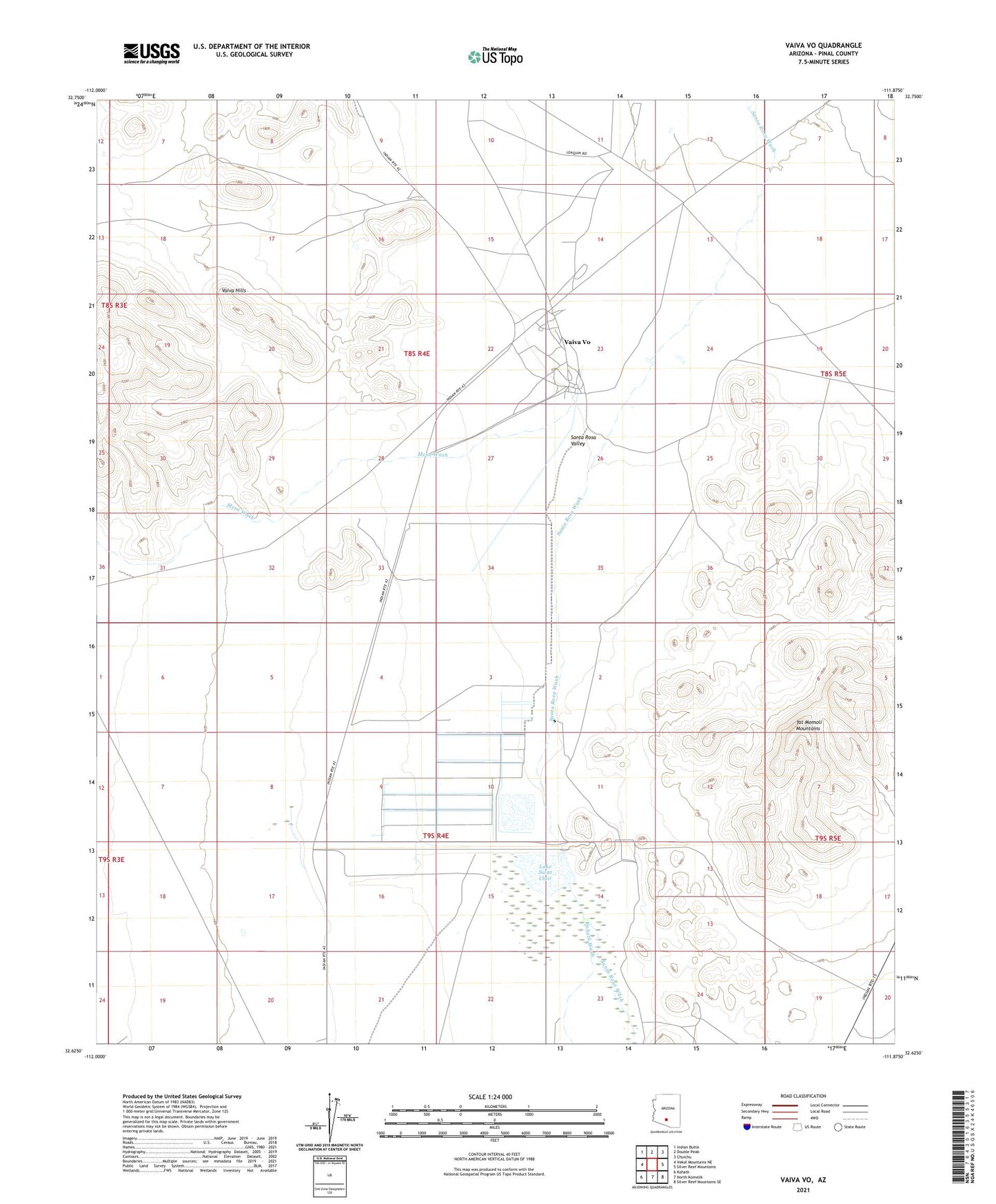
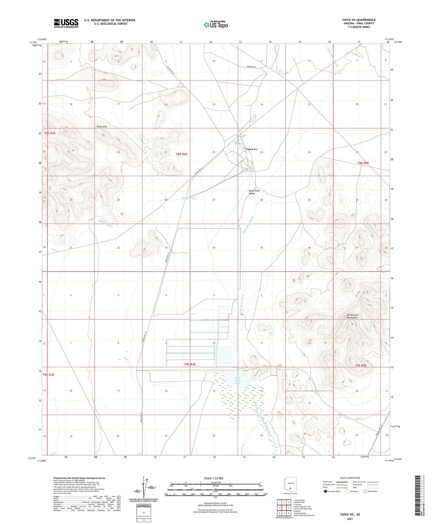
2021 topographic map quadrangle Vaiva Vo in the state of Arizona. Scale: 1:24000. Based on the newly updated USGS 7.5' US Topo map series, this map is in the following counties: Pinal. The map contains contour data, water features, and other items you are used to seeing on USGS maps, but also has updated roads and other features. This is the next generation of topographic maps. Printed on high-quality waterproof paper with UV fade-resistant inks.
Quads adjacent to this one:
West: Vekol Mountains NE
Northwest: Indian Butte
North: Double Peak
Northeast: Chuichu
East: Silver Reef Mountains
Southeast: Silver Reef Mountains SE
South: North Komelik
Southwest: Kohatk
This map covers the same area as the classic USGS quad with code o32111f8.
Contains the following named places: Antelope Tank, Kohatk Wash, Lake Saint Clair, Mesa Wash, Santa Rosa Valley, Tat Momoli Mountains, Tohono O'odham Nation Division, Vaiva Hills, Vaiva Vo, Vaiva Vo Census Designated Place