MyTopo
North Komelik Arizona US Topo Map
Couldn't load pickup availability
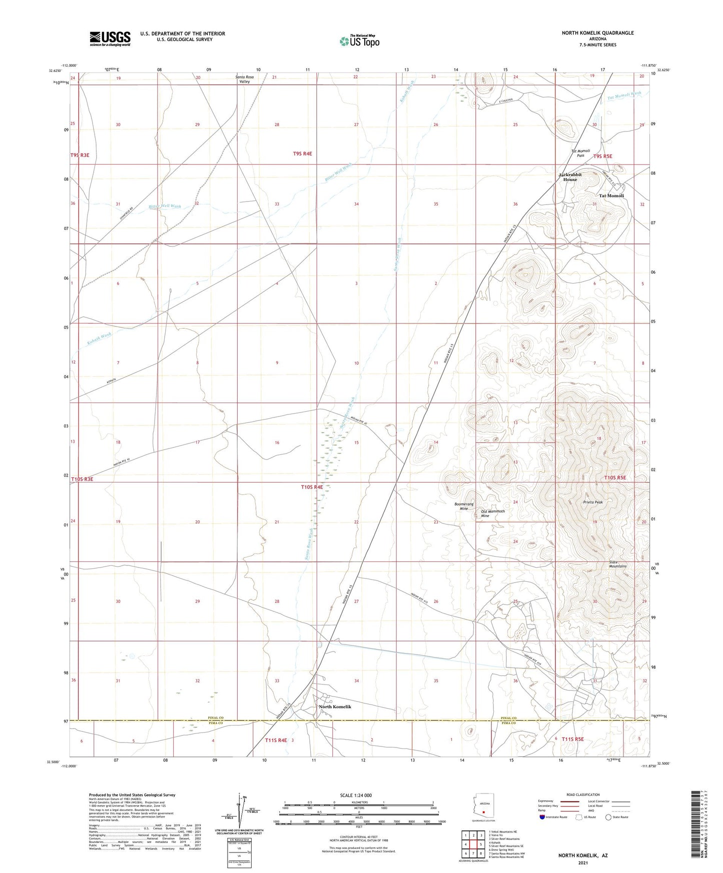
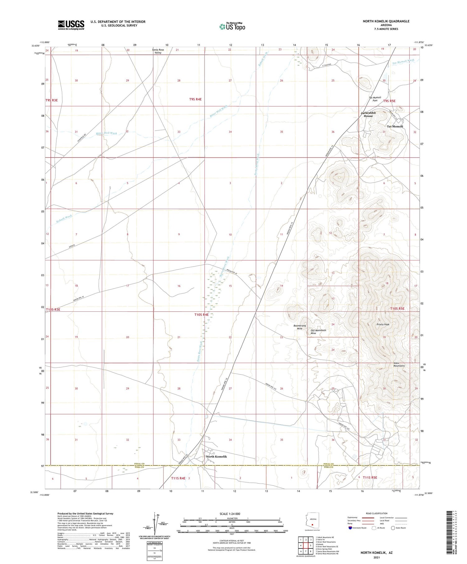
2021 topographic map quadrangle North Komelik in the state of Arizona. Scale: 1:24000. Based on the newly updated USGS 7.5' US Topo map series, this map is in the following counties: Pinal, Pima. The map contains contour data, water features, and other items you are used to seeing on USGS maps, but also has updated roads and other features. This is the next generation of topographic maps. Printed on high-quality waterproof paper with UV fade-resistant inks.
Quads adjacent to this one:
West: Kohatk
Northwest: Vekol Mountains NE
North: Vaiva Vo
Northeast: Silver Reef Mountains
East: Silver Reef Mountains SE
Southeast: Santa Rosa Mountains NE
South: Santa Rosa Mountains NW
Southwest: Drew Spring Well
This map covers the same area as the classic USGS quad with code o32111e8.
Contains the following named places: Bitter Well Wash, Boomerang Mine, Desert Queen Mine, House Mine, Jackrabbit House, Jackrabbit Mine, Lake Shore Mine, North Komelik, Old Mammoth Mine, Orizaba Mine, Orphan Mine, Prieta Peak, Ramona Mine, Red Chief Mine, Sif Oidak District, Slate Mountains, Tat Momoli, Tat Momoli Census Designated Place, Tat Momoli Pass, Turning Point Mine