MyTopo
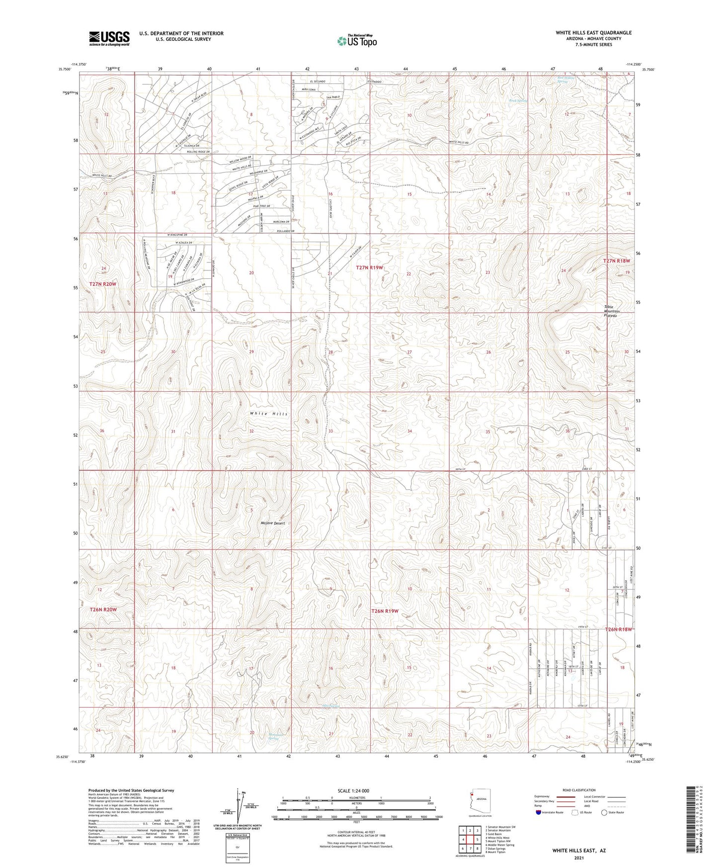
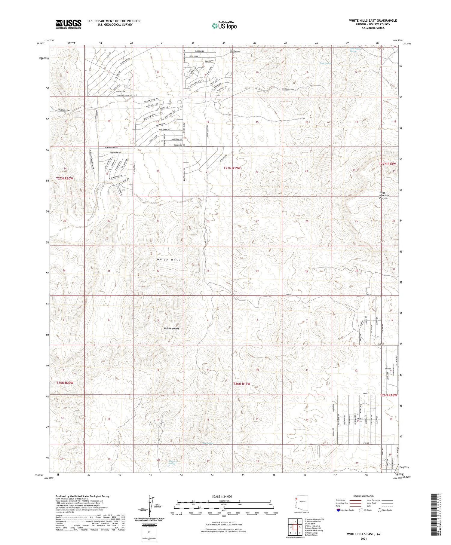
White Hills East Arizona US Topo Map
Couldn't load pickup availability
2021 topographic map quadrangle White Hills East in the state of Arizona. Scale: 1:24000. Based on the newly updated USGS 7.5' US Topo map series, this map is in the following counties: Mohave. The map contains contour data, water features, and other items you are used to seeing on USGS maps, but also has updated roads and other features. This is the next generation of topographic maps. Printed on high-quality waterproof paper with UV fade-resistant inks.
Quads adjacent to this one:
West: White Hills West
Northwest: Senator Mountain SW
North: Senator Mountain
Northeast: Gold Basin
East: Mount Tipton NW
Southeast: Mount Tipton
South: Dolan Springs
Southwest: Middle Water Spring
This map covers the same area as the classic USGS quad with code o35114f3.
Contains the following named places: Alta Spring, Butcher Camp, Butcher Windmill, Jeffs Camp, Mountain Spring, Nealy Well, North Well, Red Willow Spring, Rock Spring, Sacaton Dam, Skipper Tank, Table Mountain Plateau, Valley Tank