MyTopo
Willow Springs Arizona US Topo Map
Couldn't load pickup availability
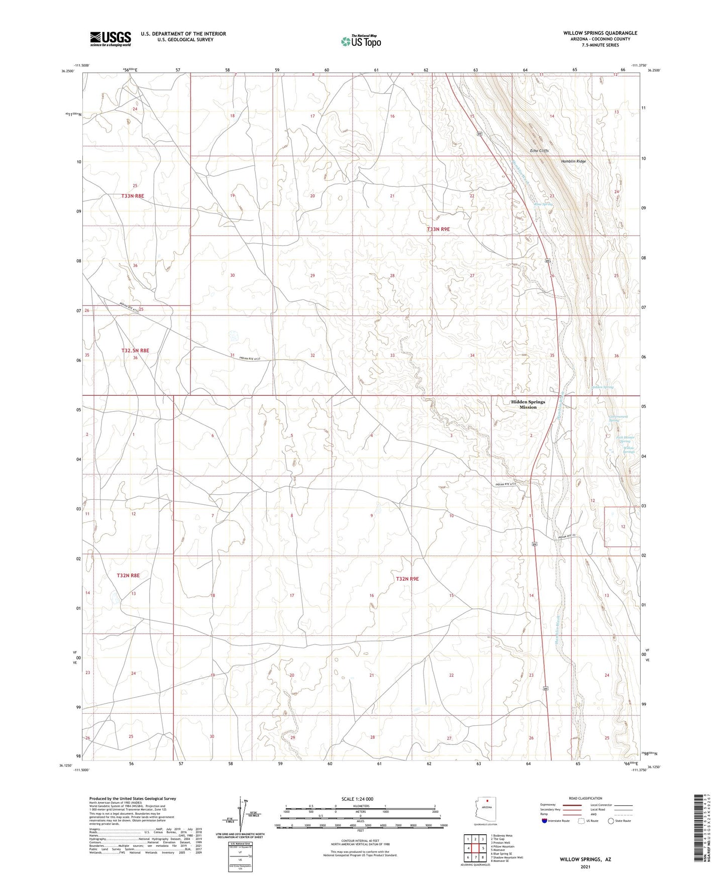
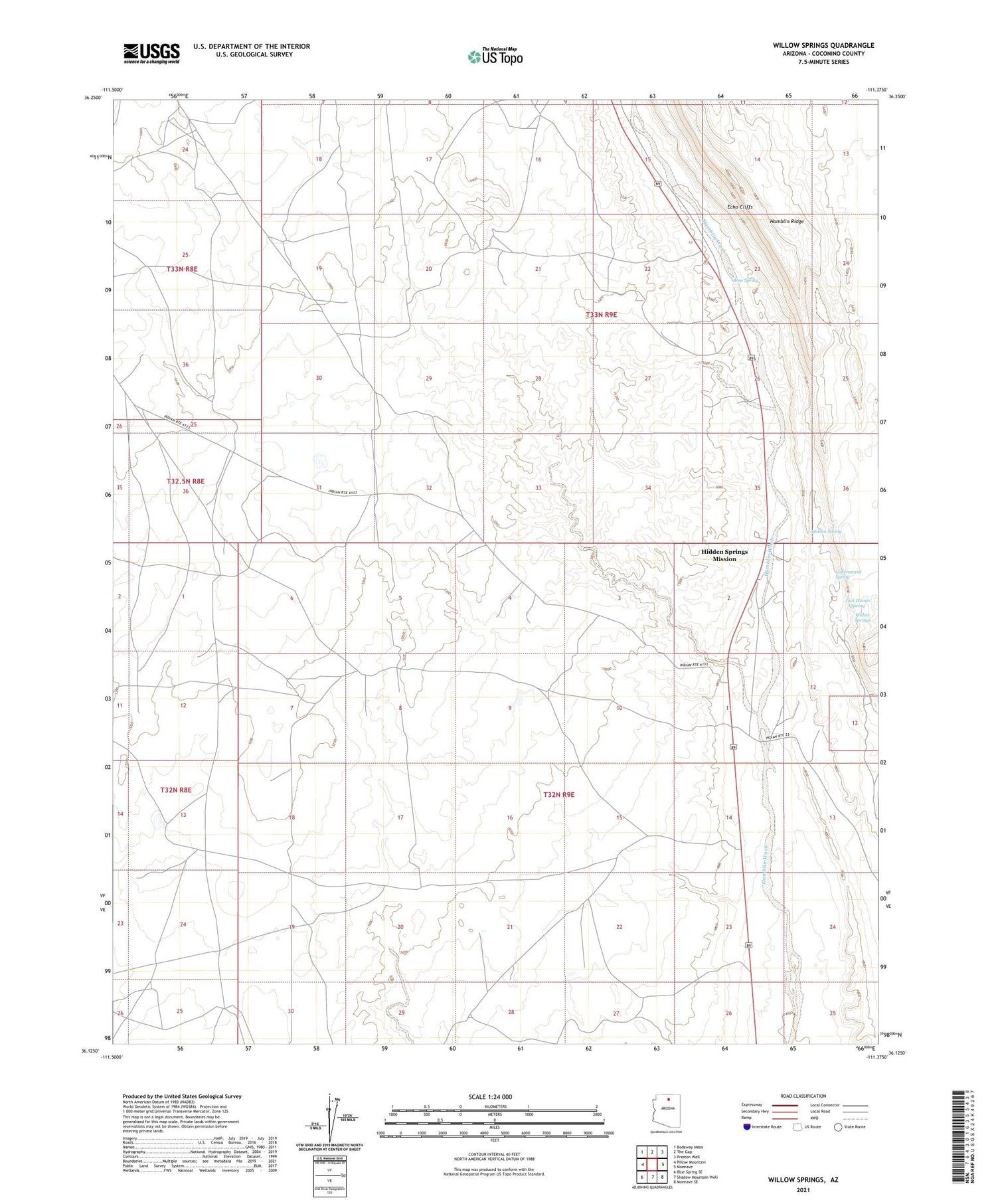
2021 topographic map quadrangle Willow Springs in the state of Arizona. Scale: 1:24000. Based on the newly updated USGS 7.5' US Topo map series, this map is in the following counties: Coconino. The map contains contour data, water features, and other items you are used to seeing on USGS maps, but also has updated roads and other features. This is the next generation of topographic maps. Printed on high-quality waterproof paper with UV fade-resistant inks.
Quads adjacent to this one:
West: Pillow Mountain
Northwest: Bodaway Mesa
North: The Gap
Northeast: Preston Well
East: Moenave
Southeast: Moenave SE
South: Shadow Mountain Well
Southwest: Blue Spring SE
This map covers the same area as the classic USGS quad with code o36111b4.
Contains the following named places: Government Spring, Hidden Spring, Hidden Springs Mission, Jack Homer Spring, Rose Spring, Willow Creek, Willow Springs