MyTopo
Yarnell Arizona US Topo Map
Couldn't load pickup availability
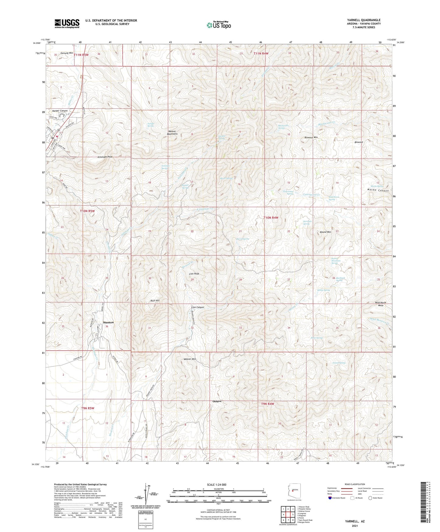
2021 topographic map quadrangle Yarnell in the state of Arizona. Scale: 1:24000. Based on the newly updated USGS 7.5' US Topo map series, this map is in the following counties: Yavapai. The map contains contour data, water features, and other items you are used to seeing on USGS maps, but also has updated roads and other features. This is the next generation of topographic maps. Printed on high-quality waterproof paper with UV fade-resistant inks.
Quads adjacent to this one:
West: Congress
Northwest: Weaver Peak
North: Peeples Valley
Northeast: Walnut Grove
East: Wagoner
Southeast: Morgan Butte
South: Sam Powell Peak
Southwest: Flores
This map covers the same area as the classic USGS quad with code o34112b6.
Contains the following named places: Antelope Peak, Antelope Spring, Barrel Spring, Beech Spring, Beehive Mine, Blackjack Spring, Blackwater Spring, Blowout, Blowout Mountain, Bricks Windmill, Carrol Well, Congress Division, Devils Nest Mine, East Antelope Creek, Genung Mountain, Goat Camp Spring, Harper Canyon, Indian Creek, Johnson Mine, Juniper Spring, Leviathan Mine, Lion Canyon, Lion Peak, Millers Windmill, Mocho Spring, Myers Mine, Octave, Octave Mine, Rich Hill, Round Mountain, Round Mountain Spring, Sinoski Mine, Stanton, Stove Spring, Stump Spring, Surveyor Spring, Tunnel Spring, Weaver Mountain, Wild Horse Mesa, Wild Horse Spring, Yarnell, Yarnell Community Hall, Yarnell Community Presbyterian Church, Yarnell Creek, Yarnell Elementary School, Yarnell Fire Department, Yarnell Mine, Yarnell Post Office, Yarnell Spring, Yavapai County Sheriff's Office Yarnell