MyTopo
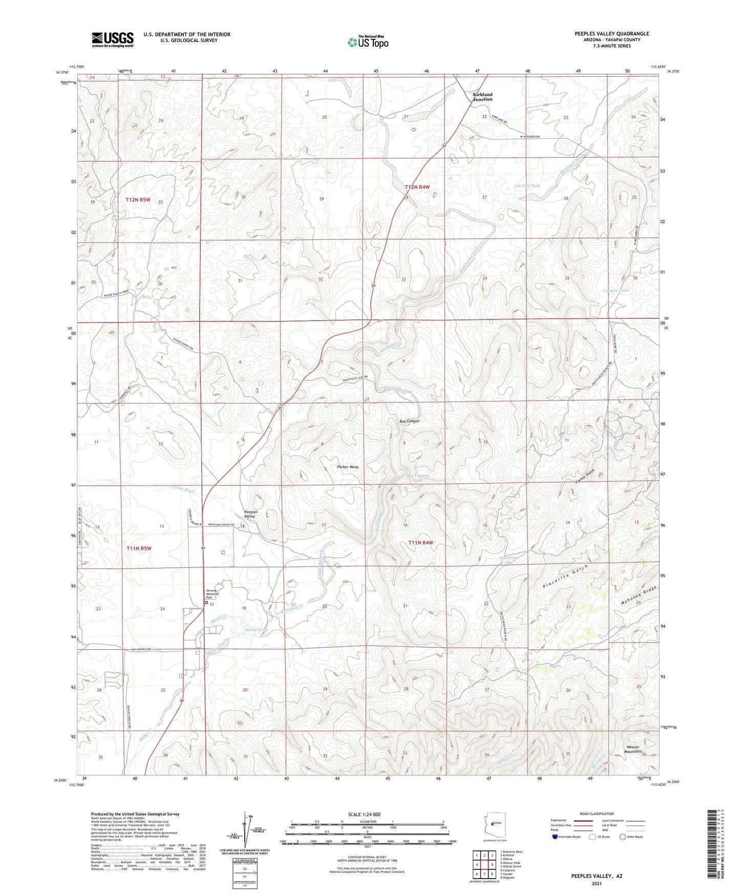
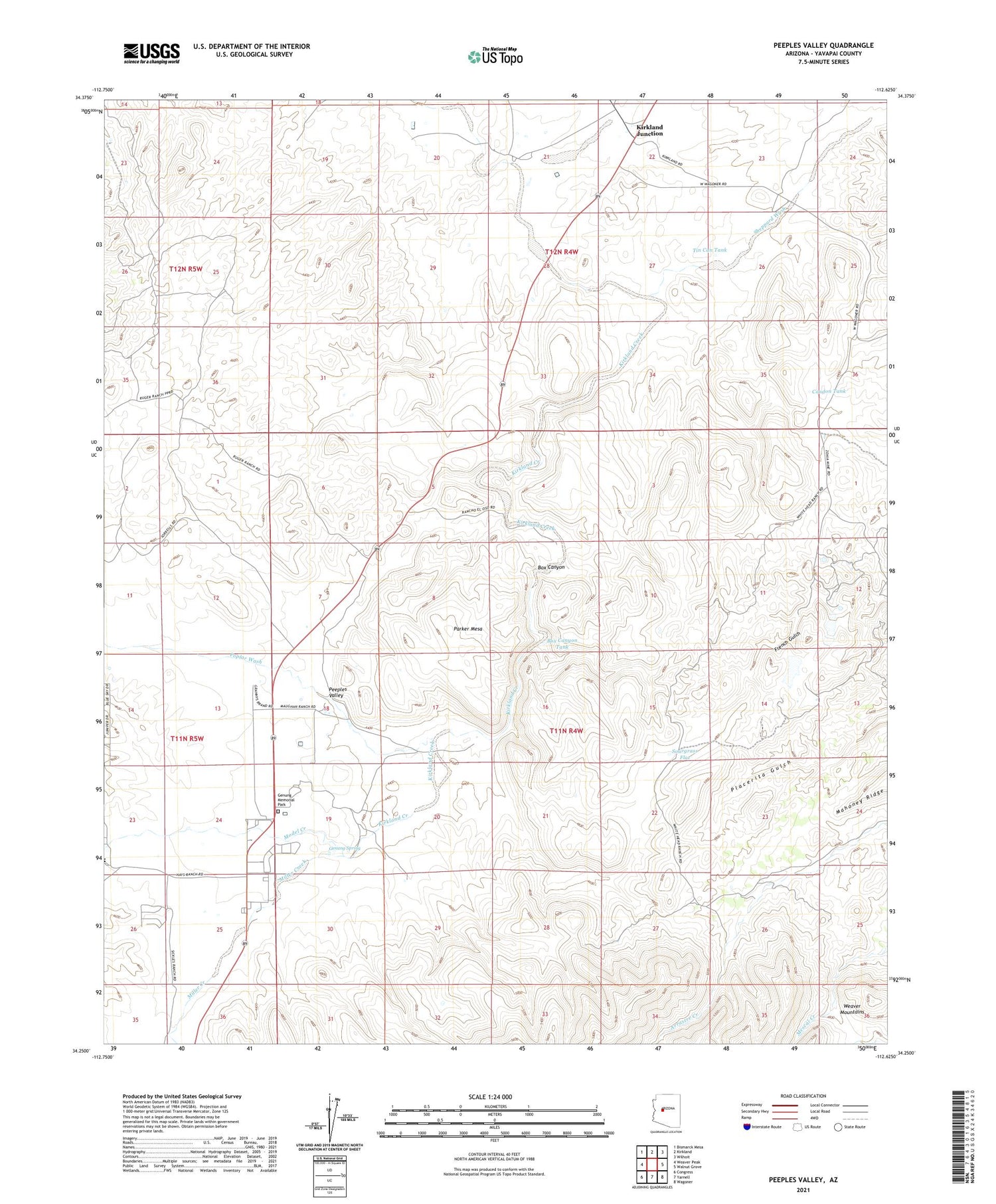
Peeples Valley Arizona US Topo Map
Couldn't load pickup availability
Also explore the Peeples Valley Forest Service Topo of this same quad for updated USFS data
2021 topographic map quadrangle Peeples Valley in the state of Arizona. Scale: 1:24000. Based on the newly updated USGS 7.5' US Topo map series, this map is in the following counties: Yavapai. The map contains contour data, water features, and other items you are used to seeing on USGS maps, but also has updated roads and other features. This is the next generation of topographic maps. Printed on high-quality waterproof paper with UV fade-resistant inks.
Quads adjacent to this one:
West: Weaver Peak
Northwest: Bismarck Mesa
North: Kirkland
Northeast: Wilhoit
East: Walnut Grove
Southeast: Wagoner
South: Yarnell
Southwest: Congress
This map covers the same area as the classic USGS quad with code o34112c6.
Contains the following named places: Arizona Highway Maintenance Peeples Valley Yard, Box Canyon, Box Canyon Tank, Box Canyon Windmill, Carter Windmill, Condon Tank, East Side Windmill, East Windmill, Ferguson Place Windmill, Genung Memorial Park, Genung Spring, Hays Ranch, Indian Camp Windmill, Jeffs Windmill, Kirkland Junction, Kirkland Junction Substation, Malipai Windmill, McCrea Windmill, Meadow Windmill, Miller Creek, Model Creek, Model Creek Elementary School, Parker Mesa, Parker Mesa Windmill, Peeples Valley, Peeples Valley School, Placerita, Poplar Wash, Road Camp Windmill, Sheppard Wash, Sheppard Windmill, Sourgrass Flat, Sourgrass Flat Windmill, Tin Can Tank, Young Windmill, Zonia Mine, ZIP Code: 86332