MyTopo
Weaver Peak Arizona US Topo Map
Couldn't load pickup availability
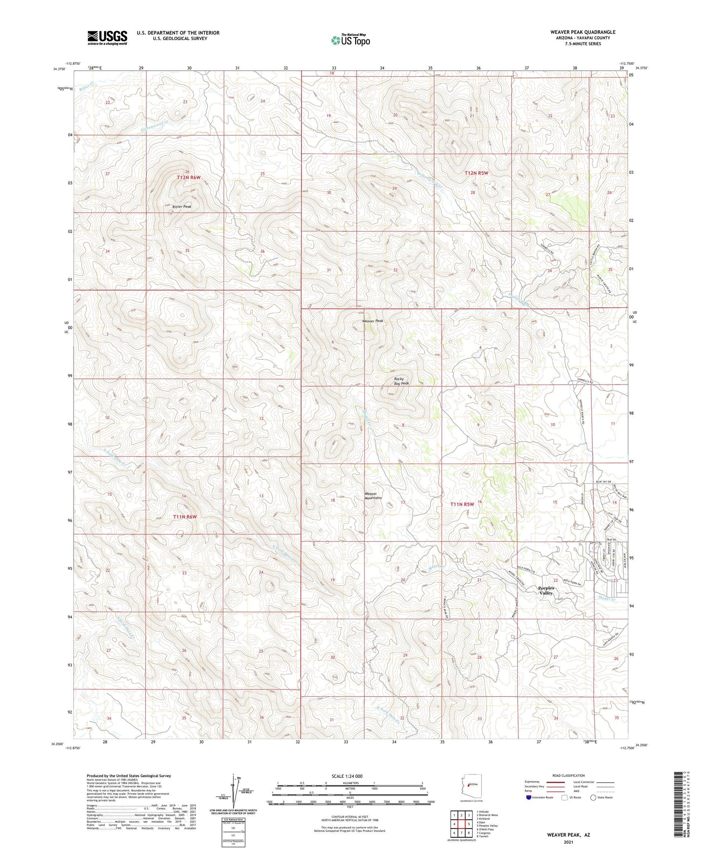
2021 topographic map quadrangle Weaver Peak in the state of Arizona. Scale: 1:24000. Based on the newly updated USGS 7.5' US Topo map series, this map is in the following counties: Yavapai. The map contains contour data, water features, and other items you are used to seeing on USGS maps, but also has updated roads and other features. This is the next generation of topographic maps. Printed on high-quality waterproof paper with UV fade-resistant inks.
Quads adjacent to this one:
West: Date
Northwest: Hillside
North: Bismarck Mesa
Northeast: Kirkland
East: Peeples Valley
Southeast: Yarnell
South: Congress
This map covers the same area as the classic USGS quad with code o34112c7.
Contains the following named places: Buckhorn Mine, Childers Well, Cuba Mine, Lounce Lookout, Monte Cristo Mine, Peeples Valley Census Designated Place, Ritter Peak, Rocky Boy Peak, Weaver Peak, ZIP Code: 85362