MyTopo
Cerrogordo Arkansas US Topo Map
Couldn't load pickup availability
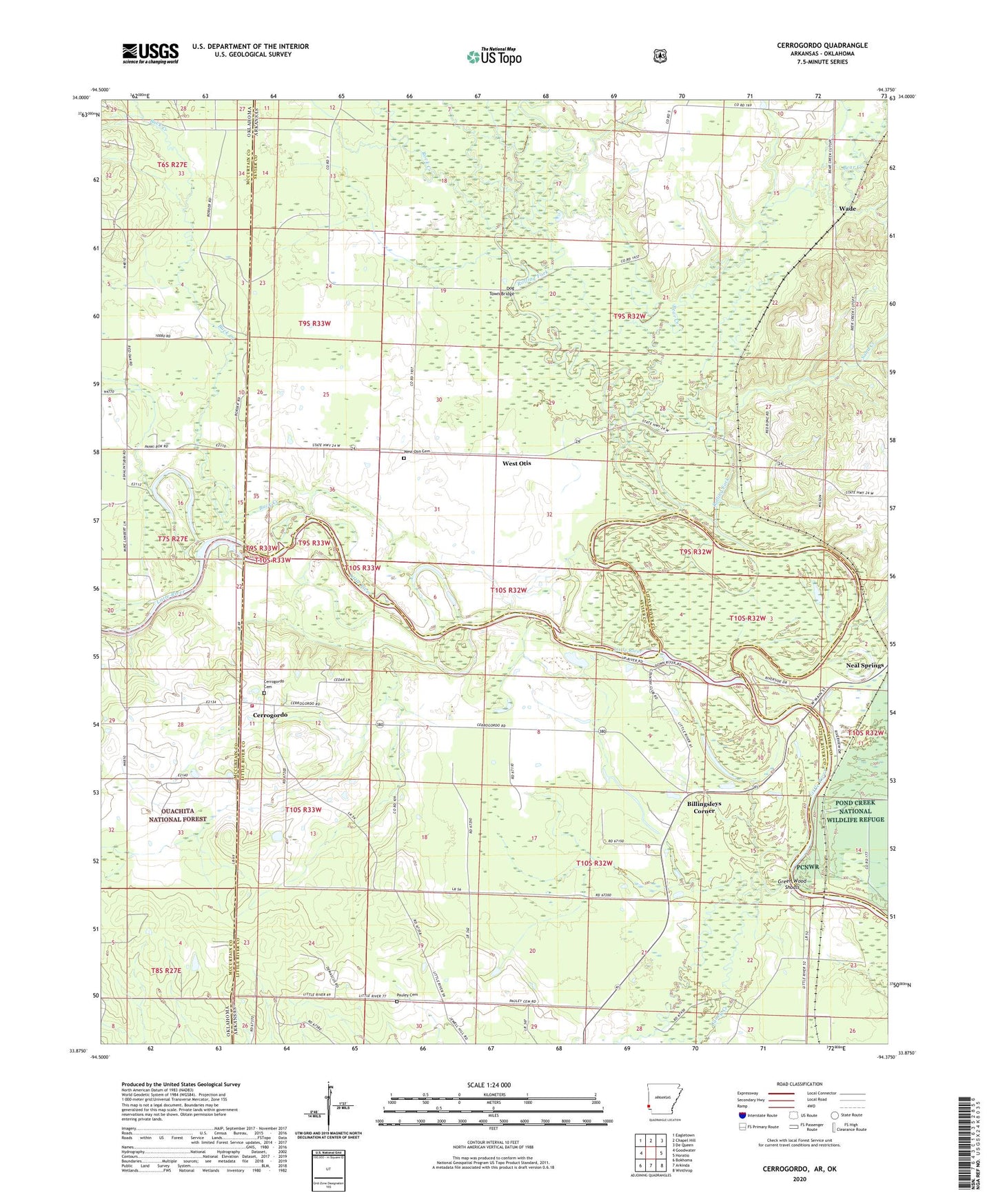
2024 topographic map quadrangle Cerrogordo in the state of Arkansas. Scale: 1:24000. Based on the newly updated USGS 7.5' US Topo map series, this map is in the following counties: Sevier, Little River, McCurtain. The map contains contour data, water features, and other items you are used to seeing on USGS maps, but also has updated roads and other features. This is the next generation of topographic maps. Printed on high-quality waterproof paper with UV fade-resistant inks.
Quads adjacent to this one:
West: Goodwater
Northwest: Eagletown
North: Chapel Hill
Northeast: De Queen
East: Horatio
Southeast: Winthrop
South: Arkinda
Southwest: Bokhoma
Contains the following named places: Bear Creek, Billingsleys Corner, Boring Crossing, Buck Creek, Caney Creek, Cerro Gordo Volunteer Fire Department, Cerrogordo, Cerrogordo Cemetery, Dog Town Bridge, Dogtown, Gin House Ford, Green Wood Ferry, Green Wood Shoals, Line Ford, Little River Country Club, Morris Ferry, Old Channel Little River, Parker Crossing, Pauley Cemetery, Plainview School, Rock Creek, Rolling Fork, Sand Creek, Sorghum Patch Ford, State Line Baptist Church, Township of Buckhorn, Township of Caney, Wade, West Otis, West Otis Cemetery, West Otis Church, Wright Chapel, ZIP Code: 71866