MyTopo
Horatio Arkansas US Topo Map
Couldn't load pickup availability
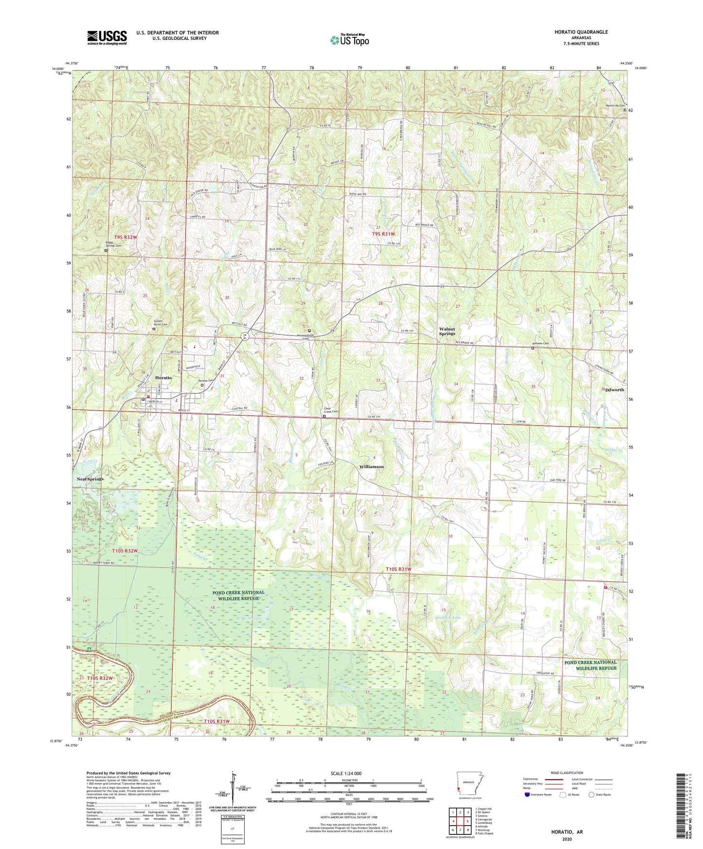
2024 topographic map quadrangle Horatio in the state of Arkansas. Scale: 1:24000. Based on the newly updated USGS 7.5' US Topo map series, this map is in the following counties: Sevier, Little River. The map contains contour data, water features, and other items you are used to seeing on USGS maps, but also has updated roads and other features. This is the next generation of topographic maps. Printed on high-quality waterproof paper with UV fade-resistant inks.
Quads adjacent to this one:
West: Cerrogordo
Northwest: Chapel Hill
North: De Queen
Northeast: Geneva
East: Lockesburg
Southeast: Falls Chapel
South: Winthrop
Southwest: Arkinda
This map covers the same area as the classic USGS quad with code o33094h3.
Contains the following named places: Beacon Hill School, Berks Slough, Blue Creek, Boggy Springs Cemetery, Boggy Springs Church, Bradley Chapel, Carrun Church, Central, Central Volunteer Fire and Rescue, City of Horatio, Clear Creek, Clear Creek Cemetery, Cool Easy Creek, Dilworth Church, Double K Lake, Double K Lake Dam, Horatio, Horatio Cemetery, Horatio Elementary School, Horatio Fire Department, Horatio High School, Horatio Post Office, Mill Creek, Millwee Cemetery, Millwee Creek, Mount Ida Cemetery, Neal Springs, Norris Ferry, Norwoodville, Norwoodville Cemetery, Old Central Church, Stallion Ford, Stringtown Creek, Sunset Acres Cemetery, Township of Clear Creek, Walnut Springs, Walnut Springs Creek, Walnut Springs School, Williamson, Williamson Methodist Church, ZIP Code: 71842