MyTopo
Board Camp Arkansas US Topo Map
Couldn't load pickup availability
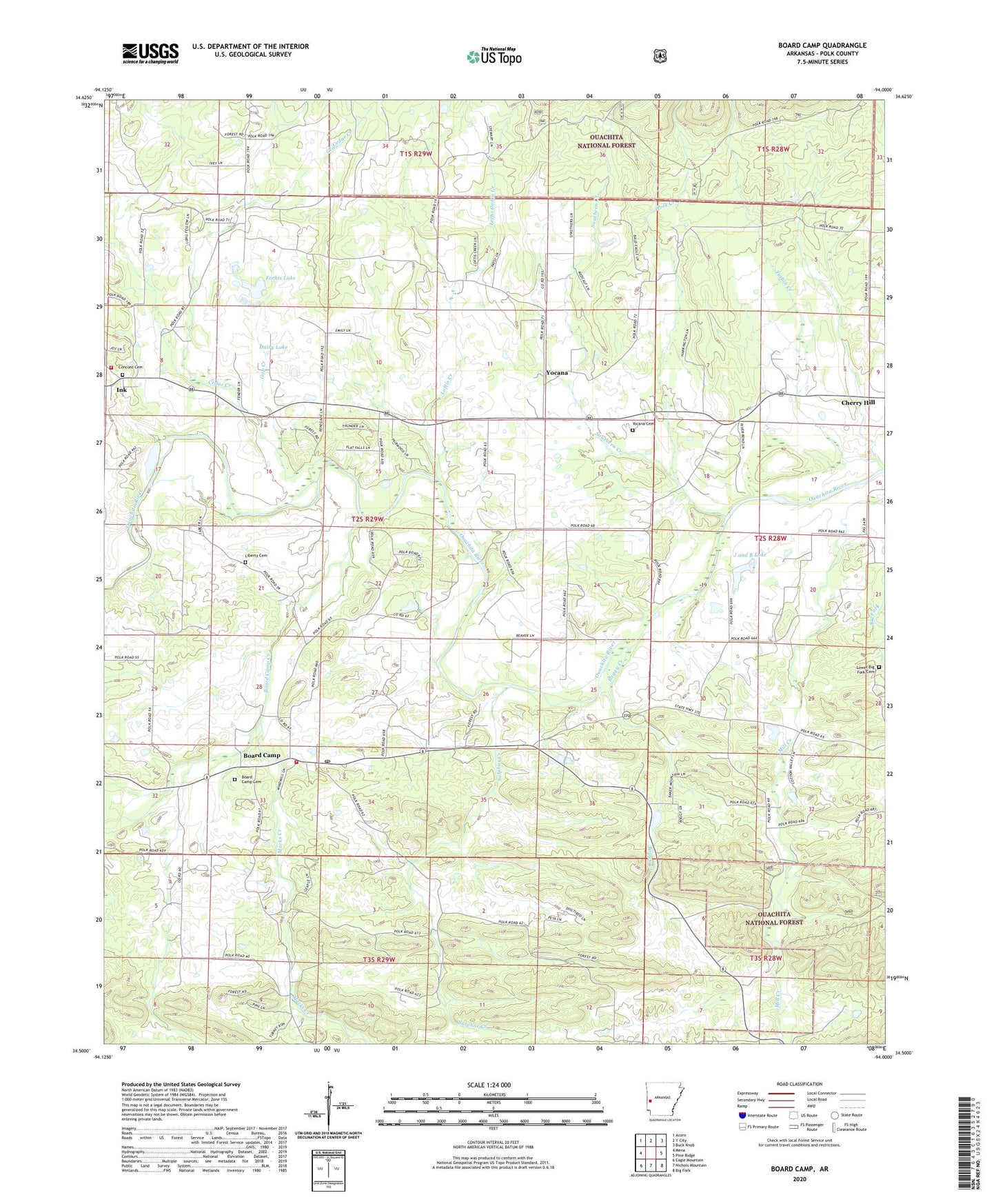
2024 topographic map quadrangle Board Camp in the state of Arkansas. Scale: 1:24000. Based on the newly updated USGS 7.5' US Topo map series, this map is in the following counties: Polk. The map contains contour data, water features, and other items you are used to seeing on USGS maps, but also has updated roads and other features. This is the next generation of topographic maps. Printed on high-quality waterproof paper with UV fade-resistant inks.
Quads adjacent to this one:
West: Mena
Northwest: Acorn
North: Y City
Northeast: Buck Knob
East: Pine Ridge
Southeast: Big Fork
South: Nichols Mountain
Southwest: Eagle Mountain
This map covers the same area as the classic USGS quad with code o34094e1.
Contains the following named places: Board Camp, Board Camp Assembly of God Church, Board Camp Baptist Church, Board Camp Cemetery, Board Camp Census Designated Place, Board Camp Creek, Board Camp Post Office, Board Camp Primitive Baptist Church, Board Camp School, Board Camp Station Fire District 8, Boggy Creek, Cedar Creek, Concord Baptist Church, Concord Cemetery, Dairy Lake, Dairy Lake Dam, Forbis Lake, Forbis Lake Dam, Gap Creek, Goldsberry Mountain, High Point Camp, Ink, Ink Station Fire District 12, J and B Lake, J and B Lake Dam, Liberty Cemetery, Loftis Creek, Lower Big Fork Cemetery, Macks Creek, Midway Freewill Baptist Church, Pine Grove, Pine Grove Church of Christ, Polk Creek, Robinson Creek, Southern Creek, Sulphur Creek, Township of Fulton, Turbin Creek, Yocana, Yocana Baptist Church, Yocana Cemetery