MyTopo
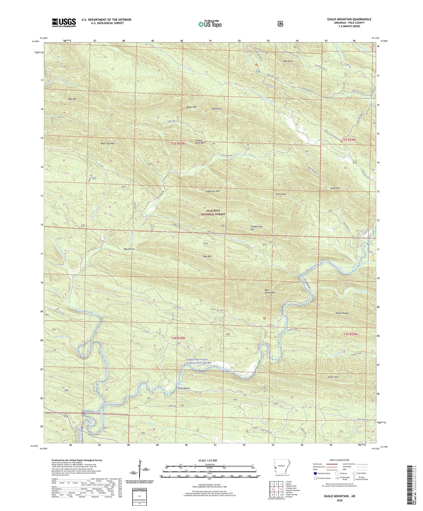
Eagle Mountain Arkansas US Topo Map
Couldn't load pickup availability
Also explore the Eagle Mountain Forest Service Topo of this same quad for updated USFS data
2024 topographic map quadrangle Eagle Mountain in the state of Arkansas. Scale: 1:24000. Based on the newly updated USGS 7.5' US Topo map series, this map is in the following counties: Polk. The map contains contour data, water features, and other items you are used to seeing on USGS maps, but also has updated roads and other features. This is the next generation of topographic maps. Printed on high-quality waterproof paper with UV fade-resistant inks.
Quads adjacent to this one:
West: Vandervoort
Northwest: Potter
North: Mena
Northeast: Board Camp
East: Nichols Mountain
Southeast: Umpire
South: Baker Springs
Southwest: Wickes
This map covers the same area as the classic USGS quad with code o34094d2.
Contains the following named places: Baker Mountain, Bald Knob, Bee Mountain, Boar Tusk Mountain, Brushy Creek, Caney Creek, Cossatot Wild and Scenic River, Dog Hollow, Dog Mountain, Eagle Mountain, Fodderstack Mountain, Gillham Springs, High Point, Holly Branch, Holly Creek, Little Brushy Creek, Long Branch, Long Hollow, Polk County, Rock Creek, Rocky Mountain, Short Creek, Smoke Rock Creek, Smoke Rock Mountain, Sugar Creek, Sugartree Mountain, West Hanna Mountain