MyTopo
Bono Arkansas US Topo Map
Couldn't load pickup availability
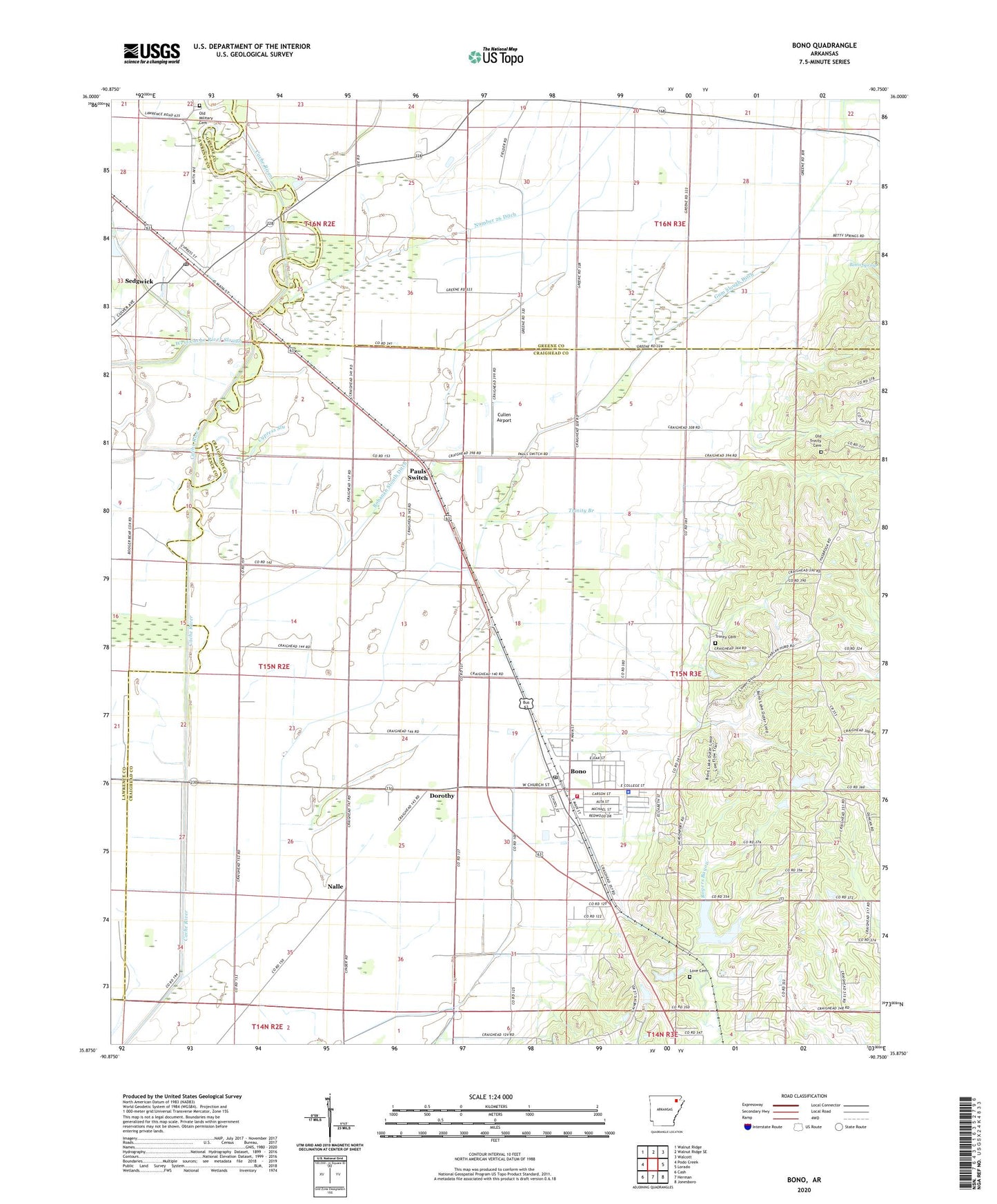
2024 topographic map quadrangle Bono in the state of Arkansas. Scale: 1:24000. Based on the newly updated USGS 7.5' US Topo map series, this map is in the following counties: Craighead, Greene, Lawrence. The map contains contour data, water features, and other items you are used to seeing on USGS maps, but also has updated roads and other features. This is the next generation of topographic maps. Printed on high-quality waterproof paper with UV fade-resistant inks.
Quads adjacent to this one:
West: Podo Creek
Northwest: Walnut Ridge
North: Walnut Ridge SE
Northeast: Walcott
East: Lorado
Southeast: Jonesboro
South: Herman
Southwest: Cash
This map covers the same area as the classic USGS quad with code o35090h7.
Contains the following named places: 56 School, 72416, Ames School, Bells Chapel Church, Bethel Church, Big Creek Site 10 Dam, Big Creek Site 10 Reservoir, Bohanan Slouth Ditch, Bono, Bono Fire Protection District, Bono Police Department, Bono Post Office, Bono School, City of Bono, Cross Road Church, Cullen Airport, Cypress Slough, Dorothy, East Cache River Ditch, Enterprise School, Fiftysix, Gum Slough Ditch, Guy Parden Pond, Guy Parden Pond Dam, Hackberry Island, Hendrix Chapel, Interprise Church, J L Craft Pond, J L Craft Pond Dam, KTEJ-TV (Jonesboro), Love Cemetery, March, Nalle, New Interprise Church, Number 26 Ditch, Oak Ridge, Oak Ridge Church, Oak Ridge School, Old Military Cemetery, Old Trinity Cemetery, Pauls Switch, Poplar Valley Church, Ralph Cox Pond, Ralph Cox Pond Dam, Sedgwick, Sedgwick Post Office, Shady Grove Church, Town of Sedgwick, Township of Big Creek, Township of Shady Grove, Trinity Branch, Trinity Cemetery, Trinity Methodist Church, Trinity School, West 56 School