MyTopo
Podo Creek Arkansas US Topo Map
Couldn't load pickup availability
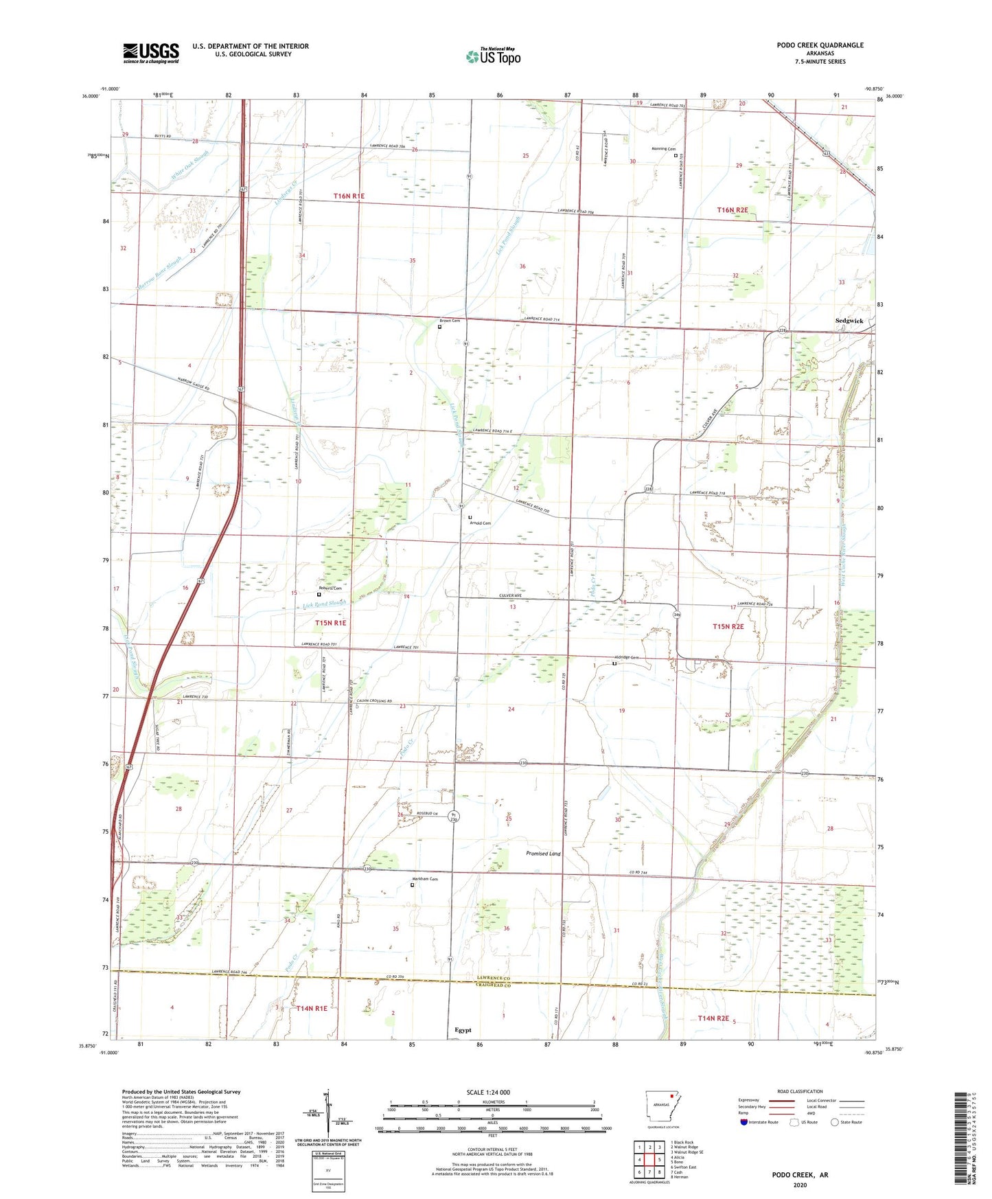
2024 topographic map quadrangle Podo Creek in the state of Arkansas. Scale: 1:24000. Based on the newly updated USGS 7.5' US Topo map series, this map is in the following counties: Lawrence, Craighead. The map contains contour data, water features, and other items you are used to seeing on USGS maps, but also has updated roads and other features. This is the next generation of topographic maps. Printed on high-quality waterproof paper with UV fade-resistant inks.
Quads adjacent to this one:
West: Alicia
Northwest: Black Rock
North: Walnut Ridge
Northeast: Walnut Ridge SE
East: Bono
Southeast: Herman
South: Cash
Southwest: Swifton East
This map covers the same area as the classic USGS quad with code o35090h8.
Contains the following named places: Aldridge Cemetery, Arnold Cemetery, Bessie, Brown Cemetery, Cache River Church, Egypt Church, Egypt School, KAIT-TV (Jonesboro), Lindseys Creek, Little Brown Church, Manning Cemetery, Maple Slough, Markham Cemetery, Oak Grove Church, Oak Hill Church, Promised Land, Roberts Cemetery, Township of Dowell, Township of Promised Land, West Cache River Ditch, West Cache River Slough