MyTopo
Herman Arkansas US Topo Map
Couldn't load pickup availability
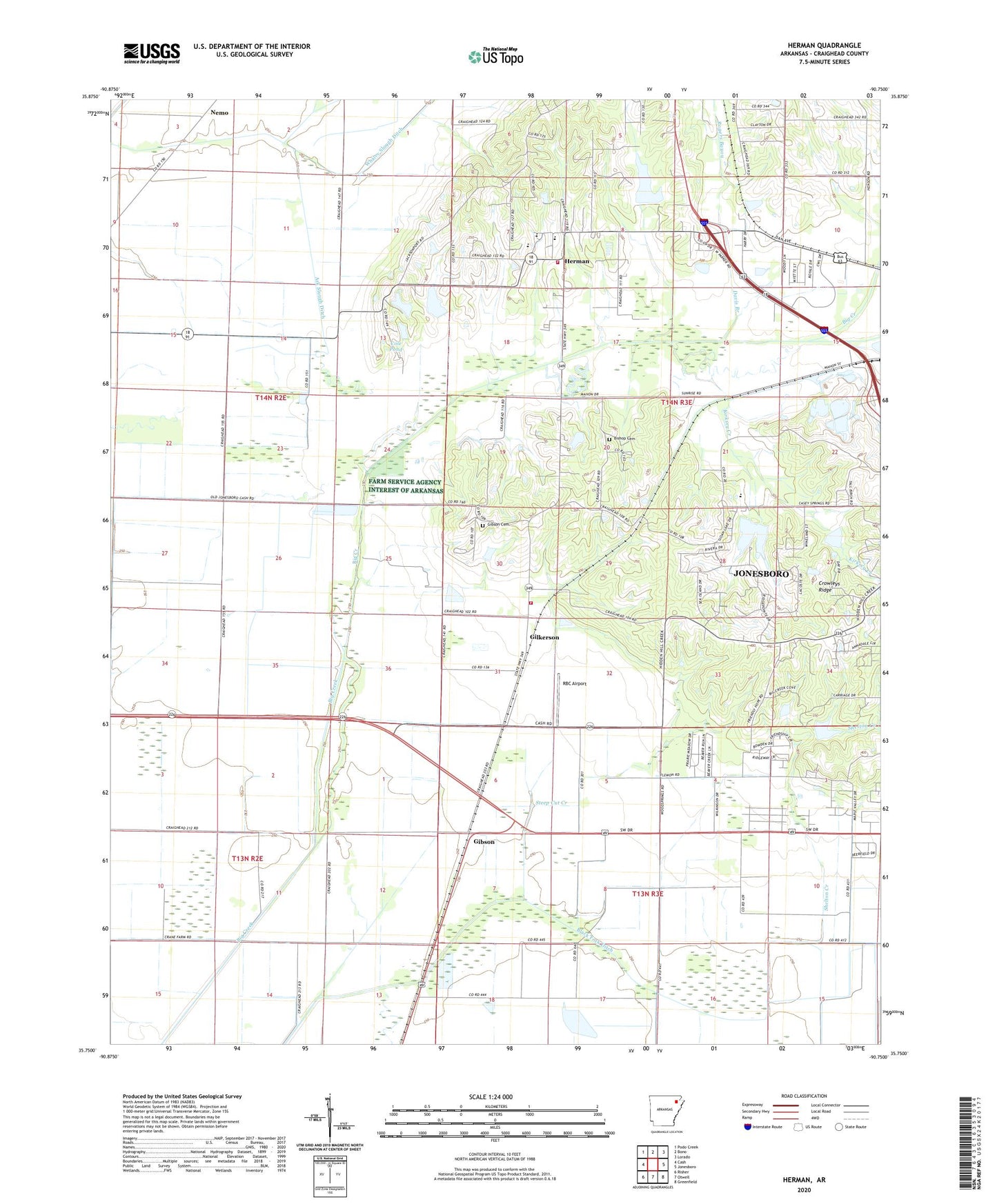
2024 topographic map quadrangle Herman in the state of Arkansas. Scale: 1:24000. Based on the newly updated USGS 7.5' US Topo map series, this map is in the following counties: Craighead. The map contains contour data, water features, and other items you are used to seeing on USGS maps, but also has updated roads and other features. This is the next generation of topographic maps. Printed on high-quality waterproof paper with UV fade-resistant inks.
Quads adjacent to this one:
West: Cash
Northwest: Podo Creek
North: Bono
Northeast: Lorado
East: Jonesboro
Southeast: Greenfield
South: Otwell
Southwest: Risher
This map covers the same area as the classic USGS quad with code o35090g7.
Contains the following named places: Ark Slough Ditch, Big Creek Ditch, Big Creek Site 11 Dam, Big Creek Site 11 Reservoir, Big Creek Site 13 Dam, Big Creek Site 13 Reservoir, Big Creek Site 14 Dam, Big Creek Site 14 Reservoir, Big Creek Site 21 Dam, Big Creek Site 21 Reservoir, Big Creek Site 22 Dam, Big Creek Site 22 Reservoir, Big Creek Valley Church, Bishop Cemetery, Black Fork Ditch, Bono Fire Department Westside Station, Casey School, Cole Pond, Cole Pond Dam, Davis Branch, Elm Grove School, Emerson Ditch Lateral Number 2, Friendly Hope Baptist Church, Gibson, Gibson Cemetery, Gilkerson, Gilkerson School, Harmony Church, Herman, Herman School, Hickory Ridge School, Kirksey Creek, Nemo, Oak Grove Church, Pleasant Hill School, Prairie Grove School, RBC Airport, Rogers Bayou, Rogers Branch, Scarb, Shelton Creek, Steep Cut Creek, Township of Gilkerson, Unity Church, Valley View Fire Department, Westside Elementary School, Westside High School, Westside Middle School, Westvale Church, Whaley Slough Ditch, ZIP Code: 72404