MyTopo
Brookland Arkansas US Topo Map
Couldn't load pickup availability
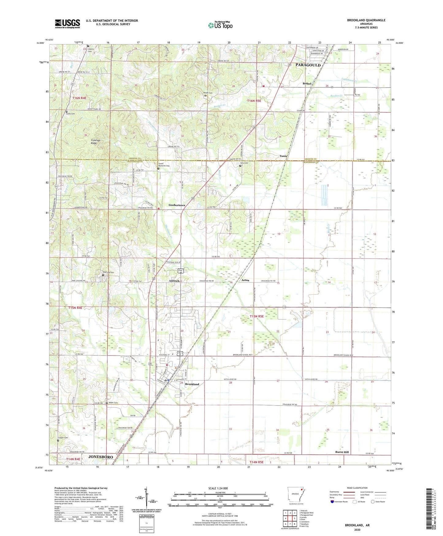
2024 topographic map quadrangle Brookland in the state of Arkansas. Scale: 1:24000. Based on the newly updated USGS 7.5' US Topo map series, this map is in the following counties: Craighead, Greene. The map contains contour data, water features, and other items you are used to seeing on USGS maps, but also has updated roads and other features. This is the next generation of topographic maps. Printed on high-quality waterproof paper with UV fade-resistant inks.
Quads adjacent to this one:
West: Lorado
Northwest: Walcott
North: Paragould West
Northeast: Paragould East
East: Dixie
Southeast: Lake City
South: Needham
Southwest: Jonesboro
This map covers the same area as the classic USGS quad with code o35090h5.
Contains the following named places: Aetna, Antioch, Antioch Church, Antioch School, Bethel, Birch Creek, Brookland, Brookland Church, Brookland Elementary School, Brookland High School, Brookland Intermediate School, Brookland Police Department, Brookland Post Office, Brookland Volunteer Fire Department Goobertown Station, Brookland Volunteer Fire Department Station 2, Burnt Hill, Burnt Hill School, City of Brookland, Clarkes Chapel Baptist Church, Clarks Cemetery, Clarks Chapel School, Clinton School, Cole Mill, Cooper Cemetery, Cottonwood Slough, Dark Slough, Goobertown, Grassy Slough, Greene County Church, Greensboro, Gubertown School, Jonesboro Junction, Kerr School, Liberty Cemetery, Liberty Church, New Antioch Baptist Church, Nober Cemetery, Overcup Slough, Pine Log Cemetery, Pine Log Church, Shady Grove School, Sims Cemetery, Smithville, Southern Greene County Station 1 - Fire Station, Sweet Moments Cemetery, Sweet Moments Church, Thompson Creek, Township of Brookland, Township of Saint Francis, Tunis, Wood Church, Woods Cemetery, Woods Chapel Methodist Church, Yapp School, ZIP Code: 72417