MyTopo
Dixie Arkansas US Topo Map
Couldn't load pickup availability
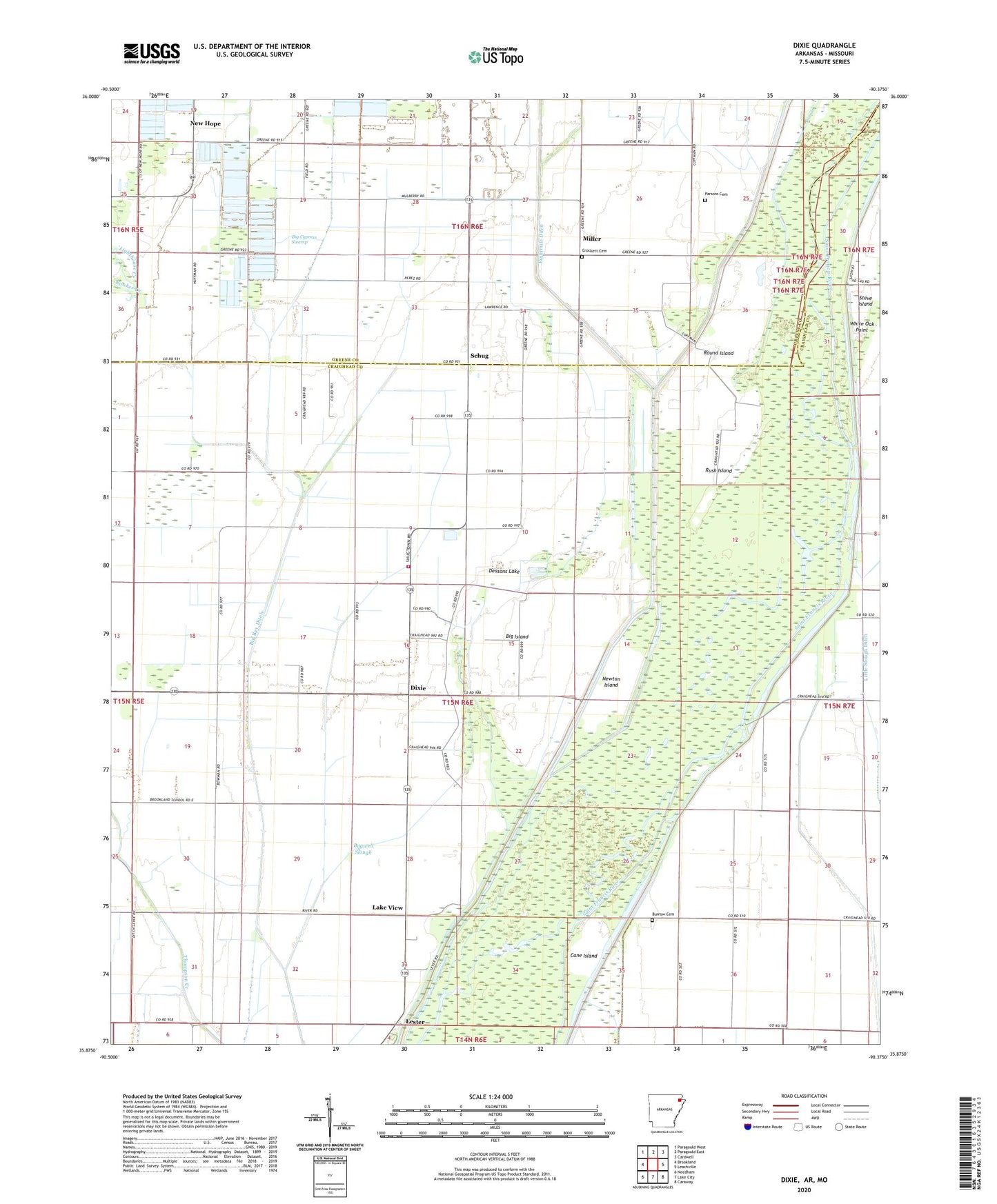
2024 topographic map quadrangle Dixie in the state of Arkansas. Scale: 1:24000. Based on the newly updated USGS 7.5' US Topo map series, this map is in the following counties: Craighead, Greene, Dunklin. The map contains contour data, water features, and other items you are used to seeing on USGS maps, but also has updated roads and other features. This is the next generation of topographic maps. Printed on high-quality waterproof paper with UV fade-resistant inks.
Quads adjacent to this one:
West: Brookland
Northwest: Paragould West
North: Paragould East
Northeast: Cardwell
East: Leachville
Southeast: Caraway
South: Lake City
Southwest: Needham
Contains the following named places: Bagwell Slough, Beech Grove Church, Big Cypress Swamp, Big Island, Brookland East School, Burnt Hill Church, Burrow Cemetery, Caney Slough, Crockett Cemetery, Deasons Lake, Decent Lake School, Ditch Number 2, Ditch Number 3, Dixie, Dixie Baptist Church, Jackson Landing, Lake City Fire Protection District Dixie Station, Lake View, Lake View School, Lake View United Methodist Church, Lester, Lighthouse Creek, Lighthouse Ditch, Maysville, Miller, Millers Store, Mitchell Point, Mulberry Church, New 24 Liberty Church, New Hope, New Hope Baptist Church, New Hope School, Newton Island, Parsons Cemetery, Rooker Creek, Round Island, Rush Island, Saint Paul School, Schug, Schugtown United Methodist Church, Stave Island, Township of Collier, Township of Lester, Trinity Church, Upper Poplar Ridge, Upper Poplar Ridge School, White Oak Point