MyTopo
Cord Arkansas US Topo Map
Couldn't load pickup availability
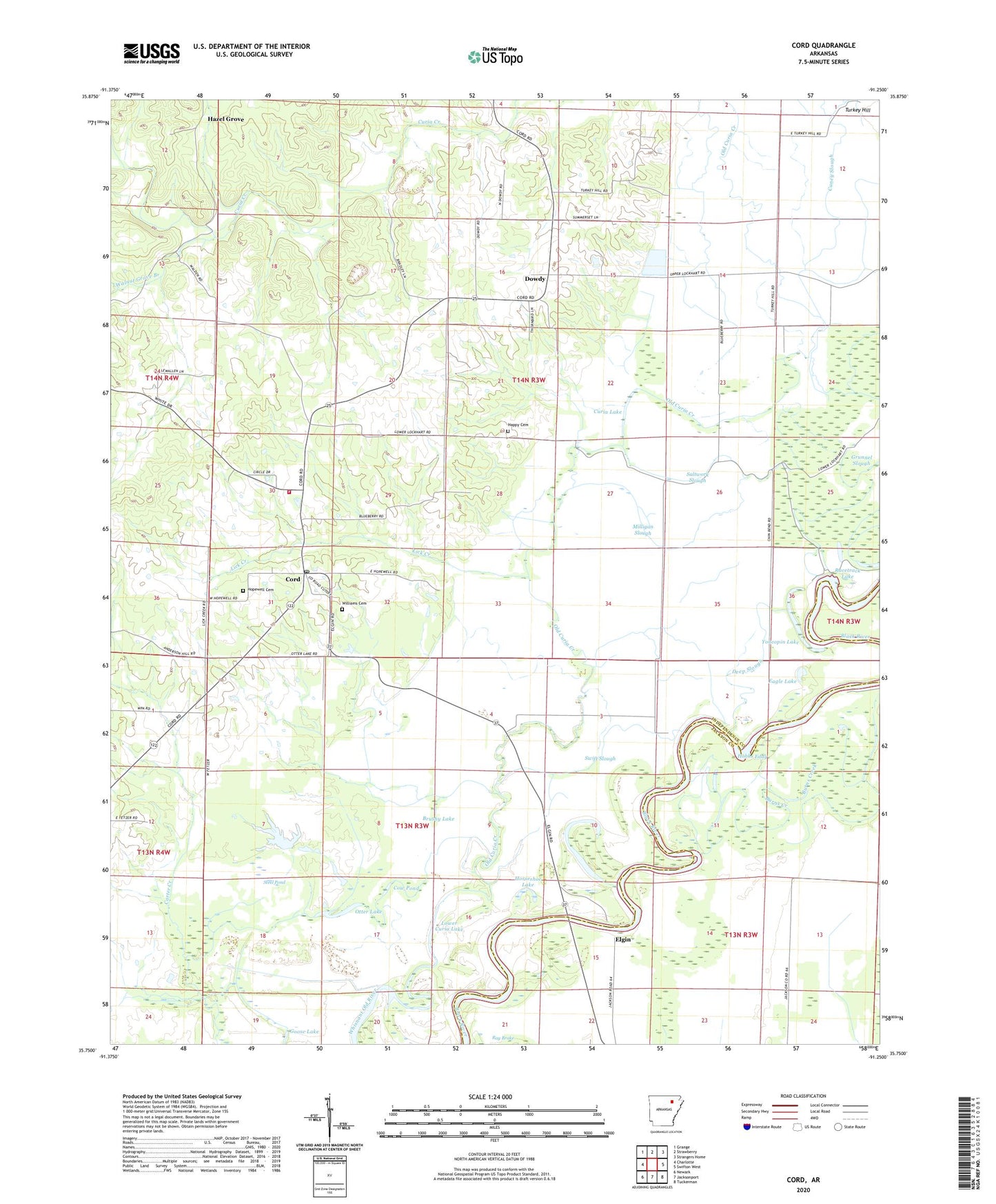
2024 topographic map quadrangle Cord in the state of Arkansas. Scale: 1:24000. Based on the newly updated USGS 7.5' US Topo map series, this map is in the following counties: Independence, Jackson. The map contains contour data, water features, and other items you are used to seeing on USGS maps, but also has updated roads and other features. This is the next generation of topographic maps. Printed on high-quality waterproof paper with UV fade-resistant inks.
Quads adjacent to this one:
West: Charlotte
Northwest: Grange
North: Strawberry
Northeast: Strangers Home
East: Swifton West
Southeast: Tuckerman
South: Jacksonport
Southwest: Newark
This map covers the same area as the classic USGS quad with code o35091g3.
Contains the following named places: Bee Tree Slough, Brushy Lake, Burns Creek, Caney Slough, Cord, Cord Baptist Church, Cord Fire Station, Cord Post Office, Cow Pond, Curia Lake, Deep Slough, Dowdy, Eagle Lake, Elgin, Goose Lake, Grunnel Slough, Happy Cemetery, Hazel Grove, Hobbs Eddy, Hopewell Cemetery, Hopewell Church, Horseshoe Lake, Lick Creek, Lower Curia Lake, Middle Old River, Milligan Slough, Oak Ridge United Methodist Church, Old Curia Creek, Otter Lake, Racetrack Lake, Saltwork Slough, Steel Pond, Stone Church, Swift Slough, Township of Black River, Township of Black River-Marshell, Township of Marshell, Walnut Grove Branch, Williams Cemetery, Williams Church, Yoncopin Lake, ZIP Code: 72524