MyTopo
Charlotte Arkansas US Topo Map
Couldn't load pickup availability
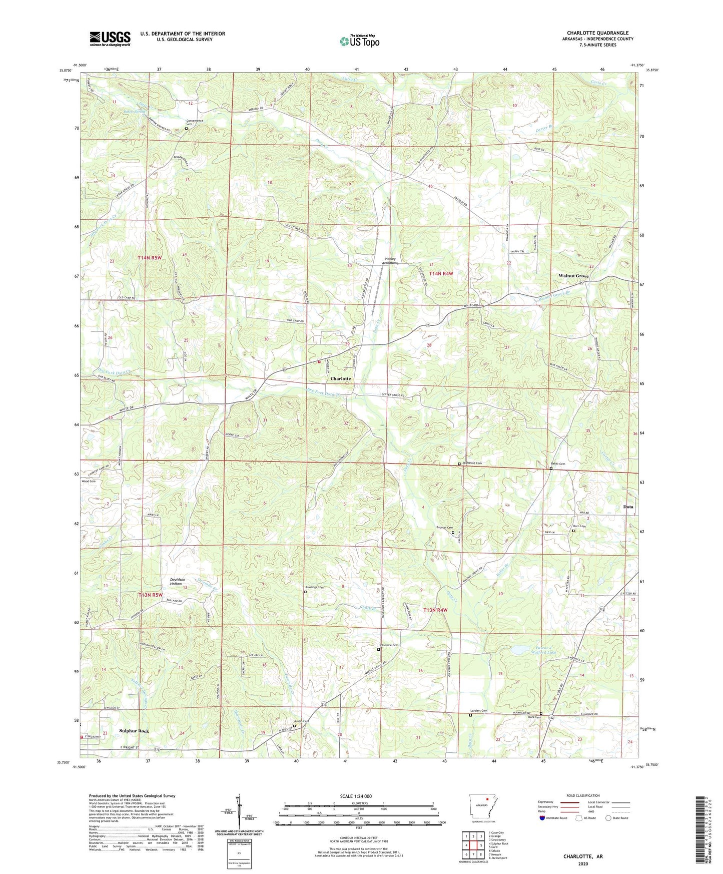
2024 topographic map quadrangle Charlotte in the state of Arkansas. Scale: 1:24000. Based on the newly updated USGS 7.5' US Topo map series, this map is in the following counties: Independence. The map contains contour data, water features, and other items you are used to seeing on USGS maps, but also has updated roads and other features. This is the next generation of topographic maps. Printed on high-quality waterproof paper with UV fade-resistant inks.
Quads adjacent to this one:
West: Sulphur Rock
Northwest: Cave City
North: Grange
Northeast: Strawberry
East: Cord
Southeast: Jacksonport
South: Newark
Southwest: Salado
This map covers the same area as the classic USGS quad with code o35091g4.
Contains the following named places: Antioch Church, Austin Cemetery, Baker Branch, Baker Cemetery, Batman Cemetery, Baxter Spring, Buck Cemetery, Carter Branch, Cedar Grove, Center Grove Church, Chalk Branch, Charlotte, Charlotte Fire Station, Convenience Cemetery, Cord - Charlotte Elementary School, Cord-Charlotte High School, Dorr Cemetery, Dota, Dry Fork Dota Creek, Henley Aerodrome, Holcombe Cemetery, Landers Cemetery, McDonald Cemetery, Oak Hill Church, Pascoe J Stafford Lake, Pascoe J Stafford Lake Dam, Pleasant Hill, Pleasant Hill Church, Rawlings Cemetery, Sulphur Rock Area Volunteer Fire Department, Sulphur Rock Elementary School, Sulphur Rock High School, Township of Dota, Walnut Grove, Walnut Grove Post Office, ZIP Codes: 72522, 72579