MyTopo
Strangers Home Arkansas US Topo Map
Couldn't load pickup availability
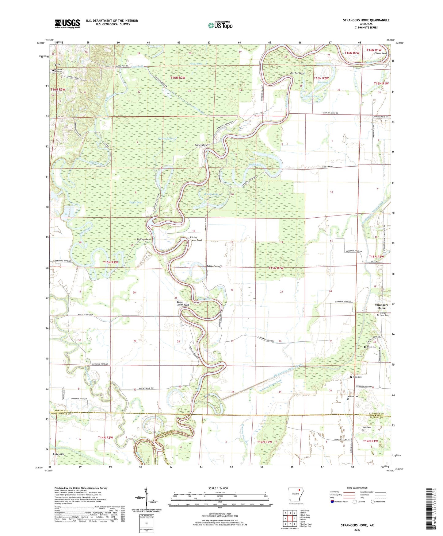
2024 topographic map quadrangle Strangers Home in the state of Arkansas. Scale: 1:24000. Based on the newly updated USGS 7.5' US Topo map series, this map is in the following counties: Lawrence, Jackson, Independence. The map contains contour data, water features, and other items you are used to seeing on USGS maps, but also has updated roads and other features. This is the next generation of topographic maps. Printed on high-quality waterproof paper with UV fade-resistant inks.
Quads adjacent to this one:
West: Strawberry
Northwest: Smithville
North: Eaton
Northeast: Black Rock
East: Alicia
Southeast: Swifton East
South: Swifton West
Southwest: Cord
This map covers the same area as the classic USGS quad with code o35091h2.
Contains the following named places: Adams Brake, Big Running Water Creek, Broom Cemetery, Brushy Lake, Burns Lower Bend, Caney Creek, Clover Bend, Count School, Cross Cemetery, Cypress Creek, Eagle Pond, Eron Reach, Eureka Lodge, Hill Slough, Horseshoe Lake, Old Martin Mill Place, Paradise Landing, Pleasant Hill Cemetery, Rainey Bend, Rainey Brake, Red Fox Bend, Round Pond, Ruffner Cemetery, Running Water Ditch, Selser Cut-off, Shell Cemetery, Shirey Bay, Shirley Lower Bend, Stalling Bend, Strangers Home, Strangers Home Cemetery, Strangers Home United Methodist Church, Strawberry Ferry, Strawberry River, Township of Morgan, Tucker Bay, Turkey Hill, Whitelow Ferry