MyTopo
Dardanelle Arkansas US Topo Map
Couldn't load pickup availability
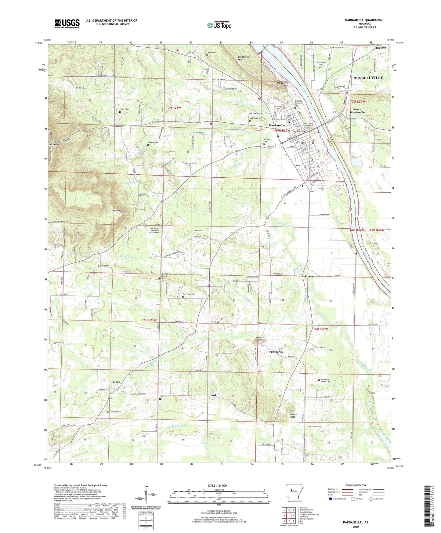
2024 topographic map quadrangle Dardanelle in the state of Arkansas. Scale: 1:24000. Based on the newly updated USGS 7.5' US Topo map series, this map is in the following counties: Yell, Pope. The map contains contour data, water features, and other items you are used to seeing on USGS maps, but also has updated roads and other features. This is the next generation of topographic maps. Printed on high-quality waterproof paper with UV fade-resistant inks.
Quads adjacent to this one:
West: Chickalah Mountain East
Northwest: Delaware
North: Russellville West
Northeast: Russellville East
East: Holla Bend
Southeast: Casa
South: Ola
Southwest: Danville Mountain
This map covers the same area as the classic USGS quad with code o35093b2.
Contains the following named places: Ard, Ard Cemetery, Ard Church, Banks Hill Family Cemetery, Bethel, Bethel Church, Brearley Cemetery, Brearley Memorial Park, Bryant Branch, Callan Cemetery, Centerville Airstrip, City of Dardanelle, Dacus Cemetery, Dardanelle, Dardanelle Elementary School, Dardanelle Fire Department, Dardanelle High School, Dardanelle Hospital, Dardanelle Hospital Heliport, Dardanelle Intermediate School, Dardanelle Lock and Dam, Dardanelle Police Department, Dardanelle Post Office, Dardanelle Primary School, Dardanelle Regional Medical Center, Dardanelle Rock, Dardanelle Rural Fire Department Station 3, Dardanelle Rural Volunteer Fire Department Main Station, Dardanelle Rural Volunteer Fire Department Station 2, Dobson Spring School, Elberta, Elmwood School, Faith Church, Fields Chapel, First Presbyterian Church, Gibson Lake, Greenwood School, Gum Springs Cumberland Presbyterian Church, Harris Creek, Hobsons Knob, Hudson Cemetery, Jones Mountain, KCAB-AM (Dardanelle), KWXT-AM (Dardanelle), Lavenia School, Louvean Presbyterian Church, Louvenia Cemetery, Lyons Cemetery, Moore Hill Cemetery, Mount Pisgah Church, Mount Zion School, New Hope Baptist Church, New Hope Cemetery, Norristown Cemetery, North Dardanelle, Nunley Cemetery, Oak Grove, Oak Grove Methodist Church, Oak Grove Methodist Church Cemetery, Oak Grove School, Oak Ridge Cemetery, Old Post Road Public Use Area, Pisgah, Pisgah Methodist Church, Pole Pin Creek, Prosperity, River Front Park, Riverview Recreation Area, Smiley Bayou, Thompson Family Cemetery, Township of Dardanelle, Whig Creek, Yell County Emergency Medical Services, Yell County Sheriff Dardanelle Office, ZIP Code: 72834