
MyTopo
Danville Mountain Arkansas US Topo Map
Couldn't load pickup availability
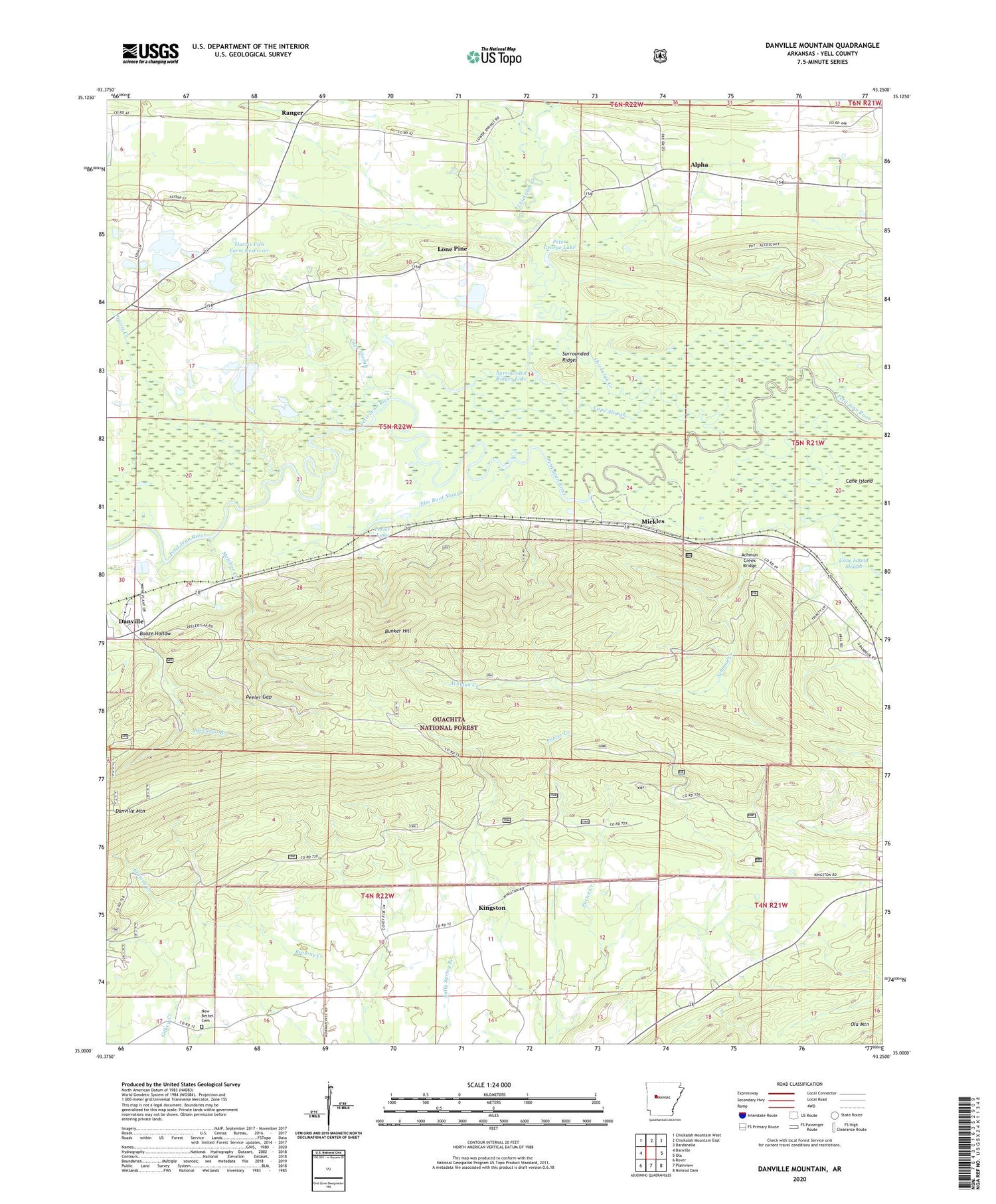
2024 topographic map quadrangle Danville Mountain in the state of Arkansas. Scale: 1:24000. Based on the newly updated USGS 7.5' US Topo map series, this map is in the following counties: Yell. The map contains contour data, water features, and other items you are used to seeing on USGS maps, but also has updated roads and other features. This is the next generation of topographic maps. Printed on high-quality waterproof paper with UV fade-resistant inks.
Quads adjacent to this one:
West: Danville
Northwest: Chickalah Mountain West
North: Chickalah Mountain East
Northeast: Dardanelle
East: Ola
Southeast: Nimrod Dam
South: Plainview
Southwest: Rover
This map covers the same area as the classic USGS quad with code o35093a3.
Contains the following named places: Achmun Creek, Achmun Creek Bridge, Alpha, Booze Hollow, Bunker Hill, Cane Island, Cane Island Slough, Cape Slough, Chickalah Creek, Danville Mountain, Elm Root Slough, Harris Fish Farm Dam, Harris Fish Farm Reservoir, Jake Creek, Kingston, Lone Pine, Lone Pine School, Melchor Creek, Mickles, New Bethel Cemetery, New Bethel Church, Nimrod State Wildlife Management Area, Peeler Gap, Peeler Lake, Peter George Lake, Prairie Creek, Prairie Creek School, Ranger, Ridge Church, Salem Church, Social Circle School, Surrounded Ridges, Surrounded Ridges Lake, Township of Prairie, Union Grove School


