MyTopo
De Roche Arkansas US Topo Map
Couldn't load pickup availability
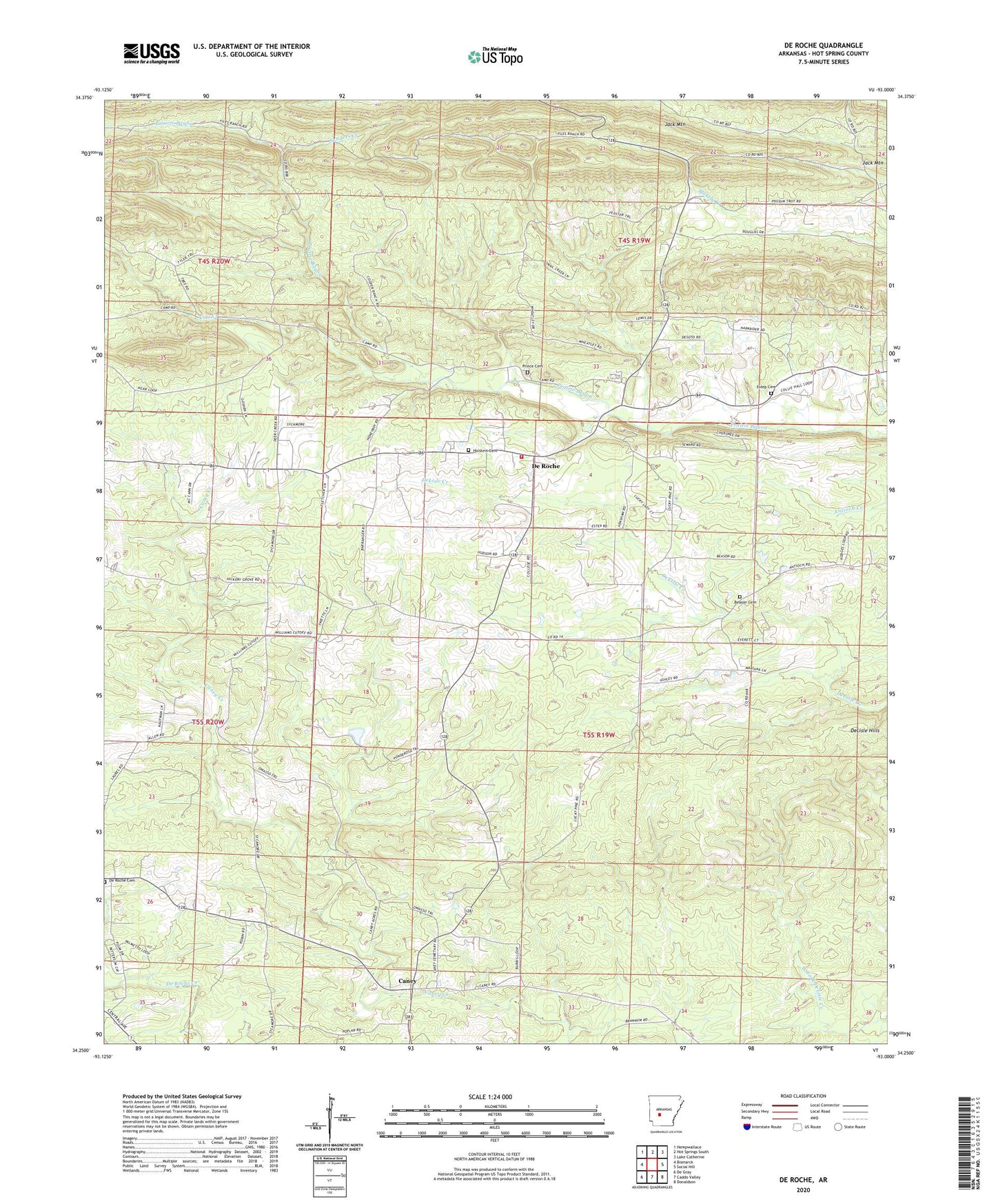
2024 topographic map quadrangle De Roche in the state of Arkansas. Scale: 1:24000. Based on the newly updated USGS 7.5' US Topo map series, this map is in the following counties: Hot Spring. The map contains contour data, water features, and other items you are used to seeing on USGS maps, but also has updated roads and other features. This is the next generation of topographic maps. Printed on high-quality waterproof paper with UV fade-resistant inks.
Quads adjacent to this one:
West: Bismarck
Northwest: Hempwallace
North: Hot Springs South
Northeast: Lake Catherine
East: Social Hill
Southeast: Donaldson
South: Caddo Valley
Southwest: De Gray
This map covers the same area as the classic USGS quad with code o34093c1.
Contains the following named places: Beason Cemetery, Caney, Curl Creek, De Roche, De Roche Cemetery, De Roche Church, DeLisle Hills, Estep Cemetery, Hickory Grove Church, Holstein Cemetery, Jack Mountain, KLAZ-FM (Hot Springs), KRZB-TV (Hot Springs), New DeRoche Fire Department, Prairie Bayou Church, Prince Cemetery, Prince Field, Sanders, Sanders Creek, Township of De Roche, Township of Montgomery