MyTopo
Lake Catherine Arkansas US Topo Map
Couldn't load pickup availability
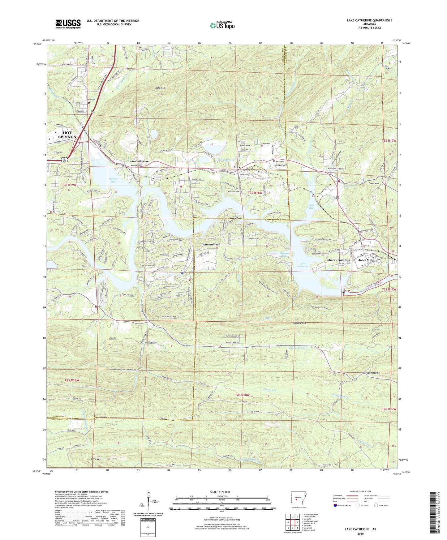
2024 topographic map quadrangle Lake Catherine in the state of Arkansas. Scale: 1:24000. Based on the newly updated USGS 7.5' US Topo map series, this map is in the following counties: Hot Spring, Garland. The map contains contour data, water features, and other items you are used to seeing on USGS maps, but also has updated roads and other features. This is the next generation of topographic maps. Printed on high-quality waterproof paper with UV fade-resistant inks.
Quads adjacent to this one:
West: Hot Springs South
Northwest: Hot Springs North
North: Fountain Lake
Northeast: Lonsdale
East: Malvern North
Southeast: Malvern South
South: Social Hill
Southwest: De Roche
This map covers the same area as the classic USGS quad with code o34092d8.
Contains the following named places: Arkansas Noname 110 Dam, Bald Mountain, Boss Island Creek, Camp Couchdale, Camp Tanako, Cedar Creek, Cook Mountain, Cooper Creek, Cove Creek, Cove Creek Station, Crouchwood Lake, Crouchwood Lake Dam, Diamondhead, Diamondhead Police Department, East Branch Gulpha Creek, Falls Creek, Gulpha Creek, Irwin Cemetery, Jones Mills, Jones Mills Census Designated Place, Jones Mills Post Office, Justus Mill, KBHS-AM (Hot Springs), Lake Catherine, Lake Catherine State Park, Lake Hamilton Fire Department Station 4, Lake Hamilton Fire Department Station 5, Lakeside Elementary School, Lakeside High School, Lakeside Intermediate School, Lakeside Junior High School, Lakeside Middle School, Lakeside Primary School, Lecroy Post Office, Morning Star Fire Department, Morning Star Fire Department Station 3, Morning Star Fire Department Station 4, Narrow Mountain, Potash Sulphur Springs, Price, Price Cemetery, Remmel Dam, Ross Ferry, Shinn Mountain, Shorewood Hills, Slunger Bay, Slunger Creek, Spencer Bay, Spring Lake, Spurlins Ferry, Stony Creek, Sulphur Springs Church, Tailings Pond, Tigre Bay, Tigre Creek, Township of Sulphur, Wiggins Creek