MyTopo
De Witt SW Arkansas US Topo Map
Couldn't load pickup availability
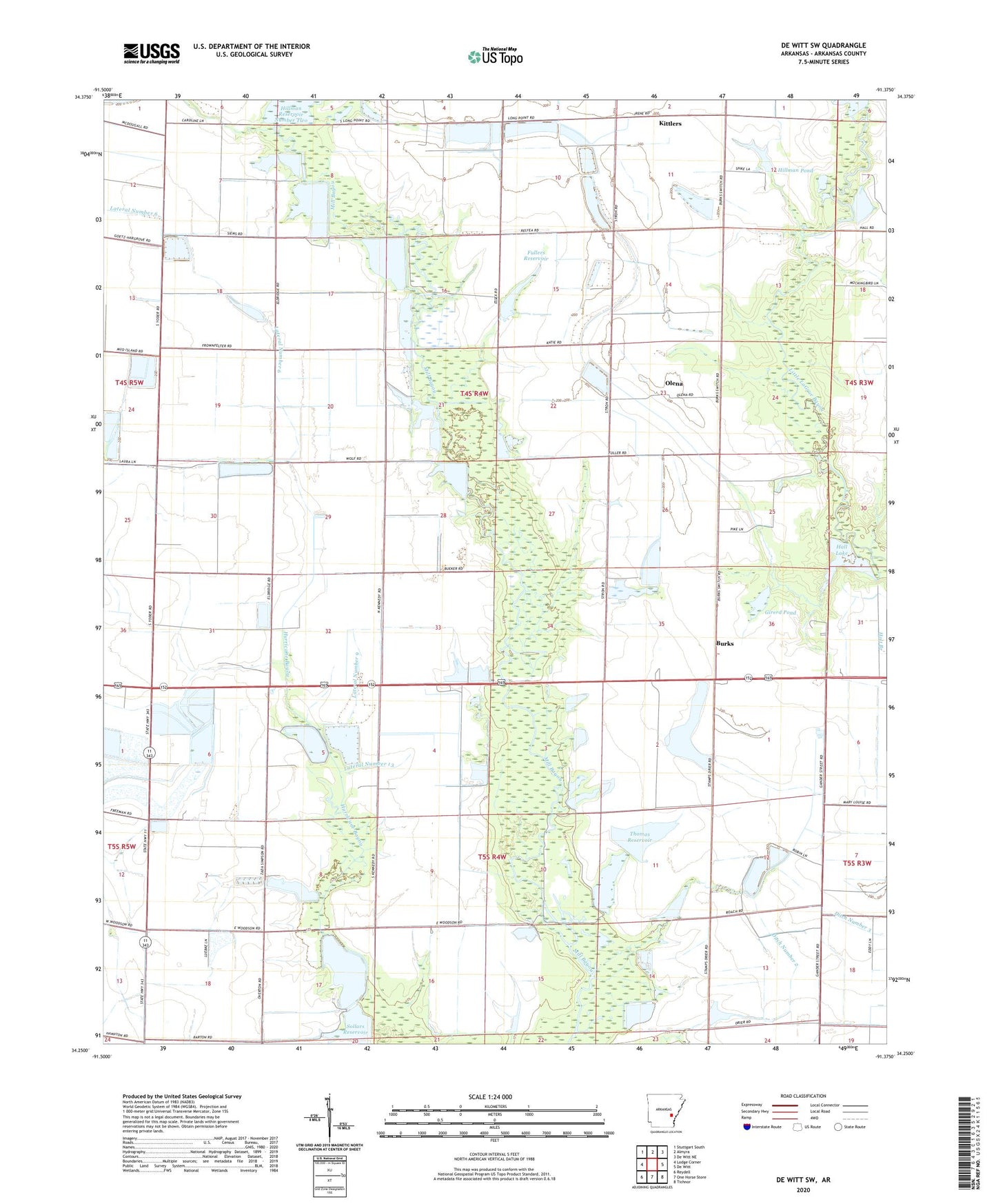
2024 topographic map quadrangle De Witt SW in the state of Arkansas. Scale: 1:24000. Based on the newly updated USGS 7.5' US Topo map series, this map is in the following counties: Arkansas. The map contains contour data, water features, and other items you are used to seeing on USGS maps, but also has updated roads and other features. This is the next generation of topographic maps. Printed on high-quality waterproof paper with UV fade-resistant inks.
Quads adjacent to this one:
West: Lodge Corner
Northwest: Stuttgart South
North: Almyra
Northeast: De Witt NE
East: De Witt
Southeast: Tichnor
South: One Horse Store
Southwest: Reydell
This map covers the same area as the classic USGS quad with code o34091c4.
Contains the following named places: Arkansas Noname 280 Dam, Burks, Ditch Number 1, Ditch Number 2, Eldridge Corner, Fullers Reservoir, Girerd Pond, Girerd Pond Dam, Hall Lake, Hall Lake Dam, Hillman Pond, Hillman Pond Dam, Hillman Reservoir Dam, Hillman Reservoir Number Two Dam, Kittlers, Lateral Number 10, Lateral Number 11, Lateral Number 12, Lateral Number 13, Lateral Number 5, Lateral Number 6, Lateral Number 9, Main Ditch, Monica, New Providence School, Olena, Sollars Reservoir, Sollars Reservoir Dam, Thomas Reservoir, Thomas Reservoir Dam, Thomas Reservoirs