MyTopo
De Witt NE Arkansas US Topo Map
Couldn't load pickup availability
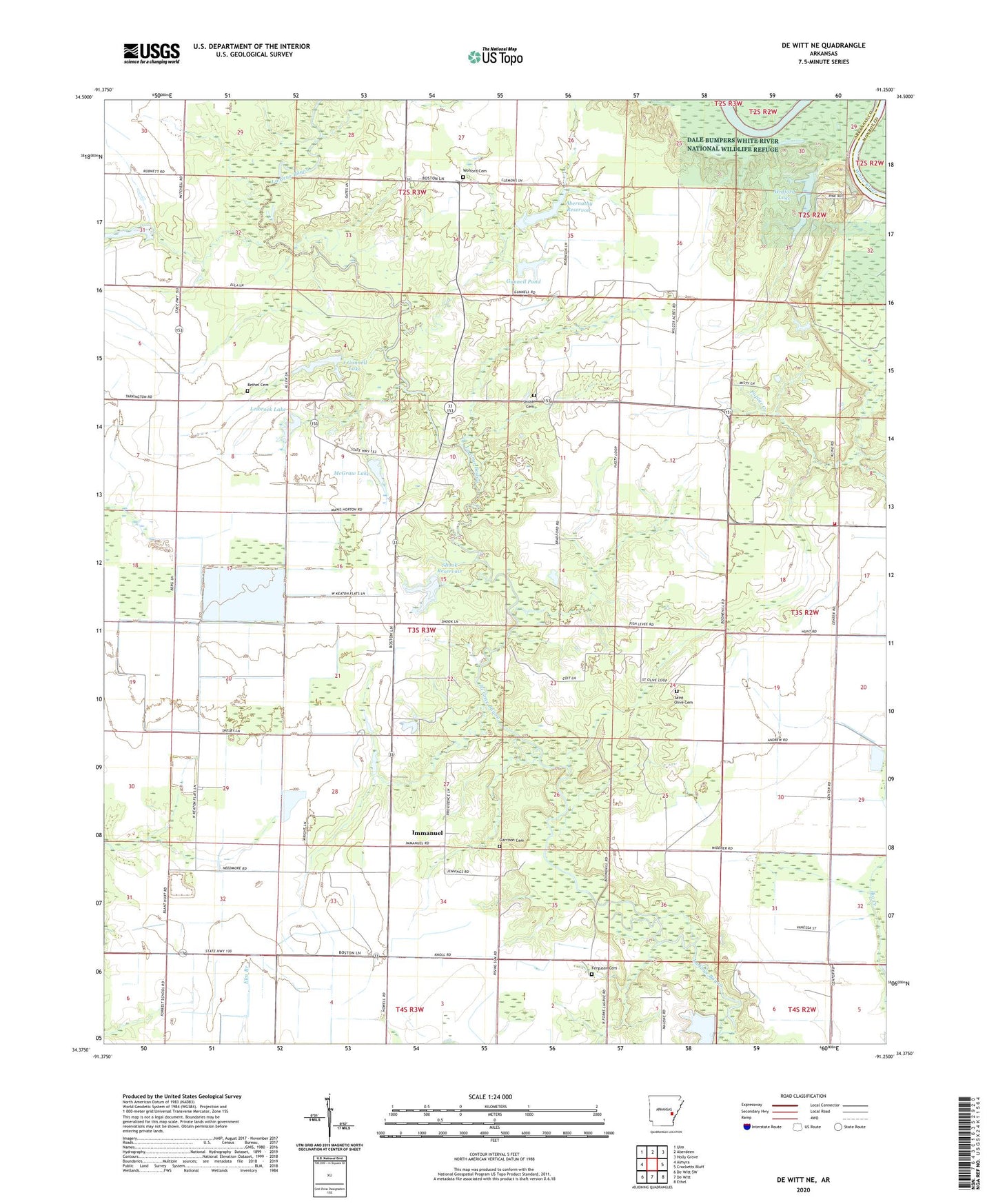
2024 topographic map quadrangle De Witt NE in the state of Arkansas. Scale: 1:24000. Based on the newly updated USGS 7.5' US Topo map series, this map is in the following counties: Arkansas, Monroe. The map contains contour data, water features, and other items you are used to seeing on USGS maps, but also has updated roads and other features. This is the next generation of topographic maps. Printed on high-quality waterproof paper with UV fade-resistant inks.
Quads adjacent to this one:
West: Almyra
Northwest: Ulm
North: Aberdeen
Northeast: Holly Grove
East: Crocketts Bluff
Southeast: Ethel
South: De Witt
Southwest: De Witt SW
This map covers the same area as the classic USGS quad with code o34091d3.
Contains the following named places: Abernathy Reservoir, Abernathy Reservoir Dam, Bethel Cemetery, Bethel Church, Brough School, Cooks Lake, Crocketts Bluff Volunteer Fire Department, Emanuel Industrial School, Ferguson Cemetery, Garrison Cemetery, Gunnell Pond, Gunnell Pond Dam, Immanuel, J Gunnell Lake, J Gunnell Lake Dam, LaGrue, Lake Lane, Lake Lane Dam, Leibrock Lake, Leibrock Lake Dam, McGraw Lake, McGraw Lake Dam, Mount Adams, Needmore School, Plainview, Poplar Creek Church, Poplar Creek School, Providence Church, Rising Sun Church, Saint Olive Cemetery, Saint Olive Church, Sassafras, Shiloh Cemetery, Shiloh Church, Shook Reservoir, Shook Reservoir Dam, Township of Keaton, Woffard Chapel, Wofford Cemetery, Wofford Lake, Wofford Lake Dam