MyTopo
Reydell Arkansas US Topo Map
Couldn't load pickup availability
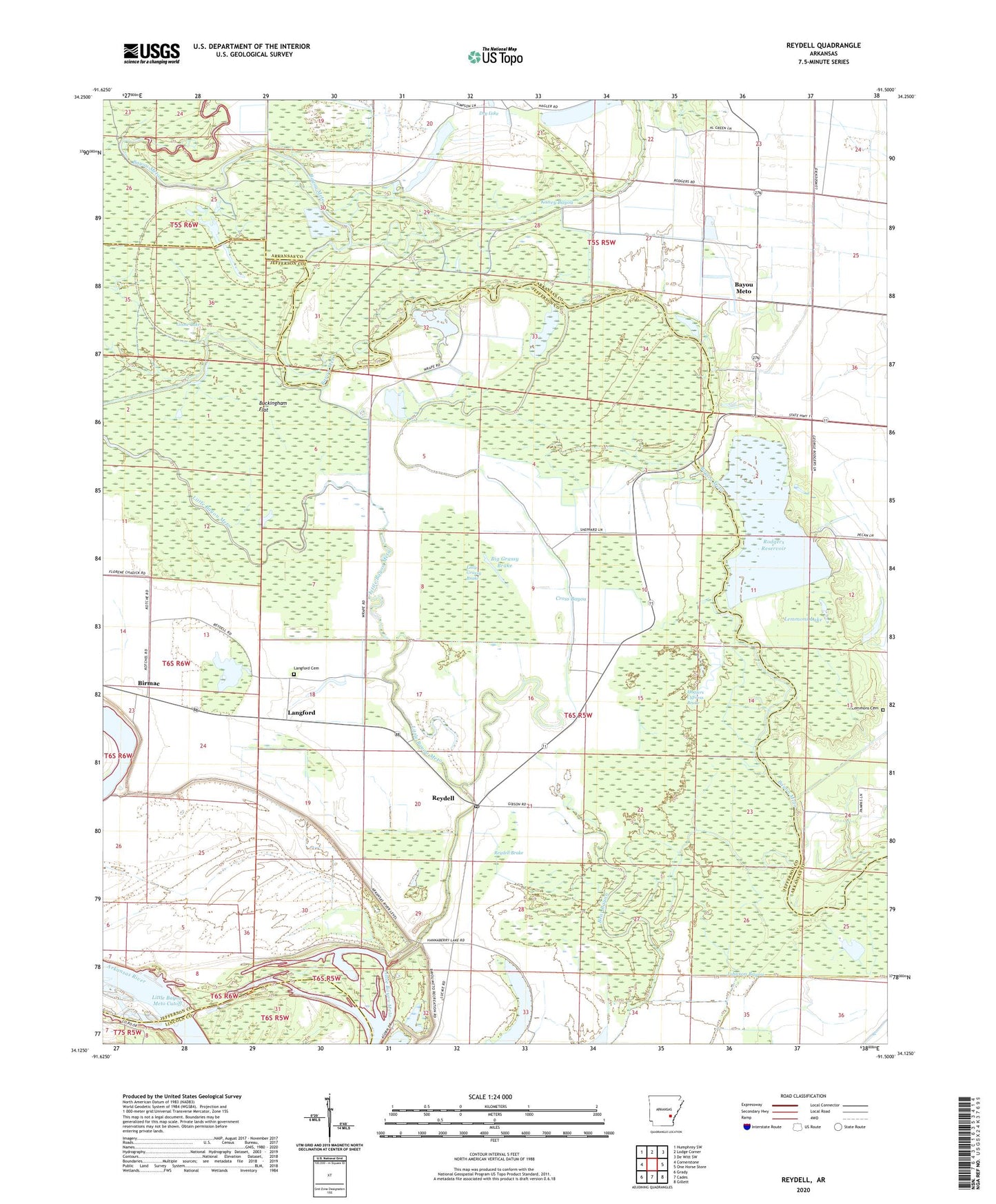
2024 topographic map quadrangle Reydell in the state of Arkansas. Scale: 1:24000. Based on the newly updated USGS 7.5' US Topo map series, this map is in the following counties: Jefferson, Arkansas, Lincoln. The map contains contour data, water features, and other items you are used to seeing on USGS maps, but also has updated roads and other features. This is the next generation of topographic maps. Printed on high-quality waterproof paper with UV fade-resistant inks.
Quads adjacent to this one:
West: Cornerstone
Northwest: Humphrey SW
North: Lodge Corner
Northeast: De Witt SW
East: One Horse Store
Southeast: Gillett
South: Cades
Southwest: Grady
This map covers the same area as the classic USGS quad with code o34091b5.
Contains the following named places: Anrep, Bayou Meto, Bear Bayou, Big Grassy Brake, Birmac, Brushy Lake, Buckingham Flat, Cannon Church, Cross Bayou, Dry Lake, Goose Lake, Haglers Cypress Brake, Hannaberry School, Johnson Bayou, Kaney Bayou, Langford, Langford Cemetery, Langford Lake, Leland Landing, Lemmons Cemetery, Lemmons Lake, Little Bayou Meto, Little Bayou Meto Park, Little Grassy Brake, Mount Zion Church, Mud Lake, Reydell, Reydell Baptist Church, Reydell Brake, Reydell Post Office, Rodgers Reservoir, Township of Villemont, Waldstein, Williamette Bend