MyTopo
Des Arc West Arkansas US Topo Map
Couldn't load pickup availability
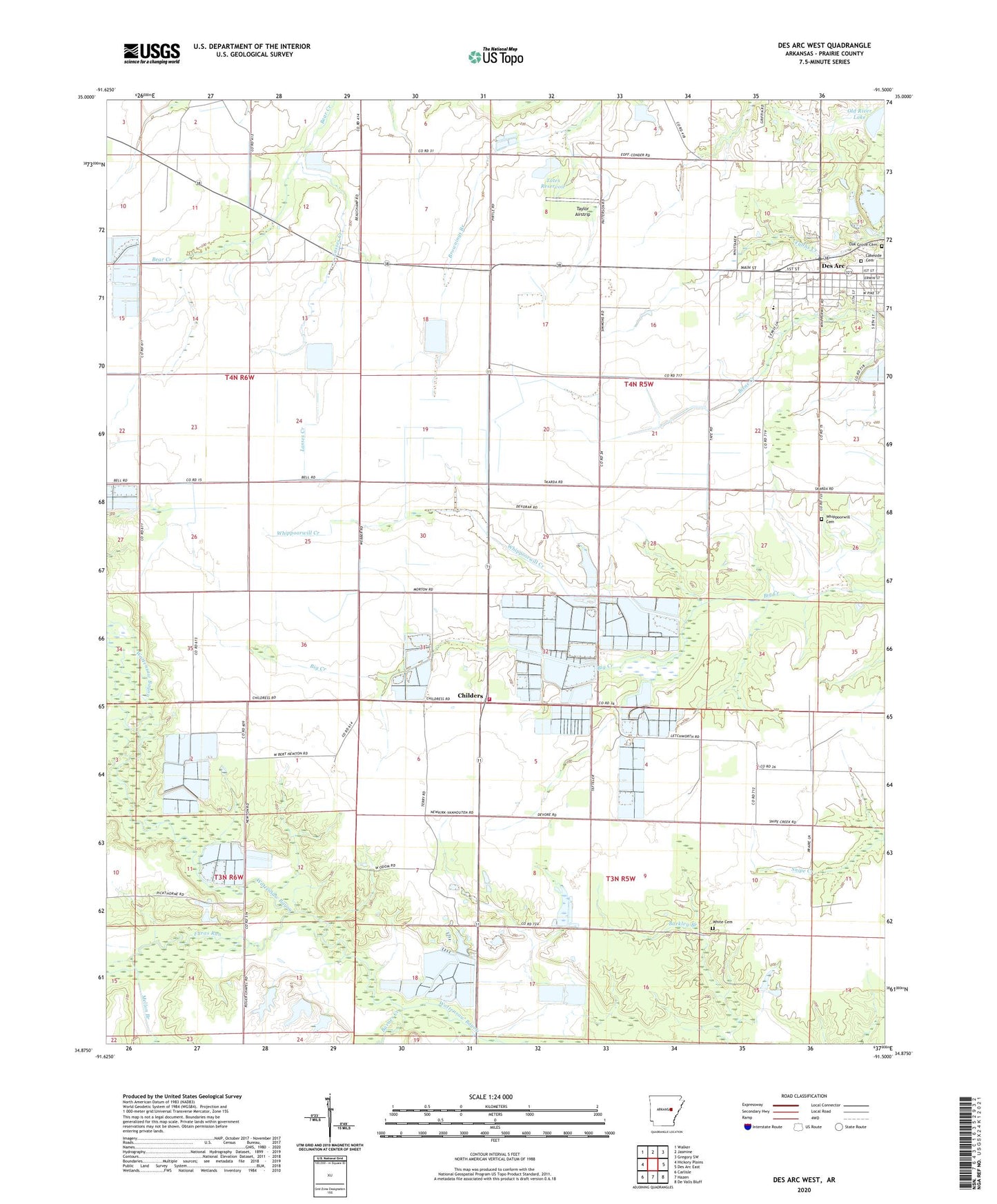
2024 topographic map quadrangle Des Arc West in the state of Arkansas. Scale: 1:24000. Based on the newly updated USGS 7.5' US Topo map series, this map is in the following counties: Prairie. The map contains contour data, water features, and other items you are used to seeing on USGS maps, but also has updated roads and other features. This is the next generation of topographic maps. Printed on high-quality waterproof paper with UV fade-resistant inks.
Quads adjacent to this one:
West: Hickory Plains
Northwest: Walker
North: Jasmine
Northeast: Gregory SW
East: Des Arc East
Southeast: De Valls Bluff
South: Hazen
Southwest: Carlisle
This map covers the same area as the classic USGS quad with code o34091h5.
Contains the following named places: Abbington Church, Barnes Creek, Bob Norman Airstrip, Childers, Church of Christ, City of Des Arc, Des Arc Ambulance Service, Des Arc Elementary School, Faras Run, Fourmile Corner, Harrys, Lakeside Cemetery, Lakeside Church, Lasses Creek, Mellon Branch, Morris Chapel, Oak Grove Cemetery, Oak Prairie Church, Oak Prairie School, Oak Prairie Volunteer Fire Station, Old River Lake, Philadelphia Church, Tates Reservoir, Tates Reservoir Dam, Taylor Airstrip, Township of White River, Whippoorwill Cemetery, Whippoorwill Church, Whippoorwill Creek, White Cemetery, ZIP Code: 72040