MyTopo
Walker Arkansas US Topo Map
Couldn't load pickup availability
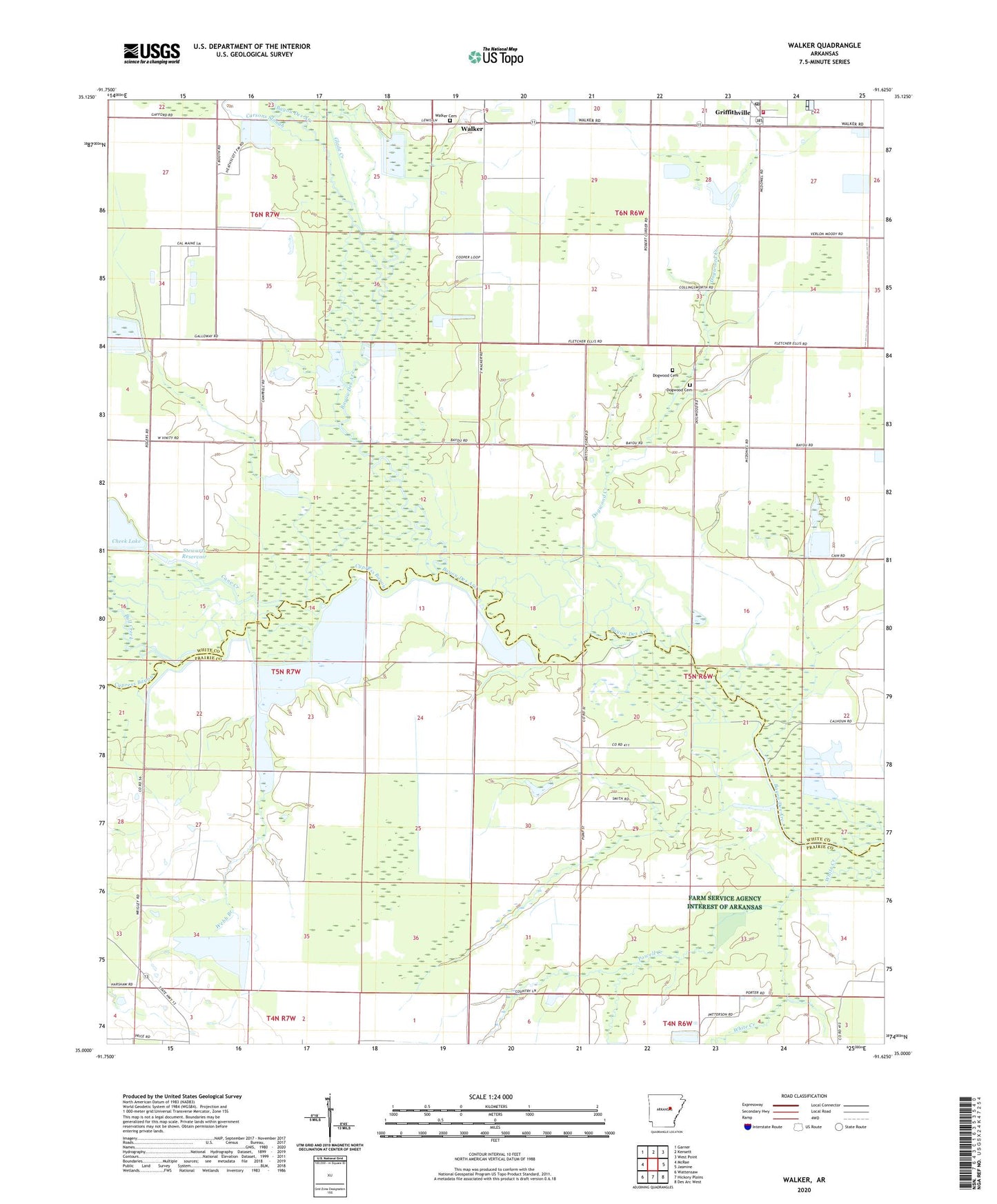
2024 topographic map quadrangle Walker in the state of Arkansas. Scale: 1:24000. Based on the newly updated USGS 7.5' US Topo map series, this map is in the following counties: White, Prairie. The map contains contour data, water features, and other items you are used to seeing on USGS maps, but also has updated roads and other features. This is the next generation of topographic maps. Printed on high-quality waterproof paper with UV fade-resistant inks.
Quads adjacent to this one:
West: McRae
Northwest: Garner
North: Kensett
Northeast: West Point
East: Jasmine
Southeast: Des Arc West
South: Hickory Plains
Southwest: Wattensaw
This map covers the same area as the classic USGS quad with code o35091a6.
Contains the following named places: Bull Creek, Cane Creek, Carsons Slough, Cheek Lake, Cypress Bayou, Defiance, Dogwood, Dogwood Cemetery, Dogwood Creek, Dogwood United Methodist Church, Egbert, Glade Creek, Griffithville, Griffithville Elementary School, Griffithville High School, Griffithville Post Office, Hickory Plains School, Horsehead Creek, Jenkins Lake, Jenkins Lake Dam, Lindermans Lake, Little Lake, Mooresville, Pleasant Ridge Church, Powell Creek, Southeast White County Volunteer Fire Station, Stewarts Reservoir, Town of Griffithville, Township of Walker, Vinity Corner, Walker, Walker Cemetery, Webb Branch, White Creek