MyTopo
Hickory Plains Arkansas US Topo Map
Couldn't load pickup availability
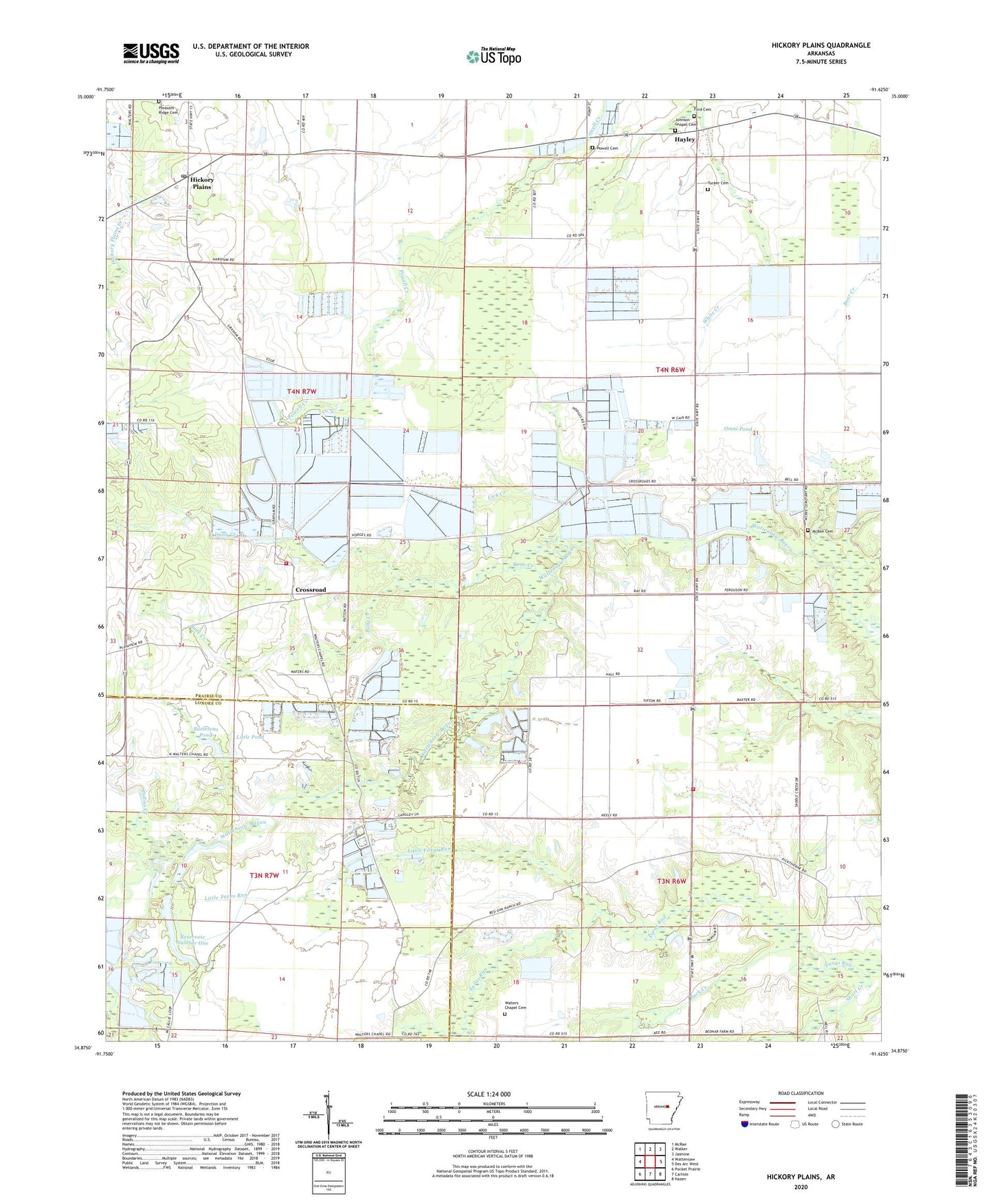
2024 topographic map quadrangle Hickory Plains in the state of Arkansas. Scale: 1:24000. Based on the newly updated USGS 7.5' US Topo map series, this map is in the following counties: Prairie, Lonoke. The map contains contour data, water features, and other items you are used to seeing on USGS maps, but also has updated roads and other features. This is the next generation of topographic maps. Printed on high-quality waterproof paper with UV fade-resistant inks.
Quads adjacent to this one:
West: Wattensaw
Northwest: McRae
North: Walker
Northeast: Jasmine
East: Des Arc West
Southeast: Hazen
South: Carlisle
Southwest: Pocket Prairie
This map covers the same area as the classic USGS quad with code o34091h6.
Contains the following named places: Arkansas Noname 12 Dam, Arkansas Noname 13 Dam, Bane Creek, Big Pond Dam, Brown Grove School, Brown Grove Volunteer Fire Department, Buck Creek, Burlesons Pond, Collins Creek, Cross Roads Church, Cross Roads School, Crossroad, Crossroads Volunteer Fire Department, Dunn Creek, Ford Cemetery, Hayley, Hickory Plains, Hickory Plains Church, Hickory Plains Post Office, Hickory Plains School, Hodges School, Johnson Chapel, Johnson Chapel Cemetery, Johnson Chapel School, Lick Creek, Little Faras Run, Little Pond, Little Pond Dam, McBee Cemetery, McBy Church, McCallie - North Lake, McCallie - South Reservoir, Murdocks Mill, Omni Corporation Pond Dam, Omni Pond, Peters School, Plainview School, Pleasant Ridge Cemetery, Pleasant Ridge Church, Powell Cemetery, Reservoir Number One, Short Creek, Township of Bullard, Township of Hickory Plain, Township of Union, Tucker Cemetery, Uzzett, Walters Chapel, Walters Chapel Cemetery, Winborn School, Youngs Pond, Youngs Reservoir Number One Dam