MyTopo
Elaine Arkansas US Topo Map
Couldn't load pickup availability
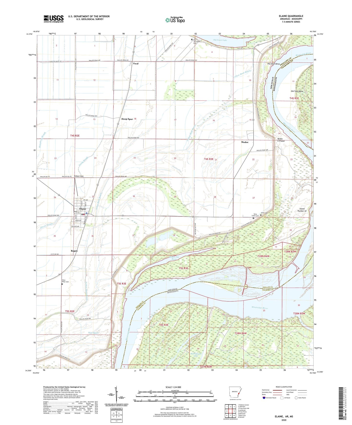
2024 topographic map quadrangle Elaine in the states of Arkansas, Mississippi. Scale: 1:24000. Based on the newly updated USGS 7.5' US Topo map series, this map is in the following counties: Phillips, Coahoma. The map contains contour data, water features, and other items you are used to seeing on USGS maps, but also has updated roads and other features. This is the next generation of topographic maps. Printed on high-quality waterproof paper with UV fade-resistant inks.
Quads adjacent to this one:
West: Lambrook
Northwest: Watkins Corner
North: Lakeview
Northeast: Friars Point NW
East: Friars Point
Southeast: Sherard
South: Rena Lara
Southwest: Mellwood
Contains the following named places: Burke Landing, Burke Landing Revetment, Church of God, City of Elaine, Dixie Bayou, Elaine, Elaine High School, Elaine Police Department, Elaine Post Office, Elaine Volunteer Fire Department, Ewal, Fair Landing, Fess Landing Strip, Hoop Spur, Island Number 62, Island Number 62 Revetment, Jones Cemetery, Lucilia Wood Elementary School, Lucilla Ward Elementary School, McWilliams Lake, Mittletons Landing, Modoc, Modoc Crevasse, Modoc Landing, Modoc Old River, Morning Star, Morning Star Church, Morning Star School, New Jerusalem Cemetery, New Jerusalem Church, Old Town Bend, Old Town Lake, Oldtown Bend Revetment, Pilgrim Guide Church, Ragan, Riddell Field, Robson Towhead, Saint Claire Cemetery, Saint Claire Church, Saint Peter Cemetery, Saint Peter Church, Swan Lake, Vanhook Church, Williams Landing Strip, ZIP Code: 72333