MyTopo
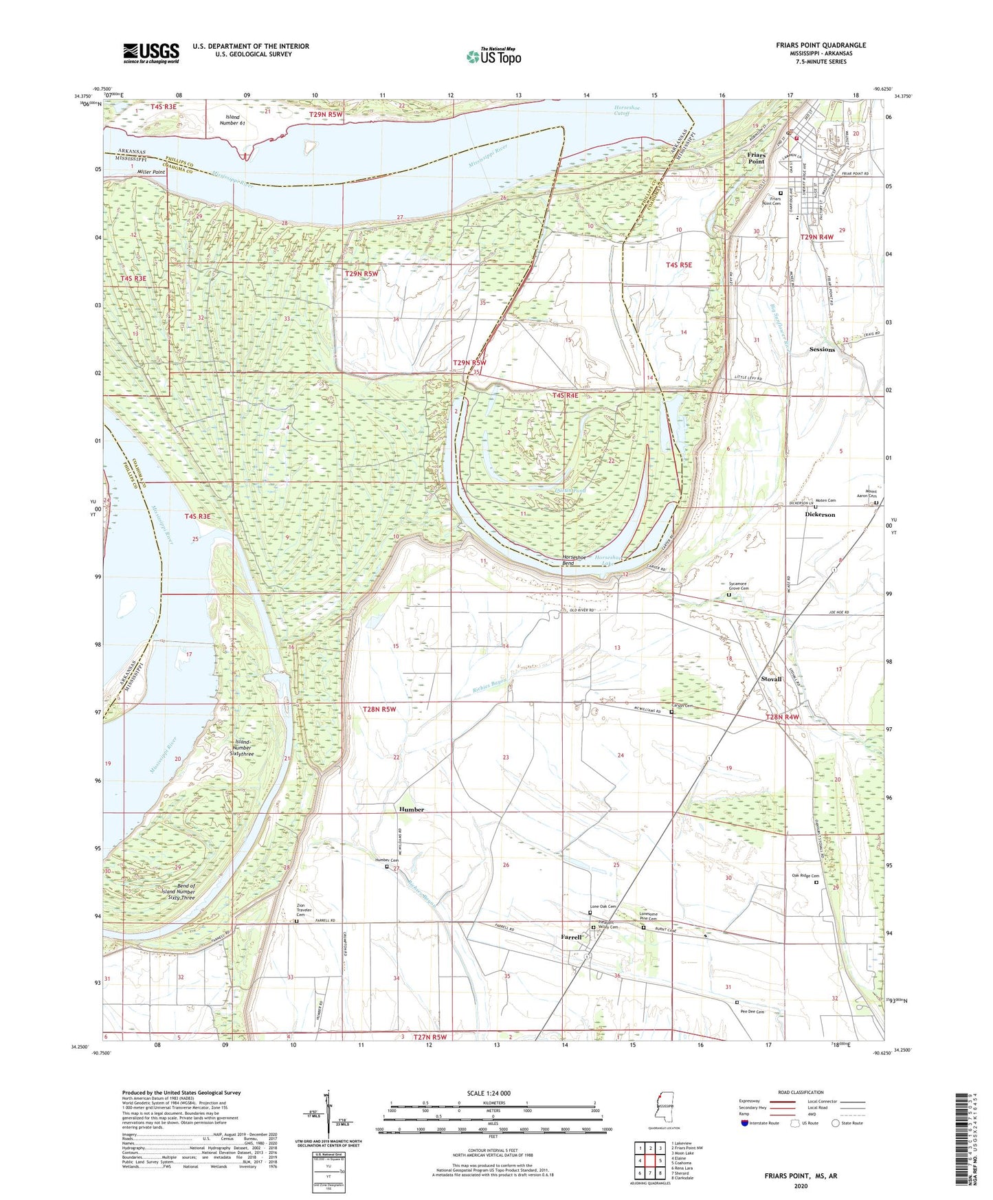
Friars Point Mississippi US Topo Map
Couldn't load pickup availability
2024 topographic map quadrangle Friars Point in the states of Mississippi, Arkansas. Scale: 1:24000. Based on the newly updated USGS 7.5' US Topo map series, this map is in the following counties: Coahoma, Phillips. The map contains contour data, water features, and other items you are used to seeing on USGS maps, but also has updated roads and other features. This is the next generation of topographic maps. Printed on high-quality waterproof paper with UV fade-resistant inks.
Quads adjacent to this one:
West: Elaine
Northwest: Lakeview
North: Friars Point NW
Northeast: Moon Lake
East: Coahoma
Southeast: Clarksdale
South: Sherard
Southwest: Rena Lara
This map covers the same area as the classic USGS quad with code o34090c6.
Contains the following named places: Bend of Island Number Sixty Three, Carson Cemetery, Coahoma County Volunteer Fire Department Friars Point, Dickerson, Dustin Pond, Elk Horn Plantation, Farrell, Farrell Census Designated Place, Farrell Church, Fitzhugh Landing, Friars Point, Friars Point Cemetery, Friars Point Elementary School, Friars Point Police Department, Friars Point Post Office, Horseshoe Bend, Horseshoe Cutoff, Horseshoe Lake, Horseshoe Revetment, Houston Landing, Humber, Humber Cemetery, Island Number 61, Island Number Sixty three Dikes, Island Number Sixtythree, John Gilbert Pond Dam, Kangaroo Point Dikes, Ledbetter Landing, Lone Oak Cemetery, Lone Oak Church, Lonesome Pine Cemetery, McCloud Landing, McCloud School, McLemore School, McWilliams Landing, Miller Point, Moten Cemetery, Mount Aaron Cemetery, Mount Aaron Church, Mount Aaron School, Mount Pisgah Church, Mud Lake, Oak Ridge Cemetery, Oak Ridge Church, Oak Ridge School, Pee Dee Cemetery, Pleasant Valley Cemetery, Pleasant Valley Church, Sessions, Stokely, Stovall, Supervisor District 2, Sycamore Grove Cemetery, Sycamore Grove Church, Town of Friars Point, West End School, Zion Traveler Cemetery, Zion Traveler Church, ZIP Code: 38630


