MyTopo
Lakeview Arkansas US Topo Map
Couldn't load pickup availability
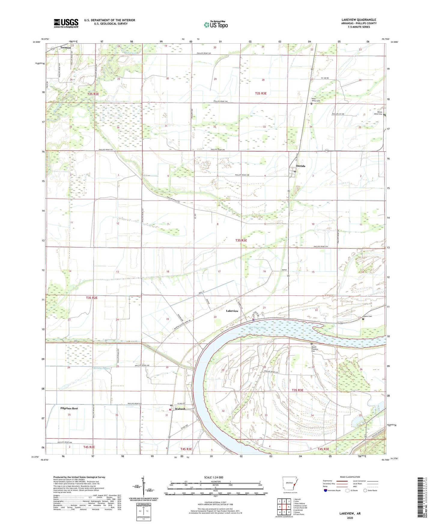
2024 topographic map quadrangle Lakeview in the state of Arkansas. Scale: 1:24000. Based on the newly updated USGS 7.5' US Topo map series, this map is in the following counties: Phillips. The map contains contour data, water features, and other items you are used to seeing on USGS maps, but also has updated roads and other features. This is the next generation of topographic maps. Printed on high-quality waterproof paper with UV fade-resistant inks.
Quads adjacent to this one:
West: Watkins Corner
Northwest: Marvell
North: Lexa
Northeast: West Helena
East: Friars Point NW
Southeast: Friars Point
South: Elaine
Southwest: Lambrook
This map covers the same area as the classic USGS quad with code o34090d7.
Contains the following named places: Beaver Bayou Ditch, C V White High School, Church of God, City of Lake View, Hugo, Johnson Bayou Ditch, Key Store, Lake View Church, Lake View Elementary School, Lake View Police Department, Lakeview, Lakeview Elementary School, Lakeview Fire Department, Lick Creek, Macedonia Church, McGehee Bayou, Morning Star Church, Mount Olive Cemetery, Mount Olive Church, Mount Pleasant Cemetery, Mount Pleasant Church, Mount Pleasant School, Old Jerusalem Church, Old Town, Oneida, Oneida Census Designated Place, Oneida Junior High School, Oneida Post Office, Phillips County, Pilgrims Rest, Pilgrims Rest Church, Saint James Church, Saint Johns Cemetery, Saint Johns Church, Salem Cemetery, Salem School, Township of James R Bush, Township of Searcy, Trenton, Wabash, Wabash Post Office, Wabash Volunteer Fire Department, ZIP Code: 72355