MyTopo
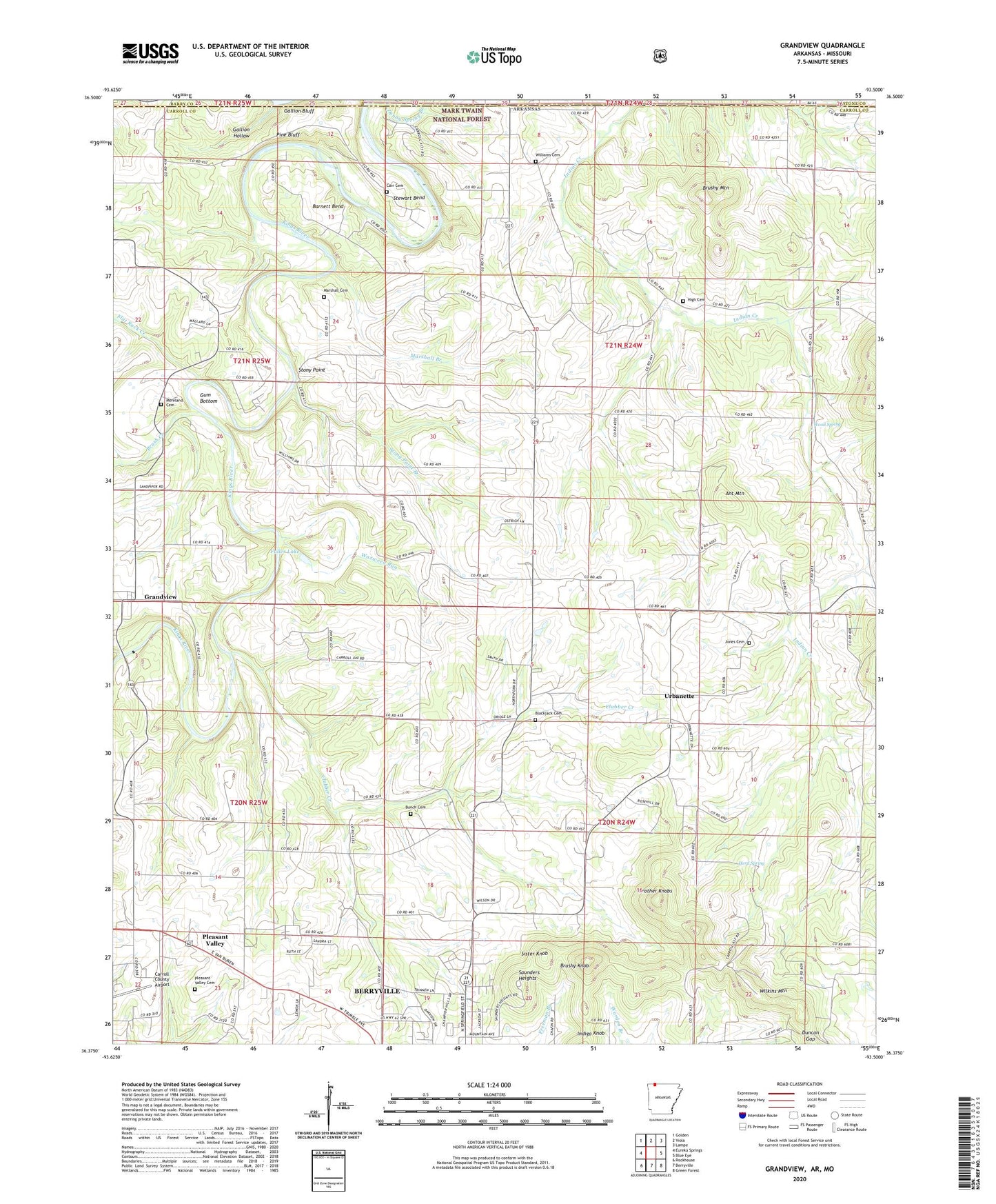
Grandview Arkansas US Topo Map
Couldn't load pickup availability
Also explore the Grandview Forest Service Topo of this same quad for updated USFS data
2024 topographic map quadrangle Grandview in the states of Arkansas, Missouri. Scale: 1:24000. Based on the newly updated USGS 7.5' US Topo map series, this map is in the following counties: Carroll, Stone, Barry. The map contains contour data, water features, and other items you are used to seeing on USGS maps, but also has updated roads and other features. This is the next generation of topographic maps. Printed on high-quality waterproof paper with UV fade-resistant inks.
Quads adjacent to this one:
West: Eureka Springs
Northwest: Golden
North: Viola
Northeast: Lampe
East: Blue Eye
Southeast: Green Forest
South: Berryville
Southwest: Rockhouse
Contains the following named places: Ant Mountain, Antioch Church of God of the Apostolic Faith, Barnett Bend, Berkes Community Church, Blackjack Cemetery, Blackjack Church, Brother Knobs, Brush Creek, Brushy Knob, Brushy Mountain, Bunch Cemetery, Carr Cemetery, Carroll County Airport, Clabber Creek, Duncan Gap, Flat Rock Creek, Freeman, Fuller Lake, Fuller Lake Dam, Gallion Bluff, Gallion Hollow, Grandview, Grandview Post Office, Gum Bottom, Herd Spring, High, High Cemetery, High Church, High Post Office, Indian Creek, Jones Cemetery, KSCC-FM (Berryville), Marshall Branch, Marshall Cemetery, Moreland Cemetery, Pine Bluff, Pleasant Valley, Pleasant Valley Cemetery, Pleasant Valley Church, Polo, Saunders Heights, Sister Knob, Stewart Bend, Stony Point, Stony Point Branch, Summers Ford, Township of Polo, Urbanette, Urbanette School, Waxweed Run, Wilkins Mountain, Williams Cemetery, Wood Spring