MyTopo
Sandstone Mountain Arkansas US Topo Map
Couldn't load pickup availability
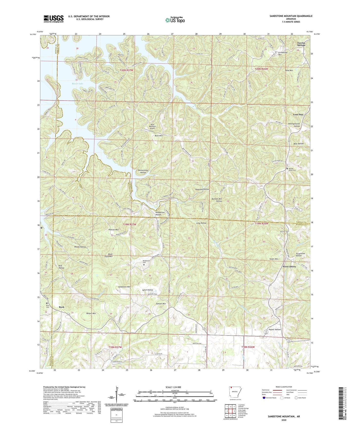
2024 topographic map quadrangle Sandstone Mountain in the state of Arkansas. Scale: 1:24000. Based on the newly updated USGS 7.5' US Topo map series, this map is in the following counties: Carroll, Madison, Benton. The map contains contour data, water features, and other items you are used to seeing on USGS maps, but also has updated roads and other features. This is the next generation of topographic maps. Printed on high-quality waterproof paper with UV fade-resistant inks.
Quads adjacent to this one:
West: War Eagle
Northwest: Garfield
North: Beaver
Northeast: Eureka Springs
East: Rockhouse
Southeast: Forum
South: Hindsville
Southwest: Spring Valley
This map covers the same area as the classic USGS quad with code o36093c7.
Contains the following named places: Beulah Church, Beulah Union Cemetery, Bluff Field Mountain, Buck Mountain, Buck Mountain Airport, Durham Mill Hollow, Grindstone Mountain, Hogscald Hollow, Kenars Mountain, Kirk Hollow, Lone Star, Long Hollow, Mountain View Church, Mundell, North Clifty Creek, Pemberton Cemetery, Pemberton Hollow, Penitentiary Hollow, Polecat Mountain, Pond Mountain, Rambo Cemetery, Rock, Rock Cemetery, Rock Church, Samuel Mountain, Sandstone Mountain, Springlawn Post Office, Swain Mountain, Township of California, Township of Clifty, Township of Packard Springs, Union Chapel, West Liberty, Woods Hollow