MyTopo
Formosa Arkansas US Topo Map
Couldn't load pickup availability
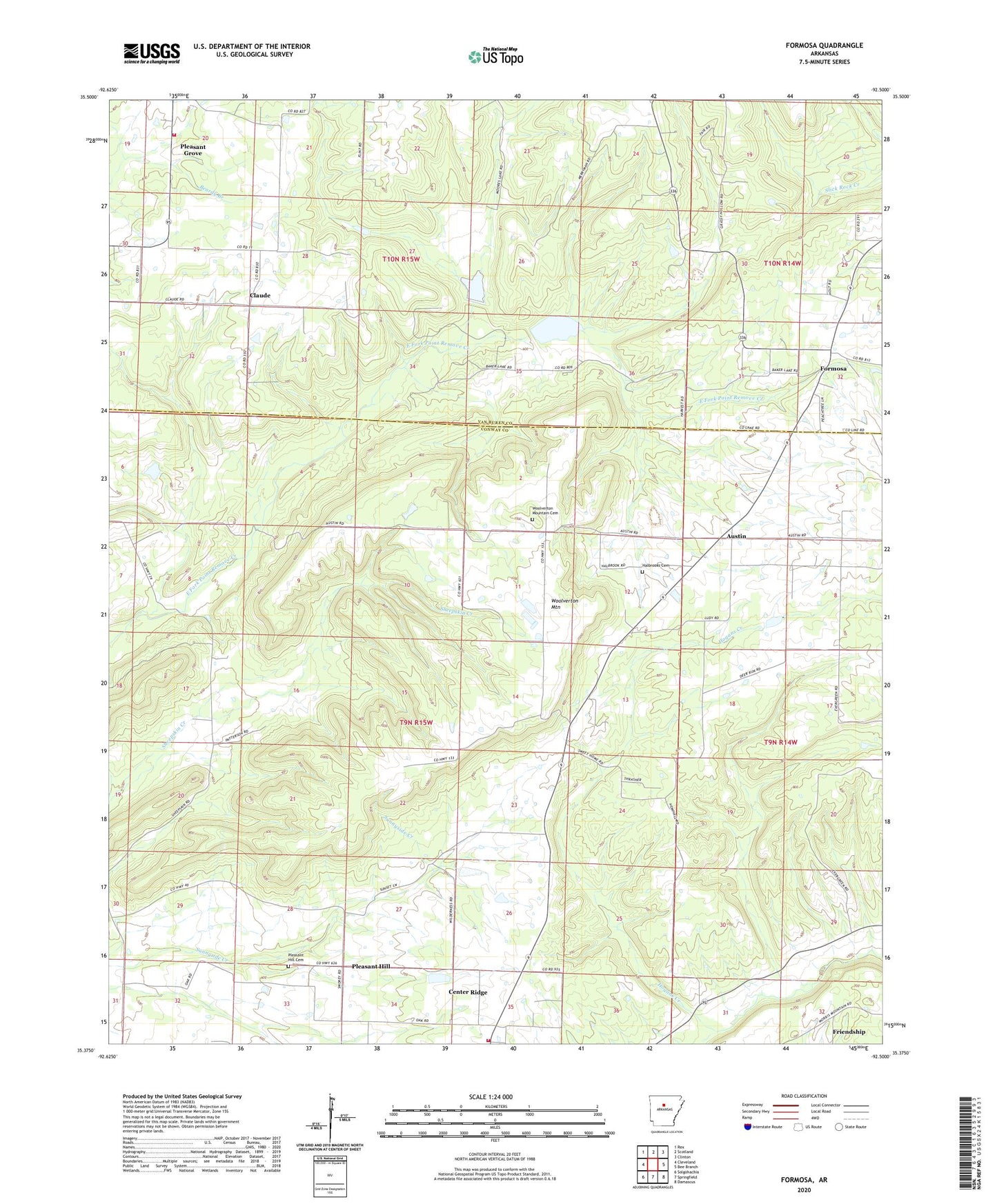
2024 topographic map quadrangle Formosa in the state of Arkansas. Scale: 1:24000. Based on the newly updated USGS 7.5' US Topo map series, this map is in the following counties: Conway, Van Buren. The map contains contour data, water features, and other items you are used to seeing on USGS maps, but also has updated roads and other features. This is the next generation of topographic maps. Printed on high-quality waterproof paper with UV fade-resistant inks.
Quads adjacent to this one:
West: Cleveland
Northwest: Rex
North: Scotland
Northeast: Clinton
East: Bee Branch
Southeast: Damascus
South: Springfield
Southwest: Solgohachia
This map covers the same area as the classic USGS quad with code o35092d5.
Contains the following named places: Austin, Buck Branch, Center Ridge Baptist Church, Center Ridge Census Designated Place, Claude, East Fork Point Remove Site One Dam, East Fork Point Remove Site One Reservoir, East Fork Point Remove Site Two Dam, East Fork Point Remove Site Two Reservoir, Formosa, Formosa Church of Christ, Friendship, Halbrooks Cemetery, Hogans Creek, Mountain View Church, Pleasant Grove, Pleasant Hill, Pleasant Hill Cemetery, Scotland Area Fire and Emergency Medical Services, Sweet Home Church, Township of Austin, Township of Formosa, Township of Lick Mountain, Woolverton, Woolverton Mountain, Woolverton Mountain Cemetery