MyTopo
Bee Branch Arkansas US Topo Map
Couldn't load pickup availability
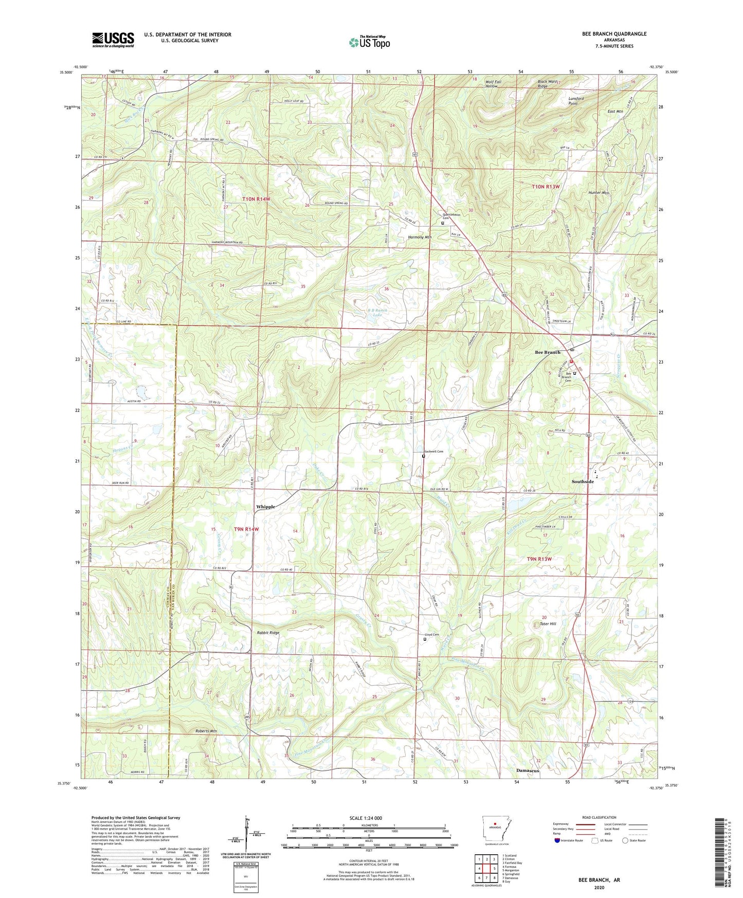
2024 topographic map quadrangle Bee Branch in the state of Arkansas. Scale: 1:24000. Based on the newly updated USGS 7.5' US Topo map series, this map is in the following counties: Van Buren, Conway. The map contains contour data, water features, and other items you are used to seeing on USGS maps, but also has updated roads and other features. This is the next generation of topographic maps. Printed on high-quality waterproof paper with UV fade-resistant inks.
Quads adjacent to this one:
West: Formosa
Northwest: Scotland
North: Clinton
Northeast: Fairfield Bay
East: Morganton
Southeast: Guy
South: Damascus
Southwest: Springfield
This map covers the same area as the classic USGS quad with code o35092d4.
Contains the following named places: B B Ranch Lake, B B Ranch Lake Dam, Bee Branch, Bee Branch Baptist Church, Bee Branch Cemetery, Bee Branch Census Designated Place, Bee Branch Post Office, Bee Branch Volunteer Fire Department, Bethlehem Church, Black Ward Ridge, Blackwell Cemetery, Duke Creek, East Mountain, Grassy Creek, Harmony Mountain, Hickory Grove Church, Hopewell Church, Johnson Branch, Kill Dead Creek, Lloyd Cemetery, Lunsford Point, Pine Mountain Creek, Pleasant Valley Church, Quattlebaum Cemetery, Rabbit Ridge, Rabbit Ridge Church, Roberts Mountain, Slick Rock Creek, South Side Elementary School, South Side High School, Southside, Southside Church, Southside Schools, Steele Hopewell United Methodist Church, Tater Hill, Township of Barnett, Township of Bradley, Ward Creek, Whipple, Wolf Fall Hollow