MyTopo
Scotland Arkansas US Topo Map
Couldn't load pickup availability
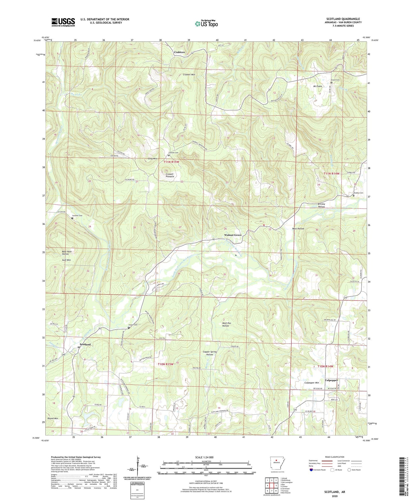
2024 topographic map quadrangle Scotland in the state of Arkansas. Scale: 1:24000. Based on the newly updated USGS 7.5' US Topo map series, this map is in the following counties: Van Buren. The map contains contour data, water features, and other items you are used to seeing on USGS maps, but also has updated roads and other features. This is the next generation of topographic maps. Printed on high-quality waterproof paper with UV fade-resistant inks.
Quads adjacent to this one:
West: Rex
Northwest: Alread
North: Botkinburg
Northeast: Old Lexington
East: Clinton
Southeast: Bee Branch
South: Formosa
Southwest: Cleveland
This map covers the same area as the classic USGS quad with code o35092e5.
Contains the following named places: Bradley Branch, Bradley Cemetery, Brickey Hollow, Butter Creek, Buzzard Roost, Copper Spring Hollow, Crabtree, Crowell Cemetery, Crowell Church, Crowell Mountain, Crowell Pinnacle, Culpepper, Culpepper Mountain, Culpepper Volunteer Fire Department, Dry Fork, Evans Cemetery, Foster Cemetery, Gardner Cemetery, Gladys, Joneed Creek, Koch Ridge, Long Mountain, Mount Evans, Opossum Walk Creek, Pine Mountain, Pleasant Grove Methodist Church, Scotland, Scotland Branch, Scotland Elementary School, Scotland High School, Scotland Post Office, Scotland Rural Fire Department, Township of Craig, Van Buren County, Walnut Grove, Walnut Grove Volunteer Fire Department, West Hollow, Wolf Pen Hollow