MyTopo
Fountain Hill Arkansas US Topo Map
Couldn't load pickup availability
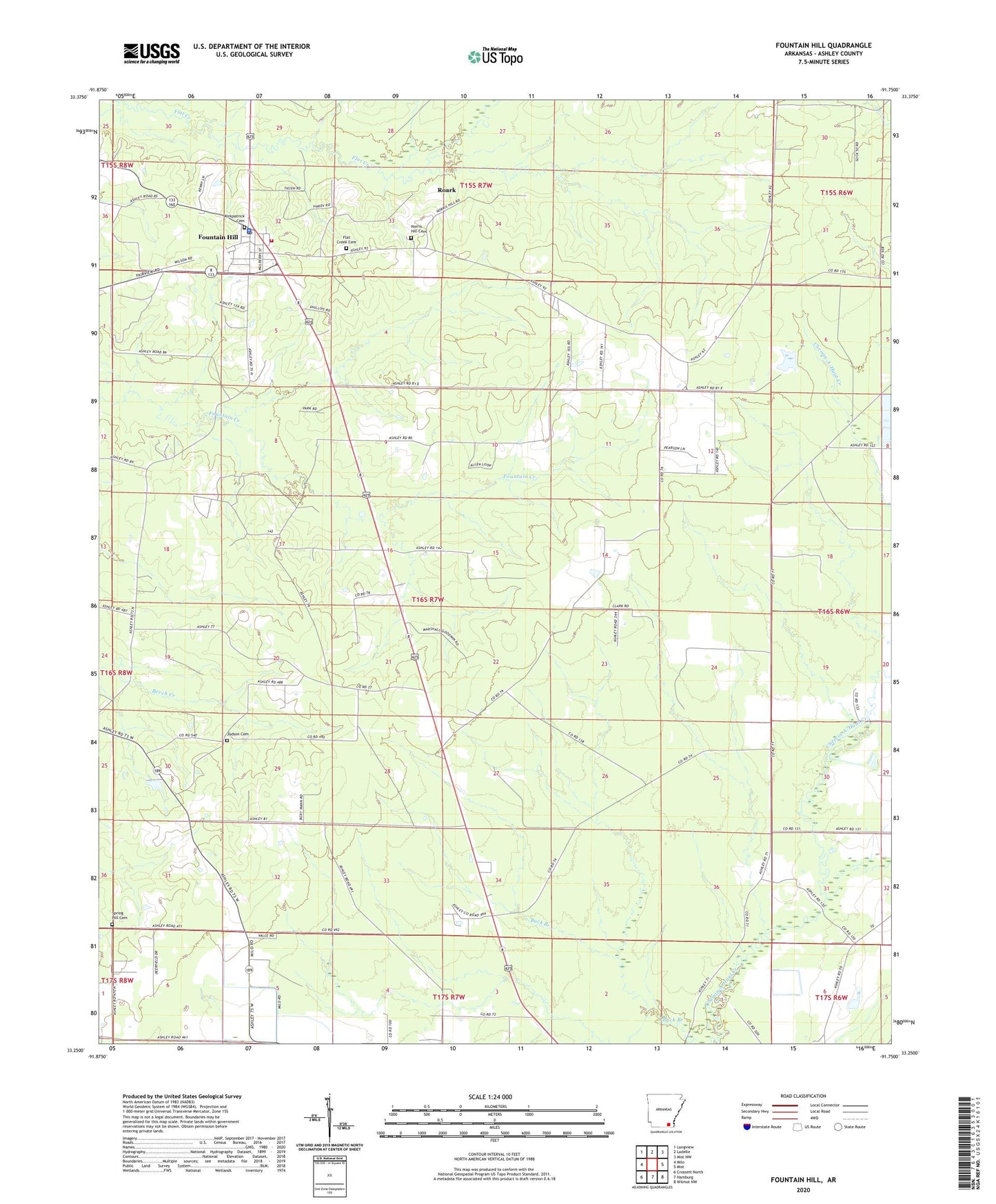
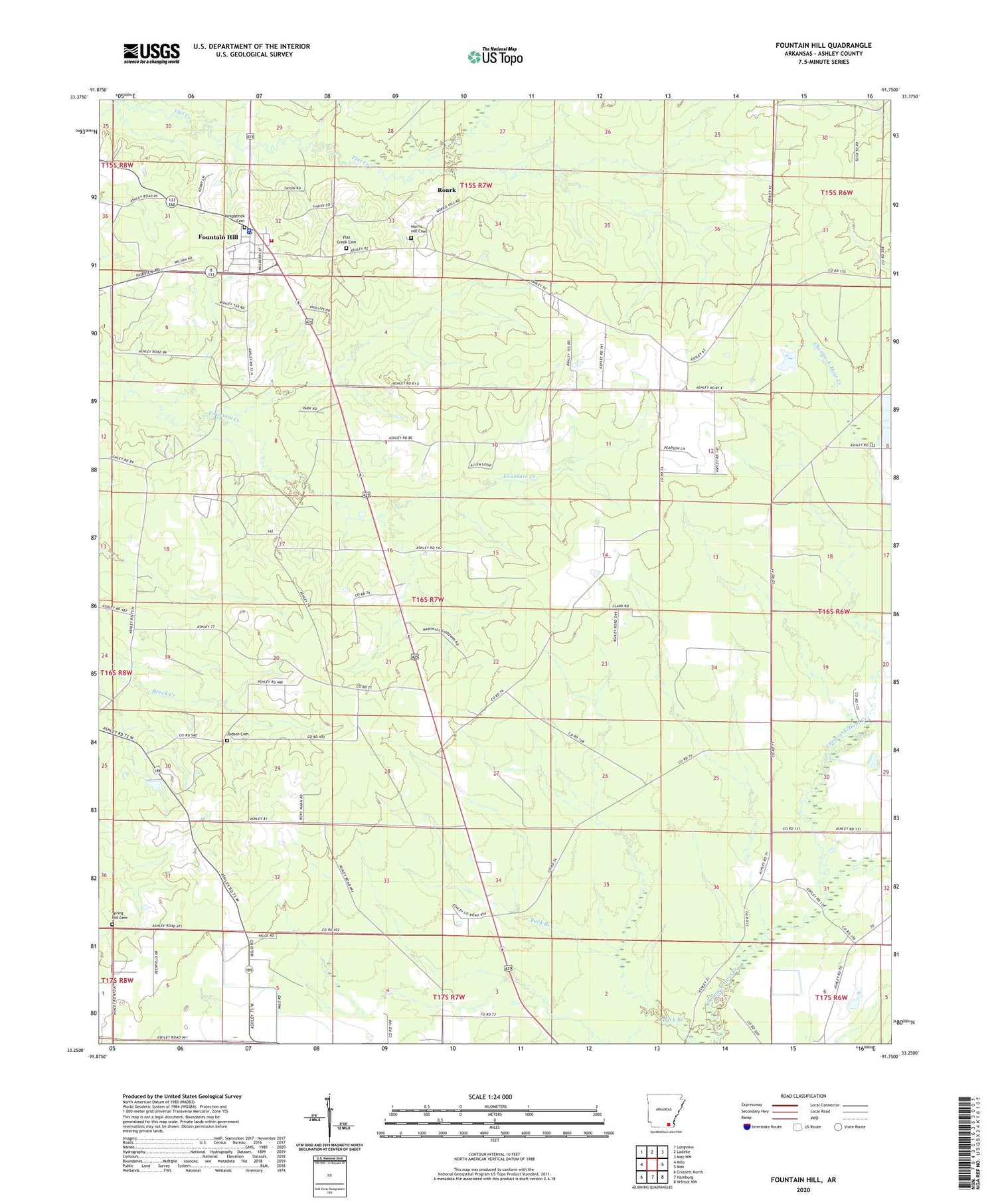
2024 topographic map quadrangle Fountain Hill in the state of Arkansas. Scale: 1:24000. Based on the newly updated USGS 7.5' US Topo map series, this map is in the following counties: Ashley. The map contains contour data, water features, and other items you are used to seeing on USGS maps, but also has updated roads and other features. This is the next generation of topographic maps. Printed on high-quality waterproof paper with UV fade-resistant inks.
Quads adjacent to this one:
West: Milo
Northwest: Longview
North: Ladelle
Northeast: Mist NW
East: Mist
Southeast: Wilmot NW
South: Hamburg
Southwest: Crossett North
This map covers the same area as the classic USGS quad with code o33091c7.
Contains the following named places: First Baptist Church of Fountain Hill, Flat Creek Cemetery, Flat Creek Church, Fountain Hill, Fountain Hill Elementary School, Fountain Hill Fire Department, Fountain Hill High School, Fountain Hill Police Department, Fountain Hill Post Office, Fountain Prairie, Judson Cemetery, Judson Missionary Baptist Church, Kirkpatrick Cemetery, Norris Hill Cemetery, Roark, Shiloh Church, Shiloh Lake, Shiloh Lake Dam, Spring Hill Cemetery, Town of Fountain Hill, Township of White