MyTopo
Ladelle Arkansas US Topo Map
Couldn't load pickup availability
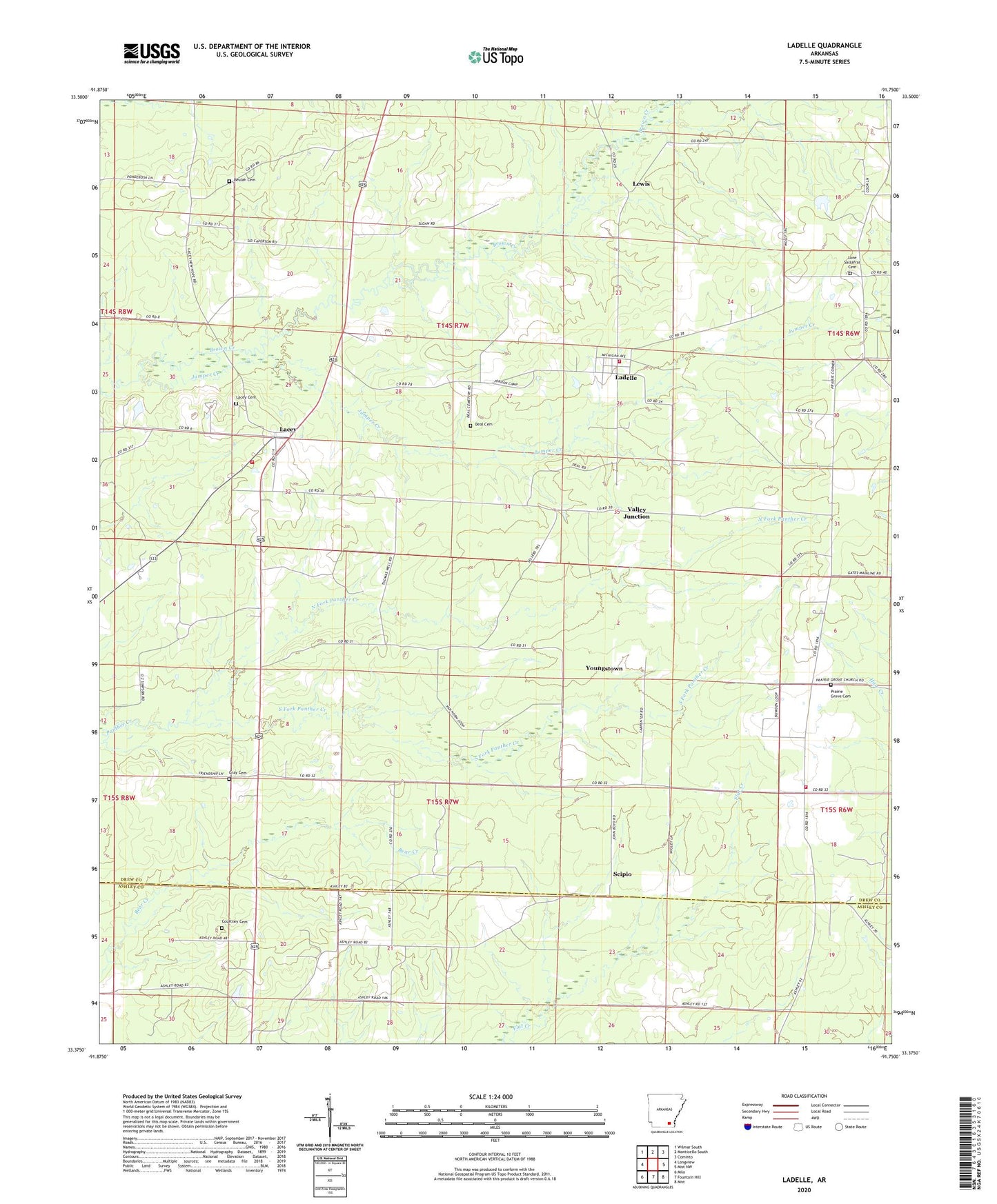
2024 topographic map quadrangle Ladelle in the state of Arkansas. Scale: 1:24000. Based on the newly updated USGS 7.5' US Topo map series, this map is in the following counties: Drew, Ashley. The map contains contour data, water features, and other items you are used to seeing on USGS maps, but also has updated roads and other features. This is the next generation of topographic maps. Printed on high-quality waterproof paper with UV fade-resistant inks.
Quads adjacent to this one:
West: Longview
Northwest: Wilmar South
North: Monticello South
Northeast: Cominto
East: Mist NW
Southeast: Mist
South: Fountain Hill
Southwest: Milo
This map covers the same area as the classic USGS quad with code o33091d7.
Contains the following named places: Beulah, Beulah Baptist Church, Beulah Cemetery, Carpenter, Courtney Cemetery, Deal Cemetery, Goose Hollow, Goose Hollow Church, Gray Cemetery, Jumper Creek, Lacey, Lacey Cemetery, Lacey Census Designated Place, Lacey Ladelle Volunteer Fire Department Station 1, Lacey Ladelle Volunteer Fire Department Station 2, Lacey Ladelle Volunteer Fire Department Station 3, Lacey School, Ladelle, Ladelle Baptist Church, Lewis, Lone Sasafras, Lone Sassafras Cemetery, Long Prairie, North Fork Panther Creek, Prairie Grove, Prairie Grove Baptist Church, Prairie Grove Cemetery, Scipio, South Fork Panther Creek, Township of Veasey, Valley Junction, Youngstown