MyTopo
Mist Arkansas US Topo Map
Couldn't load pickup availability
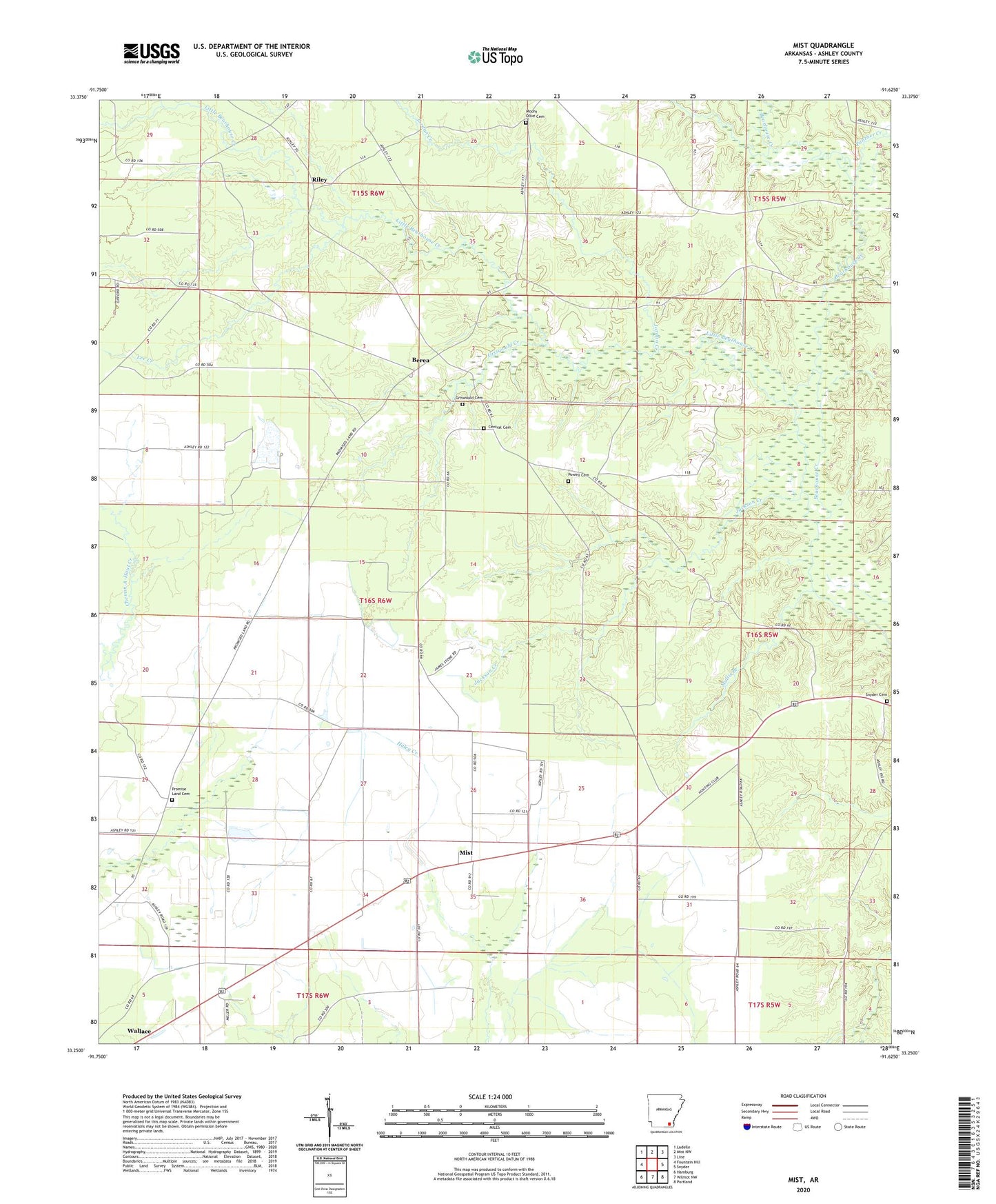
2024 topographic map quadrangle Mist in the state of Arkansas. Scale: 1:24000. Based on the newly updated USGS 7.5' US Topo map series, this map is in the following counties: Ashley. The map contains contour data, water features, and other items you are used to seeing on USGS maps, but also has updated roads and other features. This is the next generation of topographic maps. Printed on high-quality waterproof paper with UV fade-resistant inks.
Quads adjacent to this one:
West: Fountain Hill
Northwest: Ladelle
North: Mist NW
Northeast: Line
East: Snyder
Southeast: Portland
South: Wilmot NW
Southwest: Hamburg
This map covers the same area as the classic USGS quad with code o33091c6.
Contains the following named places: Berea, Central Cemetery, Griswould Cemetery, Griswould Creek, Jackson Creek, Jordan Creek, Lee Creek, Little Bearhouse Creek, Mist, Mount Olive, Mount Olive Baptist Church, Mount Olive Cemetery, Mullis Branch, Panther Creek, Phelan, Pine Prairie, Powell Cemetery, Promise Land Cemetery, Promise Land Missionary Baptist Church, Promised Land, Riley, Riley Lake, Riley Lake Dam, Riley School, Snyder Cemetery, Stone Lake, Stone Lake Dam, Township of Bearhouse