MyTopo
Glendale Arkansas US Topo Map
Couldn't load pickup availability
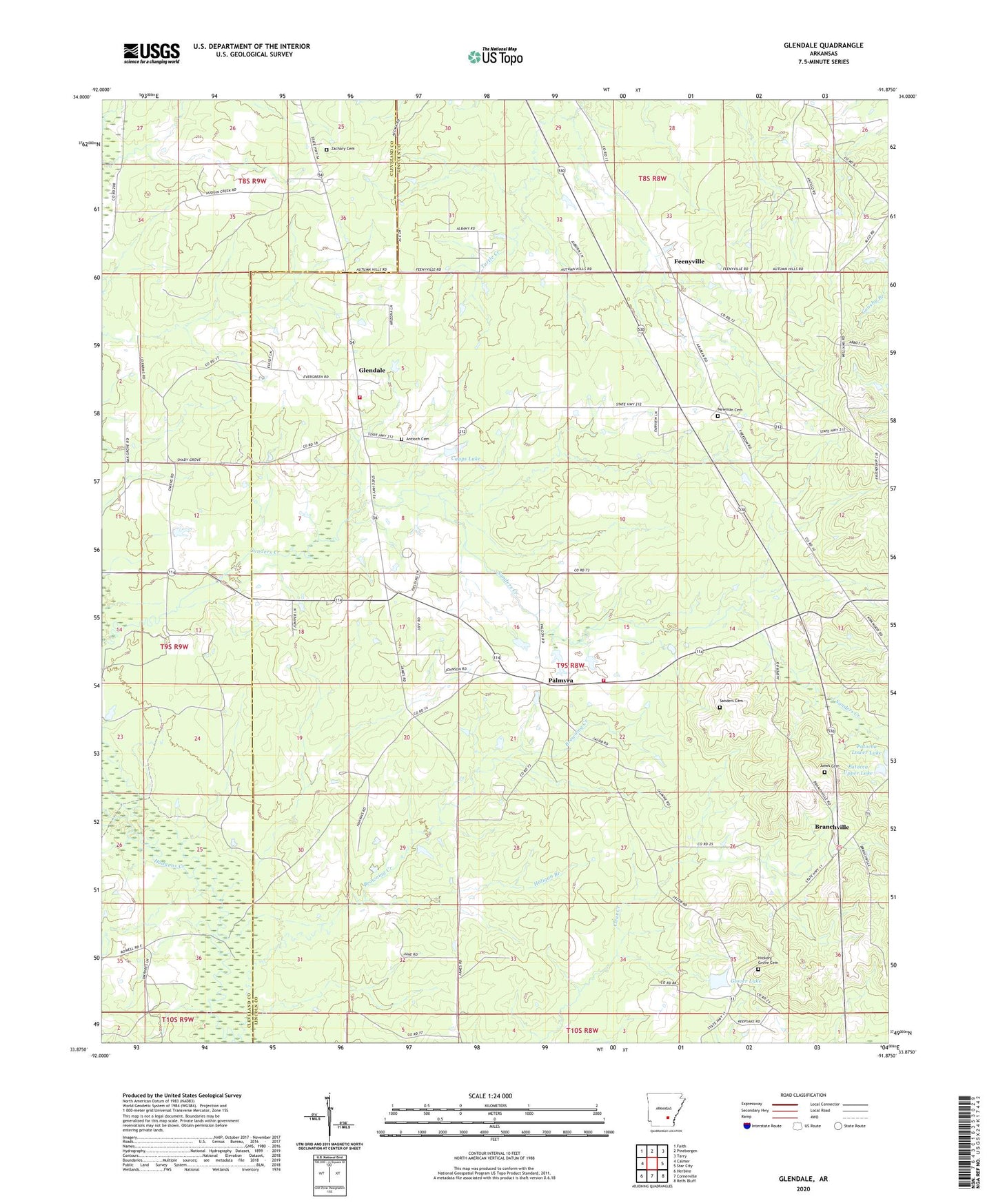
2024 topographic map quadrangle Glendale in the state of Arkansas. Scale: 1:24000. Based on the newly updated USGS 7.5' US Topo map series, this map is in the following counties: Lincoln, Cleveland. The map contains contour data, water features, and other items you are used to seeing on USGS maps, but also has updated roads and other features. This is the next generation of topographic maps. Printed on high-quality waterproof paper with UV fade-resistant inks.
Quads adjacent to this one:
West: Calmer
Northwest: Faith
North: Pinebergen
Northeast: Tarry
East: Star City
Southeast: Relfs Bluff
South: Cornerville
Southwest: Herbine
This map covers the same area as the classic USGS quad with code o33091h8.
Contains the following named places: Antioch Cemetery, Bethlehem Missionary Baptist Church, Branchville, Branchville School, Calvary Church, Capps Lake, Capps Lake Dam, Feenyville, Glendale, Glendale Fire Department Substation, Glendale Volunteer Fire Department, Glover Lake, Glover Lake Dam, Haligan Branch, Hickory Grove Baptist Church, Hickory Grove Cemetery, Jones Cemetery, Newman Cemetery, Palmyra, Patocca Lower Lake, Patocca Upper Lake, Patocca Upper Lake Dam, Rest, Sanders Cemetery, Shady Grove Missionary Baptist Church, Township of Owen, Zachary Cemetery