MyTopo
Relfs Bluff Arkansas US Topo Map
Couldn't load pickup availability
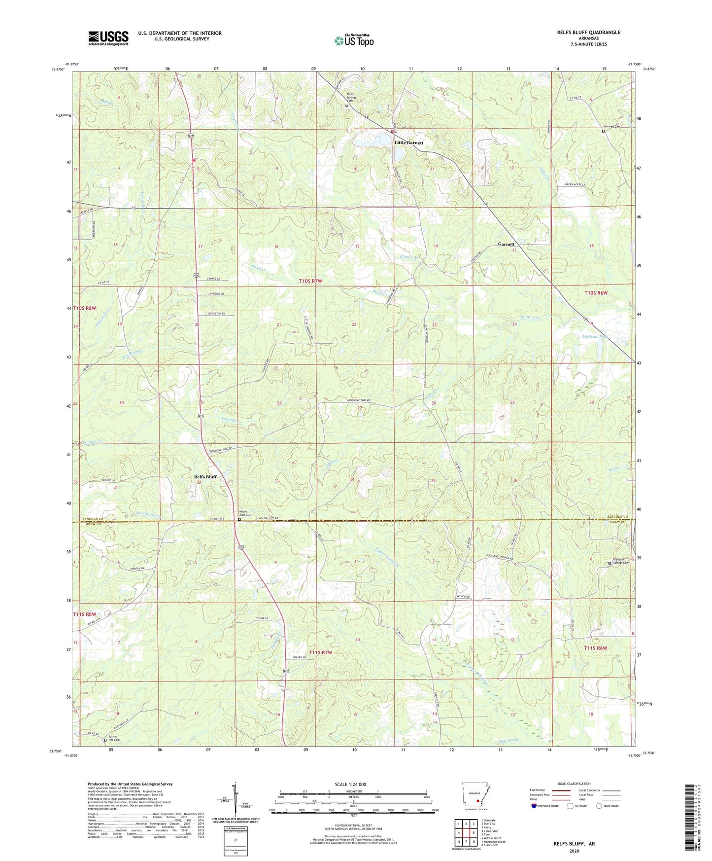
2024 topographic map quadrangle Relfs Bluff in the state of Arkansas. Scale: 1:24000. Based on the newly updated USGS 7.5' US Topo map series, this map is in the following counties: Lincoln, Drew. The map contains contour data, water features, and other items you are used to seeing on USGS maps, but also has updated roads and other features. This is the next generation of topographic maps. Printed on high-quality waterproof paper with UV fade-resistant inks.
Quads adjacent to this one:
West: Cornerville
Northwest: Glendale
North: Star City
Northeast: Avery
East: Tyro
Southeast: Collins NW
South: Monticello North
Southwest: Wilmar North
This map covers the same area as the classic USGS quad with code o33091g7.
Contains the following named places: Boyd Creek, Chance Creek, Ebenezer African Methodist Episcopal Church, Garnett, Garnett Rural Fire Department, Garnett Volunteer Fire Department, Holly Springs Cemetery, Holly Springs Missionary Baptist Church, Little Garnett, Lyle Creek, Maxwell Cemetery, McGraw Pond, McGraw Pond Dam, Mount Zion Cemetery, Mount Zion Presbyterian Church, Mountain Home Church, Pleasant Springs Baptist Church, Pleasant Springs Cemetery, Relfs Bluff, Sawyer Branch, Spring Hill Cemetery, Township of Lone Pine