MyTopo
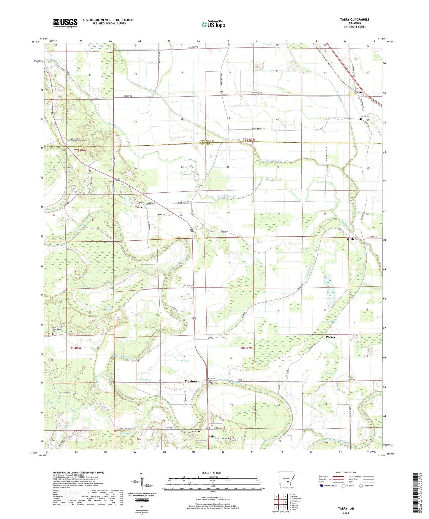
Tarry Arkansas US Topo Map
Couldn't load pickup availability
2024 topographic map quadrangle Tarry in the state of Arkansas. Scale: 1:24000. Based on the newly updated USGS 7.5' US Topo map series, this map is in the following counties: Lincoln, Jefferson. The map contains contour data, water features, and other items you are used to seeing on USGS maps, but also has updated roads and other features. This is the next generation of topographic maps. Printed on high-quality waterproof paper with UV fade-resistant inks.
Quads adjacent to this one:
West: Pinebergen
Northwest: Ladd
North: Moscow
Northeast: Cornerstone
East: Grady
Southeast: Avery
South: Star City
Southwest: Glendale
This map covers the same area as the classic USGS quad with code o34091a7.
Contains the following named places: Atkinson Ford Bridge, Beaver Brake, Belmont Church, Bethlehem Baptist Church, Bright Star Church, Bright Star School, Clowers Lake, Clowers Lake Dam, Coles Brake, Cousart Bayou, Daniels Chapel, Dry Bayou, Flat Creek, Folk Chapel, Goosby Branch, Hastings Brake, Hunters Brake, Jacks Bayou, Jefferson Church, Marzel Cemetery, Mount Nebo Missionary Baptist Church, Nebo, Nebo School, New Macedonia Cemetery, New Macedonia Church, Oak Grove Missionary Baptist Church, Phenix, Richardson Church, Richland Chapel, Shady Grove Church, Sneeds Brake, Sneeds Church, Sneeds School, Spencer Creek, Sweet Home Church, Tamo, Tarry, Township of Bartholomew, Turtle Creek, White Church Cemetery, Whitefield, Yorktown, Yorktown First Baptist Church, Yorktown Post Office